Decatur elevation
Decatur (Alabama, Morgan County), United States elevation is 175 meters and Decatur elevation in feet is 574 ft above sea level [src 1]. Decatur is a seat of a second-order administrative division (feature code) with elevation that is 104 meters (341 ft) smaller than average city elevation in United States.
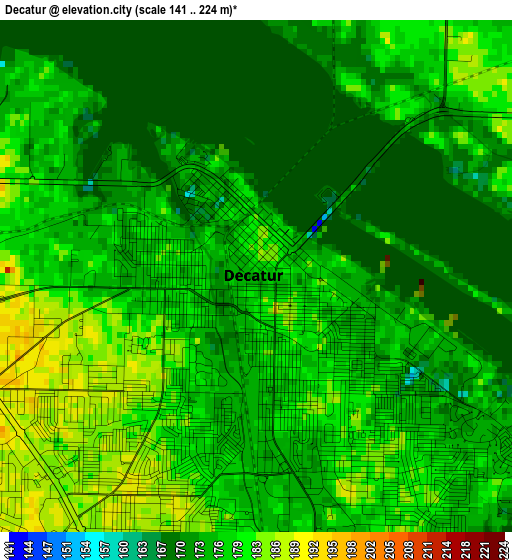
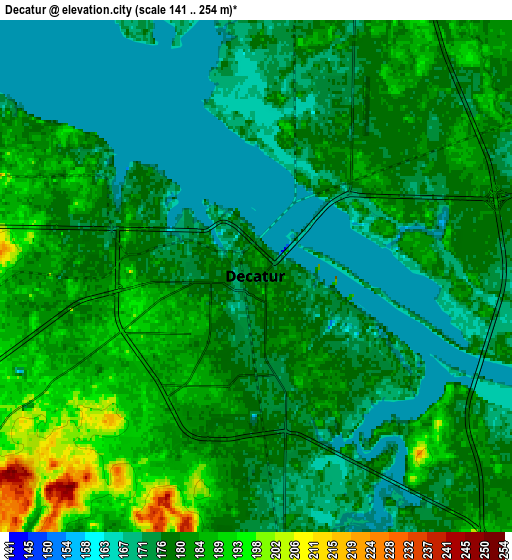
Below is the Elevation map of Decatur, which displays elevation range with different colors. Scale of the first map is from 141 to 224 m (463 to 735 ft) with average elevation of 175.7 meters (=576 ft) [note 1]
These maps also provides idea of topography and contour of this city, they are displayed at different zoom levels. More info about maps, scale and edge coordinates you can find below images.
| \ | Map #1 | Map #2 | Topo.Map |
| Scale [m] | 141..224 m | 141..254 m | × |
| Scale [ft] | 463..735 ft | 463..833 ft | × |
| Average | 175.7 m = 576 ft | 179.1 m = 588 ft | × |
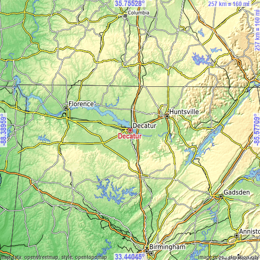
| Width | 8.04 km = 5 mi | 16.09 km = 10 mi | 257.4 km = 159.9 mi |
| Height | 8.04 km = 5 mi | 16.09 km = 10 mi | 257.4 km = 159.9 mi |
| ↑Max Latitude | 34.642093° | 34.678239° | 35.75528° |
| Latitude at center | 34.60593° | 34.60593° | 34.60593° |
| ↓Min Latitude | 34.569752° | 34.533558° | 33.44045° |
| ← Min Longitude | -87.027285° | -87.071231° | -88.38959° |
| Longitude center | -86.98334° | -86.98334° | -86.98334° |
| →Max Longitude | -86.939395° | -86.895449° | -85.57709° |
Nearby cities:
Cities around Decatur sort by population:
• Madison elevation 217 m
23.9 km,  64°
64°
• Athens 218 m
21.9 km,  2°
2°
• Hartselle 203 m
18.6 km,  166°
166°
• Danville 188 m
23.3 km,  204°
204°
• Harvest 253 m
35 km,  37°
37°
• Moulton 196 m
31.6 km,  243°
243°
• Priceville 188 m
12.1 km,  137°
137°
• Trinity 197 m
9.6 km,  270°
270°
• Redstone Arsenal 316 m
31.9 km,  74°
74°
• Falkville 183 m
27.3 km, 165°
• Flint City 188 m
9.3 km, 172°
• Washington Street Courthouse Annex 216 m
21.9 km, 2°
Multilingual:
 En español:
Decatur elevación 175 m.
 En France:
Decatur élévation 175 m.


Sources and notes:
- [note 1] Map square and city borders are not equal. Map elevation data is calculated only from area inside that square.
- [src 1] Elevation data from geonames database provided with same terms of usage.
- [src 2] The elevation map of Decatur is generated using elevation data from NASA's 3 arcsec (90m) resolution SRTM data.
- [src 3] Base (background) map © OpenStreetMap contributors tiles are generated by Geofabrik and OpenTopoMap.
Copyright & License:
This Decatur Elevation Map is licensed under CC BY-SA. You may reuse any part from this page, if you give a proper credit by linking to this URL:
 More info on terms of use page.