Mafinga elevation
Mafinga (Iringa, Iringa Rural District), Tanzania elevation is 1018 meters and Mafinga elevation in feet is 3340 ft above sea level [src 1]. Mafinga is a populated place (feature code) with elevation that is 75 meters (246 ft) bigger than average city elevation in Tanzania.
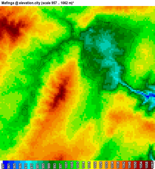
Below is the Elevation map of Mafinga, which displays elevation range with different colors. Scale of the first map is from 957 to 1062 m (3140 to 3484 ft) with average elevation of 1013.6 meters (=3325 ft) [note 1]
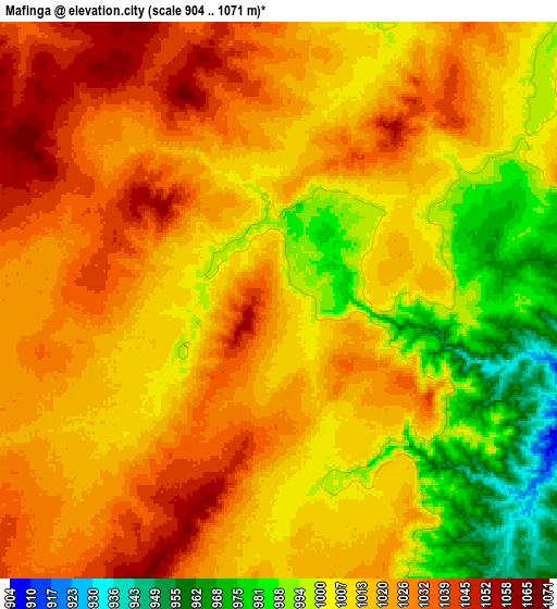
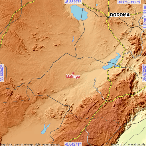
These maps also provides idea of topography and contour of this city, they are displayed at different zoom levels. More info about maps, scale and edge coordinates you can find below images.
| \ | Map #1 | Map #2 | Topo.Map |
| Scale [m] | 957..1062 m | 904..1071 m | × |
| Scale [ft] | 3140..3484 ft | 2966..3514 ft | × |
| Average | 1013.6 m = 3325 ft | 1013.6 m = 3325 ft | × |
| Width | 9.69 km = 6 mi | 19.39 km = 12 mi | 310.2 km = 192.7 mi |
| Height | 9.69 km = 6 mi | 19.39 km = 12 mi | 310.2 km = 192.7 mi |
| ↑Max Latitude | -7.206404° | -7.162804° | -5.85297° |
| Latitude at center | -7.25° | -7.25° | -7.25° |
| ↓Min Latitude | -7.293592° | -7.337179° | -8.64271° |
| ← Min Longitude | 35.022725° | 34.978779° | 33.66042° |
| Longitude center | 35.06667° | 35.06667° | 35.06667° |
| →Max Longitude | 35.110615° | 35.154561° | 36.47292° |
Nearby cities:
Cities around Mafinga sort by population:
• Dodoma elevation 1125 m
141 km,  31°
31°
• Iringa 1625 m
90.4 km,  129°
129°
• Ilula 1374 m
117 km,  113°
113°
• Kibakwe 1133 m
155.2 km,  67°
67°
• Izazi 727 m
73.7 km,  85°
85°
• Dunda 1124 m
131.8 km,  223°
223°
• Makungu 1251 m
166.6 km,  171°
171°
• Kisasa 1117 m
143.9 km, 33°
• Kintinku 848 m
153.1 km,  6°
6°
• Malangali 1388 m
148.3 km,  189°
189°
• Kilimatinde 1085 m
156.2 km,  355°
355°
• Msanga 1012 m
170.9 km,  38°
38°
Multilingual:
 En español:
Mafinga elevación 1018 m.
 En France:
Mafinga élévation 1018 m.
 Auf Deutsch:
Mafinga höhe über dem Meeresspiegel ist 1018 m.

Sources and notes:
- [note 1] Map square and city borders are not equal. Map elevation data is calculated only from area inside that square.
- [src 1] Elevation data from geonames database provided with same terms of usage.
- [src 2] The elevation map of Mafinga is generated using elevation data from NASA's 3 arcsec (90m) resolution SRTM data.
- [src 3] Base (background) map © OpenStreetMap contributors tiles are generated by Geofabrik and OpenTopoMap.
Copyright & License:
This Mafinga Elevation Map is licensed under CC BY-SA. You may reuse any part from this page, if you give a proper credit by linking to this URL:
 More info on terms of use page.