Izazi elevation
Izazi (Iringa, Iringa Rural District), Tanzania elevation is 727 meters and Izazi elevation in feet is 2385 ft above sea level [src 1]. Izazi is a populated place (feature code) with elevation that is 216 meters (709 ft) smaller than average city elevation in Tanzania.
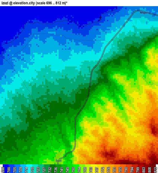
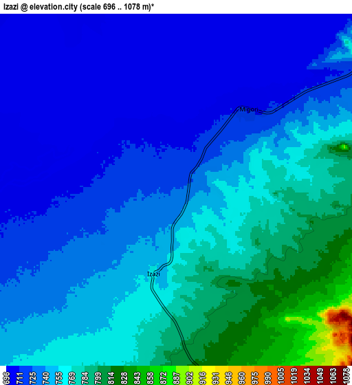
Below is the Elevation map of Izazi, which displays elevation range with different colors. Scale of the first map is from 696 to 812 m (2283 to 2664 ft) with average elevation of 734.5 meters (=2410 ft) [note 1]
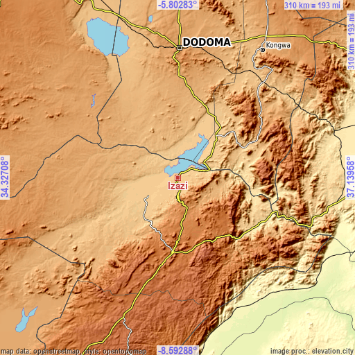
These maps also provides idea of topography and contour of this city, they are displayed at different zoom levels. More info about maps, scale and edge coordinates you can find below images.
| \ | Map #1 | Map #2 | Topo.Map |
| Scale [m] | 696..812 m | 696..1078 m | × |
| Scale [ft] | 2283..2664 ft | 2283..3537 ft | × |
| Average | 734.5 m = 2410 ft | 744.8 m = 2444 ft | × |
| Width | 9.7 km = 6 mi | 19.39 km = 12 mi | 310.2 km = 192.7 mi |
| Height | 9.7 km = 6 mi | 19.39 km = 12 mi | 310.3 km = 192.8 mi |
| ↑Max Latitude | -7.156399° | -7.112794° | -5.80283° |
| Latitude at center | -7.2° | -7.2° | -7.2° |
| ↓Min Latitude | -7.243597° | -7.287189° | -8.59288° |
| ← Min Longitude | 35.689385° | 35.645439° | 34.32708° |
| Longitude center | 35.73333° | 35.73333° | 35.73333° |
| →Max Longitude | 35.777275° | 35.821221° | 37.13958° |
Nearby cities:
Cities around Izazi sort by population:
• Dodoma elevation 1125 m
114.3 km,  0°
0°
• Iringa 1625 m
63.1 km,  183°
183°
• Kilosa 495 m
143.8 km,  73°
73°
• Kidatu 303 m
145.9 km,  112°
112°
• Mafinga 1018 m
73.7 km,  265°
265°
• Ilula 1374 m
62.7 km,  147°
147°
• Mpwapwa 998 m
125.7 km,  41°
41°
• Kibakwe 1133 m
88.2 km,  52°
52°
• Mikumi 517 m
139.7 km,  99°
99°
• Kongwa 1023 m
134.4 km,  34°
34°
• Kisasa 1117 m
114.1 km, 3°
• Msanga 1012 m
132.1 km,  14°
14°
Multilingual:
 En español:
Izazi elevación 727 m.
 En France:
Izazi élévation 727 m.


Sources and notes:
- [note 1] Map square and city borders are not equal. Map elevation data is calculated only from area inside that square.
- [src 1] Elevation data from geonames database provided with same terms of usage.
- [src 2] The elevation map of Izazi is generated using elevation data from NASA's 3 arcsec (90m) resolution SRTM data.
- [src 3] Base (background) map © OpenStreetMap contributors tiles are generated by Geofabrik and OpenTopoMap.
Copyright & License:
This Izazi Elevation Map is licensed under CC BY-SA. You may reuse any part from this page, if you give a proper credit by linking to this URL:
 More info on terms of use page.