Makungu elevation
Makungu (Iringa, Mufindi), Tanzania elevation is 1251 meters and Makungu elevation in feet is 4104 ft above sea level [src 1]. Makungu is a populated place (feature code) with elevation that is 308 meters (1010 ft) bigger than average city elevation in Tanzania.
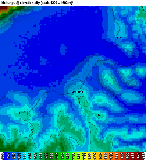
Below is the Elevation map of Makungu, which displays elevation range with different colors. Scale of the first map is from 1209 to 1692 m (3967 to 5551 ft) with average elevation of 1257.2 meters (=4125 ft) [note 1]
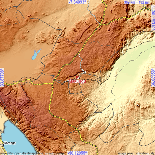
These maps also provides idea of topography and contour of this city, they are displayed at different zoom levels. More info about maps, scale and edge coordinates you can find below images.
| \ | Map #1 | Map #2 | Topo.Map |
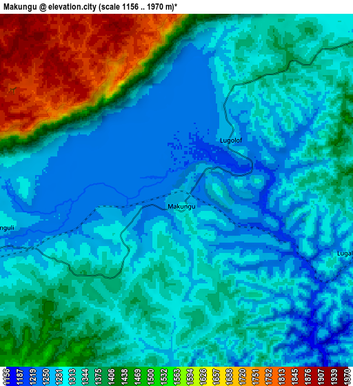
| Scale [m] | 1209..1692 m | 1156..1970 m | × |
| Scale [ft] | 3967..5551 ft | 3793..6463 ft | × |
| Average | 1257.2 m = 4125 ft | 1359.4 m = 4460 ft | × |
| Width | 9.66 km = 6 mi | 19.32 km = 12 mi | 309.1 km = 192.1 mi |
| Height | 9.66 km = 6 mi | 19.32 km = 12 mi | 309.1 km = 192.1 mi |
| ↑Max Latitude | -8.689892° | -8.646448° | -7.34093° |
| Latitude at center | -8.73333° | -8.73333° | -8.73333° |
| ↓Min Latitude | -8.776763° | -8.820191° | -10.12055° |
| ← Min Longitude | 35.239385° | 35.195439° | 33.87708° |
| Longitude center | 35.28333° | 35.28333° | 35.28333° |
| →Max Longitude | 35.327275° | 35.371221° | 36.68958° |
Nearby cities:
Cities around Makungu sort by population:
• Iringa elevation 1625 m
116.9 km,  23°
23°
• Makumbako 1651 m
51.1 km,  255°
255°
• Njombe 1676 m
88.6 km,  219°
219°
• Mlimba 306 m
59.1 km,  97°
97°
• Rujewa 1078 m
99 km,  272°
272°
• Malinyi 295 m
96 km, 103°
• Mtwango 1767 m
61.7 km,  239°
239°
• Ilembula 1425 m
79.1 km, 256°
• Mahanje 991 m
133.5 km,  177°
177°
• Dunda 1124 m
132.7 km,  301°
301°
• Mtimbira 302 m
117.4 km,  92°
92°
• Malangali 1388 m
51.1 km,  291°
291°
Multilingual:
 En español:
Makungu elevación 1251 m.
 En France:
Makungu élévation 1251 m.
 Auf Deutsch:
Makungu höhe über dem Meeresspiegel ist 1251 m.

Sources and notes:
- [note 1] Map square and city borders are not equal. Map elevation data is calculated only from area inside that square.
- [src 1] Elevation data from geonames database provided with same terms of usage.
- [src 2] The elevation map of Makungu is generated using elevation data from NASA's 3 arcsec (90m) resolution SRTM data.
- [src 3] Base (background) map © OpenStreetMap contributors tiles are generated by Geofabrik and OpenTopoMap.
Copyright & License:
This Makungu Elevation Map is licensed under CC BY-SA. You may reuse any part from this page, if you give a proper credit by linking to this URL:
 More info on terms of use page.