Babaeski elevation
Babaeski (Kırklareli), Turkey elevation is 58 meters and Babaeski elevation in feet is 190 ft above sea level [src 1]. Babaeski is a seat of a second-order administrative division (feature code) with elevation that is 665 meters (2182 ft) smaller than average city elevation in Turkey.
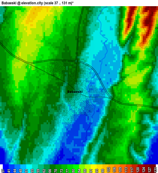
Below is the Elevation map of Babaeski, which displays elevation range with different colors. Scale of the first map is from 37 to 131 m (121 to 430 ft) with average elevation of 68.5 meters (=225 ft) [note 1]
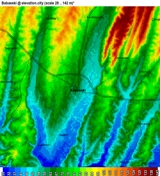
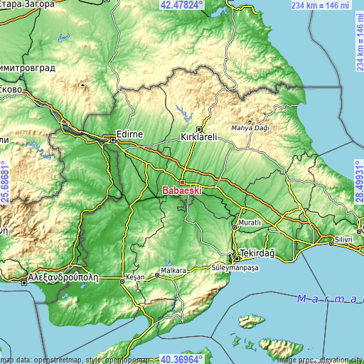
These maps also provides idea of topography and contour of this city, they are displayed at different zoom levels. More info about maps, scale and edge coordinates you can find below images.
| \ | Map #1 | Map #2 | Topo.Map |
| Scale [m] | 37..131 m | 28..142 m | × |
| Scale [ft] | 121..430 ft | 92..466 ft | × |
| Average | 68.5 m = 225 ft | 71.9 m = 236 ft | × |
| Width | 7.33 km = 4.6 mi | 14.65 km = 9.1 mi | 234.5 km = 145.7 mi |
| Height | 7.33 km = 4.6 mi | 14.65 km = 9.1 mi | 234.4 km = 145.6 mi |
| ↑Max Latitude | 41.465439° | 41.498361° | 42.47824° |
| Latitude at center | 41.4325° | 41.4325° | 41.4325° |
| ↓Min Latitude | 41.399544° | 41.366572° | 40.36964° |
| ← Min Longitude | 27.049115° | 27.005169° | 25.68681° |
| Longitude center | 27.09306° | 27.09306° | 27.09306° |
| →Max Longitude | 27.137005° | 27.180951° | 28.49931° |
Nearby cities:
Cities around Babaeski sort by population:
• Lüleburgaz elevation 71 m
22.4 km,  98°
98°
• Kırklareli 215 m
35.4 km,  18°
18°
• Uzunköprü 34 m
38.5 km,  241°
241°
• Hayrabolu 64 m
24.4 km,  177°
177°
• Havsa 80 m
26 km,  299°
299°
• Pehlivanköy 33 m
16.9 km, 236°
• Susuzmüsellim 98 m
37.2 km, 183°
• Çöpköy 79 m
32.7 km,  223°
223°
• Hasköy 108 m
30.1 km,  319°
319°
• İnece 105 m
27.3 km,  355°
355°
• Dambaslar 82 m
26.5 km,  150°
150°
• Kırcasalih 97 m
25.3 km,  259°
259°
Multilingual:
 En español:
Babaeski elevación 58 m.
 En France:
Babaeski élévation 58 m.


Sources and notes:
- [note 1] Map square and city borders are not equal. Map elevation data is calculated only from area inside that square.
- [src 1] Elevation data from geonames database provided with same terms of usage.
- [src 2] The elevation map of Babaeski is generated using elevation data from NASA's 3 arcsec (90m) resolution SRTM data.
- [src 3] Base (background) map © OpenStreetMap contributors tiles are generated by Geofabrik and OpenTopoMap.
Copyright & License:
This Babaeski Elevation Map is licensed under CC BY-SA. You may reuse any part from this page, if you give a proper credit by linking to this URL:
 More info on terms of use page.