Ağaçören elevation
Ağaçören (Aksaray), Turkey elevation is 1232 meters and Ağaçören elevation in feet is 4042 ft above sea level [src 1]. Ağaçören is a seat of a second-order administrative division (feature code) with elevation that is 509 meters (1670 ft) bigger than average city elevation in Turkey.
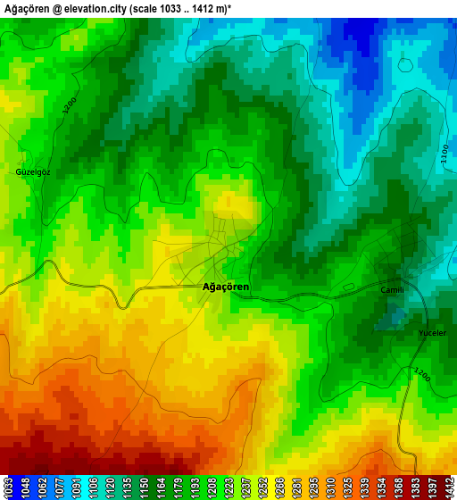
Below is the Elevation map of Ağaçören, which displays elevation range with different colors. Scale of the first map is from 1033 to 1412 m (3389 to 4633 ft) with average elevation of 1207.1 meters (=3960 ft) [note 1]
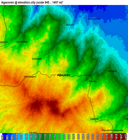
These maps also provides idea of topography and contour of this city, they are displayed at different zoom levels. More info about maps, scale and edge coordinates you can find below images.
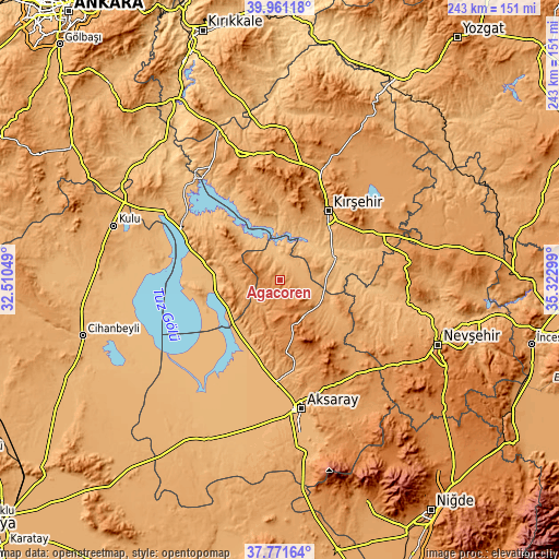
| \ | Map #1 | Map #2 | Topo.Map |
| Scale [m] | 1033..1412 m | 945..1457 m | × |
| Scale [ft] | 3389..4633 ft | 3100..4780 ft | × |
| Average | 1207.1 m = 3960 ft | 1183.3 m = 3882 ft | × |
| Width | 7.61 km = 4.7 mi | 15.22 km = 9.5 mi | 243.5 km = 151.3 mi |
| Height | 7.61 km = 4.7 mi | 15.22 km = 9.5 mi | 243.4 km = 151.2 mi |
| ↑Max Latitude | 38.909044° | 38.943232° | 39.96118° |
| Latitude at center | 38.87484° | 38.87484° | 38.87484° |
| ↓Min Latitude | 38.84062° | 38.806383° | 37.77164° |
| ← Min Longitude | 33.872795° | 33.828849° | 32.51049° |
| Longitude center | 33.91674° | 33.91674° | 33.91674° |
| →Max Longitude | 33.960685° | 34.004631° | 35.32299° |
Nearby cities:
Cities around Ağaçören sort by population:
• Kırşehir elevation 997 m
36.9 km,  35°
35°
• Şereflikoçhisar 948 m
33.5 km,  282°
282°
• Ortaköy 1226 m
18.6 km,  145°
145°
• Mucur 1084 m
45.3 km,  62°
62°
• Sarıyahşi 971 m
13.7 km,  331°
331°
• Salanda 1018 m
53.6 km,  95°
95°
• Boztepe 1181 m
53 km,  34°
34°
• Yeşilova 935 m
52.2 km,  187°
187°
• Savcılı 932 m
44.3 km, 332°
• Acıpınar 993 m
39.1 km, 188°
• Balcı 1160 m
23.1 km,  136°
136°
• Evren 895 m
19.1 km, 330°
Multilingual:
 En español:
Ağaçören elevación 1232 m.
 En France:
Ağaçören élévation 1232 m.
 Auf Deutsch:
Ağaçören höhe über dem Meeresspiegel ist 1232 m.

Sources and notes:
- [note 1] Map square and city borders are not equal. Map elevation data is calculated only from area inside that square.
- [src 1] Elevation data from geonames database provided with same terms of usage.
- [src 2] The elevation map of Ağaçören is generated using elevation data from NASA's 3 arcsec (90m) resolution SRTM data.
- [src 3] Base (background) map © OpenStreetMap contributors tiles are generated by Geofabrik and OpenTopoMap.
Copyright & License:
This Ağaçören Elevation Map is licensed under CC BY-SA. You may reuse any part from this page, if you give a proper credit by linking to this URL:
 More info on terms of use page.