Malabadi elevation
Malabadi (Diyarbakır), Turkey elevation is 613 meters and Malabadi elevation in feet is 2011 ft above sea level [src 1]. Malabadi is a seat of a third-order administrative division (feature code) with elevation that is 110 meters (361 ft) smaller than average city elevation in Turkey.
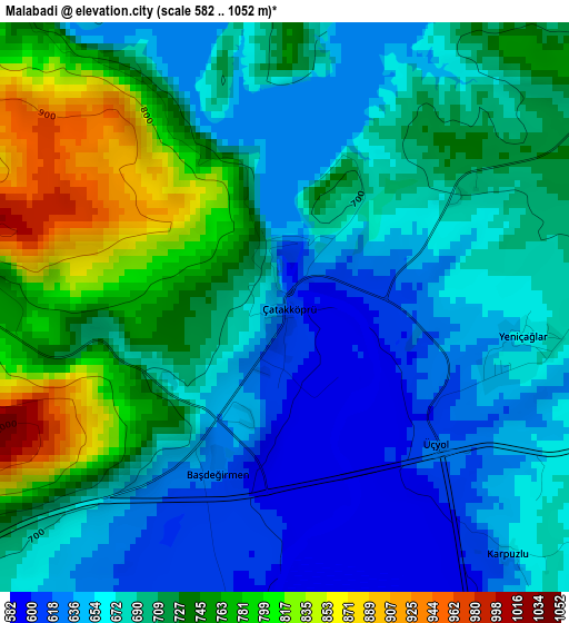
Below is the Elevation map of Malabadi, which displays elevation range with different colors. Scale of the first map is from 582 to 1052 m (1909 to 3451 ft) with average elevation of 700.5 meters (=2298 ft) [note 1]
These maps also provides idea of topography and contour of this city, they are displayed at different zoom levels. More info about maps, scale and edge coordinates you can find below images.
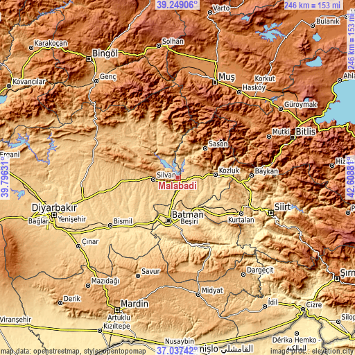
| \ | Map #1 | Topo.Map |
| Scale [m] | 582..1052 m | × |
| Scale [ft] | 1909..3451 ft | × |
| Average | 700.5 m = 2298 ft | × |
| Width | 7.68 km = 4.8 mi | 245.9 km = 152.8 mi |
| Height | 7.68 km = 4.8 mi | 245.9 km = 152.8 mi |
| ↑Max Latitude | 38.186169° | 39.24906° |
| Latitude at center | 38.15162° | 38.15162° |
| ↓Min Latitude | 38.117054° | 37.03742° |
| ← Min Longitude | 41.158615° | 39.79631° |
| Longitude center | 41.20256° | 41.20256° |
| →Max Longitude | 41.246505° | 42.60881° |
Nearby cities:
Cities around Malabadi sort by population:
• Silvan elevation 810 m
17.1 km,  264°
264°
• Kozluk 937 m
24.5 km,  79°
79°
• Sason 981 m
26.9 km,  43°
43°
• Beşiri 770 m
27.2 km,  164°
164°
• Aviski 567 m
23.6 km,  151°
151°
• Doğankavak 751 m
21.1 km,  174°
174°
• Altınkum 656 m
17.5 km,  315°
315°
• Demiryol 622 m
26.4 km,  190°
190°
• Taliban 575 m
26.5 km,  135°
135°
• Hamzalı 1049 m
21.4 km,  350°
350°
• Beyçayırı 627 m
18.6 km, 145°
• Bekirhan 645 m
8 km,  98°
98°
Multilingual:
 En español:
Malabadi elevación 613 m.
 En France:
Malabadi élévation 613 m.
 Auf Deutsch:
Malabadi höhe über dem Meeresspiegel ist 613 m.

Sources and notes:
- [note 1] Map square and city borders are not equal. Map elevation data is calculated only from area inside that square.
- [src 1] Elevation data from geonames database provided with same terms of usage.
- [src 2] The elevation map of Malabadi is generated using elevation data from NASA's 3 arcsec (90m) resolution SRTM data.
- [src 3] Base (background) map © OpenStreetMap contributors tiles are generated by Geofabrik and OpenTopoMap.
Copyright & License:
This Malabadi Elevation Map is licensed under CC BY-SA. You may reuse any part from this page, if you give a proper credit by linking to this URL:
 More info on terms of use page.