Sason elevation
Sason (Batman), Turkey elevation is 981 meters and Sason elevation in feet is 3219 ft above sea level [src 1]. Sason is a seat of a second-order administrative division (feature code) with elevation that is 258 meters (846 ft) bigger than average city elevation in Turkey.
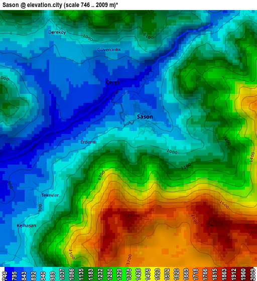
Below is the Elevation map of Sason, which displays elevation range with different colors. Scale of the first map is from 746 to 2009 m (2448 to 6591 ft) with average elevation of 1169.8 meters (=3838 ft) [note 1]
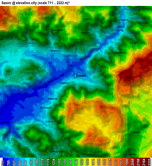
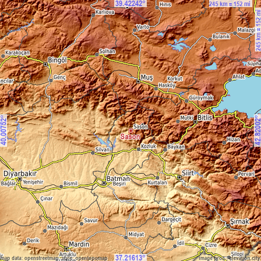
These maps also provides idea of topography and contour of this city, they are displayed at different zoom levels. More info about maps, scale and edge coordinates you can find below images.
| \ | Map #1 | Map #2 | Topo.Map |
| Scale [m] | 746..2009 m | 711..2222 m | × |
| Scale [ft] | 2448..6591 ft | 2333..7290 ft | × |
| Average | 1169.8 m = 3838 ft | 1284.6 m = 4215 ft | × |
| Width | 7.67 km = 4.8 mi | 15.33 km = 9.5 mi | 245.3 km = 152.4 mi |
| Height | 7.67 km = 4.8 mi | 15.33 km = 9.5 mi | 245.3 km = 152.4 mi |
| ↑Max Latitude | 38.362136° | 38.396585° | 39.42242° |
| Latitude at center | 38.32767° | 38.32767° | 38.32767° |
| ↓Min Latitude | 38.293188° | 38.258689° | 37.21613° |
| ← Min Longitude | 41.369825° | 41.325879° | 40.00752° |
| Longitude center | 41.41377° | 41.41377° | 41.41377° |
| →Max Longitude | 41.457715° | 41.501661° | 42.82002° |
Nearby cities:
Cities around Sason sort by population:
• Kozluk elevation 937 m
16.2 km,  159°
159°
• Altınkum 656 m
31.5 km,  256°
256°
• Beyçayırı 627 m
35.7 km,  192°
192°
• Geyikpınar 1710 m
35.5 km,  91°
91°
• Yanarsu 791 m
34.6 km, 159°
• Meydan 913 m
31.2 km,  84°
84°
• Malabadi 613 m
26.9 km,  223°
223°
• Bekirhan 645 m
23.3 km,  206°
206°
• Hamzalı 1049 m
22 km,  274°
274°
• Melefan 834 m
21.3 km,  140°
140°
• Akçasır 1158 m
18.6 km,  315°
315°
• Yücebağ 1079 m
14.7 km,  299°
299°
Multilingual:
 En español:
Sason elevación 981 m.
 En France:
Sason élévation 981 m.


Sources and notes:
- [note 1] Map square and city borders are not equal. Map elevation data is calculated only from area inside that square.
- [src 1] Elevation data from geonames database provided with same terms of usage.
- [src 2] The elevation map of Sason is generated using elevation data from NASA's 3 arcsec (90m) resolution SRTM data.
- [src 3] Base (background) map © OpenStreetMap contributors tiles are generated by Geofabrik and OpenTopoMap.
Copyright & License:
This Sason Elevation Map is licensed under CC BY-SA. You may reuse any part from this page, if you give a proper credit by linking to this URL:
 More info on terms of use page.