Hakkâri elevation
Hakkâri, Turkey elevation is 1697 meters and Hakkâri elevation in feet is 5568 ft above sea level [src 1]. Hakkâri is a seat of a first-order administrative division (feature code) with elevation that is 974 meters (3196 ft) bigger than average city elevation in Turkey.
Below is the Elevation map of Hakkâri, which displays elevation range with different colors. Scale of the first map is from 1232 to 3048 m (4042 to 10000 ft) with average elevation of 1891.2 meters (=6205 ft) [note 1]
These maps also provides idea of topography and contour of this city, they are displayed at different zoom levels. More info about maps, scale and edge coordinates you can find below images.
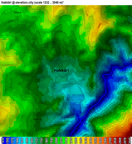
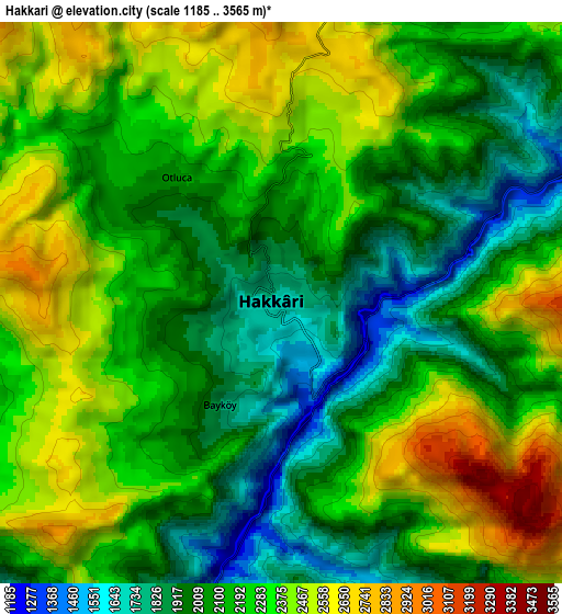
| \ | Map #1 | Map #2 | Topo.Map |
| Scale [m] | 1232..3048 m | 1185..3565 m | × |
| Scale [ft] | 4042..10000 ft | 3888..11696 ft | × |
| Average | 1891.2 m = 6205 ft | 2198.8 m = 7214 ft | × |
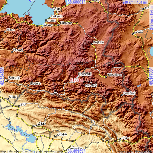
| Width | 7.75 km = 4.8 mi | 15.49 km = 9.6 mi | 247.8 km = 154 mi |
| Height | 7.75 km = 4.8 mi | 15.49 km = 9.6 mi | 247.8 km = 154 mi |
| ↑Max Latitude | 37.609261° | 37.644066° | 38.68061° |
| Latitude at center | 37.57444° | 37.57444° | 37.57444° |
| ↓Min Latitude | 37.539602° | 37.504749° | 36.45159° |
| ← Min Longitude | 43.696885° | 43.652939° | 42.33458° |
| Longitude center | 43.74083° | 43.74083° | 43.74083° |
| →Max Longitude | 43.784775° | 43.828721° | 45.14708° |
Nearby cities:
Cities around Hakkâri sort by population:
• Yüksekova elevation 1874 m
48.1 km,  90°
90°
• Çukurca 1294 m
38 km,  197°
197°
• Beytüşşebap 1475 m
50.7 km,  268°
268°
• Mezraa 2038 m
49.6 km,  281°
281°
• Andaç 1334 m
48.6 km,  239°
239°
• Karsani 1186 m
39 km,  220°
220°
• Ortaköy 1418 m
48.8 km, 235°
• Ashuta 1732 m
42.7 km,  229°
229°
• Dağlıca 1527 m
38.2 km,  127°
127°
• Yalınca 2361 m
36.8 km,  328°
328°
• Hazekyan 1757 m
30.4 km,  58°
58°
• Geçitli 1778 m
15.8 km, 274°
Multilingual:
 En español:
Hakkâri elevación 1697 m.
 En France:
Hakkâri élévation 1697 m.
 Auf Deutsch:
Hakkâri höhe über dem Meeresspiegel ist 1697 m.

Sources and notes:
- [note 1] Map square and city borders are not equal. Map elevation data is calculated only from area inside that square.
- [src 1] Elevation data from geonames database provided with same terms of usage.
- [src 2] The elevation map of Hakkâri is generated using elevation data from NASA's 3 arcsec (90m) resolution SRTM data.
- [src 3] Base (background) map © OpenStreetMap contributors tiles are generated by Geofabrik and OpenTopoMap.
Copyright & License:
This Hakkâri Elevation Map is licensed under CC BY-SA. You may reuse any part from this page, if you give a proper credit by linking to this URL:
 More info on terms of use page.