Mezraa elevation
Mezraa (Şırnak), Turkey elevation is 2038 meters and Mezraa elevation in feet is 6686 ft above sea level [src 1]. Mezraa is a populated place (feature code) with elevation that is 1315 meters (4314 ft) bigger than average city elevation in Turkey.
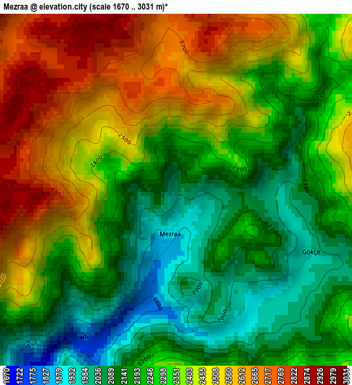
Below is the Elevation map of Mezraa, which displays elevation range with different colors. Scale of the first map is from 1670 to 3031 m (5479 to 9944 ft) with average elevation of 2323.1 meters (=7622 ft) [note 1]
These maps also provides idea of topography and contour of this city, they are displayed at different zoom levels. More info about maps, scale and edge coordinates you can find below images.
| \ | Map #1 | Map #2 | Topo.Map |
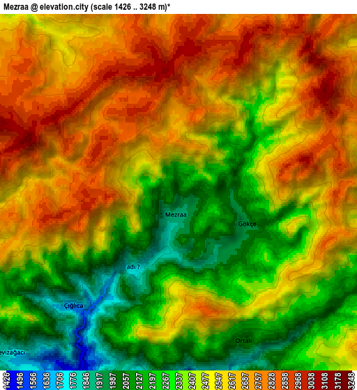
| Scale [m] | 1670..3031 m | 1426..3248 m | × |
| Scale [ft] | 5479..9944 ft | 4678..10656 ft | × |
| Average | 2323.1 m = 7622 ft | 2479.3 m = 8134 ft | × |
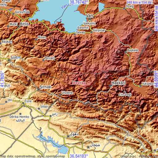
| Width | 7.74 km = 4.8 mi | 15.47 km = 9.6 mi | 247.6 km = 153.9 mi |
| Height | 7.74 km = 4.8 mi | 15.47 km = 9.6 mi | 247.5 km = 153.8 mi |
| ↑Max Latitude | 37.69735° | 37.732114° | 38.76742° |
| Latitude at center | 37.66257° | 37.66257° | 37.66257° |
| ↓Min Latitude | 37.627774° | 37.592961° | 36.54103° |
| ← Min Longitude | 43.144905° | 43.100959° | 41.7826° |
| Longitude center | 43.18885° | 43.18885° | 43.18885° |
| →Max Longitude | 43.232795° | 43.276741° | 44.5951° |
Nearby cities:
Cities around Mezraa sort by population:
• Beytüşşebap elevation 1475 m
11.2 km,  190°
190°
• Uzungeçit 1541 m
25.9 km,  222°
222°
• Becuh 1366 m
34.9 km,  210°
210°
• Konalga 1937 m
23.4 km,  339°
339°
• Andaç 1334 m
34.8 km,  169°
169°
• Yemişli 1201 m
34.3 km,  196°
196°
• Doğanköy 1673 m
36.9 km,  287°
287°
• Başaran 1156 m
21.3 km, 194°
• Boğazören 1514 m
21.9 km,  226°
226°
• Yalınca 2361 m
36.4 km,  53°
53°
• Geçitli 1778 m
33.9 km,  104°
104°
• Narlı 1652 m
31 km,  322°
322°
Multilingual:
 En español:
Mezraa elevación 2038 m.
 En France:
Mezraa élévation 2038 m.


Sources and notes:
- [note 1] Map square and city borders are not equal. Map elevation data is calculated only from area inside that square.
- [src 1] Elevation data from geonames database provided with same terms of usage.
- [src 2] The elevation map of Mezraa is generated using elevation data from NASA's 3 arcsec (90m) resolution SRTM data.
- [src 3] Base (background) map © OpenStreetMap contributors tiles are generated by Geofabrik and OpenTopoMap.
Copyright & License:
This Mezraa Elevation Map is licensed under CC BY-SA. You may reuse any part from this page, if you give a proper credit by linking to this URL:
 More info on terms of use page.