Kırka elevation
Kırka (Eskişehir), Turkey elevation is 1049 meters and Kırka elevation in feet is 3442 ft above sea level [src 1]. Kırka is a seat of a third-order administrative division (feature code) with elevation that is 326 meters (1070 ft) bigger than average city elevation in Turkey.
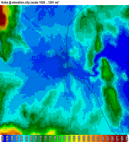
Below is the Elevation map of Kırka, which displays elevation range with different colors. Scale of the first map is from 1029 to 1291 m (3376 to 4236 ft) with average elevation of 1076.8 meters (=3533 ft) [note 1]
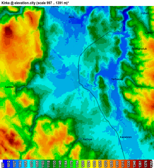
These maps also provides idea of topography and contour of this city, they are displayed at different zoom levels. More info about maps, scale and edge coordinates you can find below images.
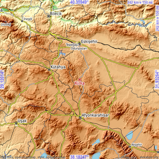
| \ | Map #1 | Map #2 | Topo.Map |
| Scale [m] | 1029..1291 m | 997..1391 m | × |
| Scale [ft] | 3376..4236 ft | 3271..4564 ft | × |
| Average | 1076.8 m = 3533 ft | 1137 m = 3730 ft | × |
| Width | 7.56 km = 4.7 mi | 15.13 km = 9.4 mi | 242.1 km = 150.4 mi |
| Height | 7.56 km = 4.7 mi | 15.13 km = 9.4 mi | 242.1 km = 150.4 mi |
| ↑Max Latitude | 39.313448° | 39.34744° | 40.35949° |
| Latitude at center | 39.27944° | 39.27944° | 39.27944° |
| ↓Min Latitude | 39.245415° | 39.211374° | 38.18247° |
| ← Min Longitude | 30.482445° | 30.438499° | 29.12014° |
| Longitude center | 30.52639° | 30.52639° | 30.52639° |
| →Max Longitude | 30.570335° | 30.614281° | 31.93264° |
Nearby cities:
Cities around Kırka sort by population:
• Eskişehir elevation 794 m
55.3 km,  359°
359°
• Kütahya 947 m
49.4 km,  289°
289°
• İscehisar 1076 m
50.3 km,  157°
157°
• Çifteler 876 m
45.6 km,  75°
75°
• İhsaniye 1101 m
29.4 km,  198°
198°
• Bayat 1063 m
47.6 km,  133°
133°
• Seyitgazi 983 m
23.4 km,  38°
38°
• Odunpazarı 799 m
54.4 km,  0°
0°
• Mahmudiye 887 m
46.5 km,  58°
58°
• Altıntaş 1033 m
43.5 km,  235°
235°
• Sabuncu 963 m
42.7 km,  317°
317°
• Han 1220 m
31.8 km,  114°
114°
Multilingual:
 En español:
Kırka elevación 1049 m.
 En France:
Kırka élévation 1049 m.


Sources and notes:
- [note 1] Map square and city borders are not equal. Map elevation data is calculated only from area inside that square.
- [src 1] Elevation data from geonames database provided with same terms of usage.
- [src 2] The elevation map of Kırka is generated using elevation data from NASA's 3 arcsec (90m) resolution SRTM data.
- [src 3] Base (background) map © OpenStreetMap contributors tiles are generated by Geofabrik and OpenTopoMap.
Copyright & License:
This Kırka Elevation Map is licensed under CC BY-SA. You may reuse any part from this page, if you give a proper credit by linking to this URL:
 More info on terms of use page.