Serinhisar elevation
Serinhisar (Denizli), Turkey elevation is 958 meters and Serinhisar elevation in feet is 3143 ft above sea level [src 1]. Serinhisar is a seat of a second-order administrative division (feature code) with elevation that is 235 meters (771 ft) bigger than average city elevation in Turkey.
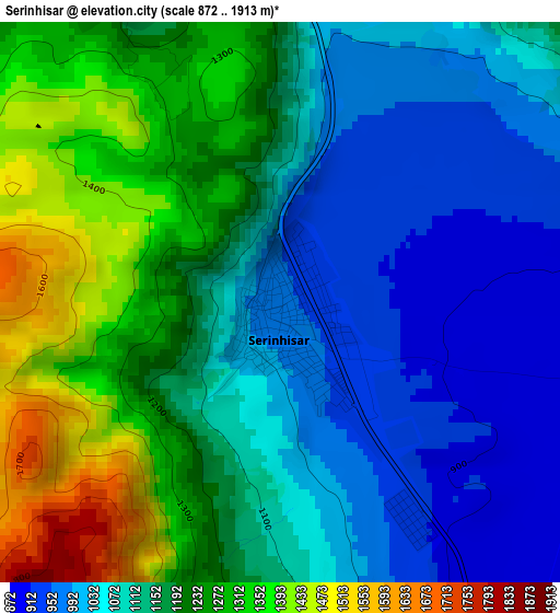
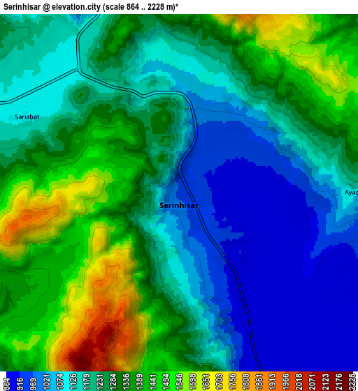
Below is the Elevation map of Serinhisar, which displays elevation range with different colors. Scale of the first map is from 872 to 1913 m (2861 to 6276 ft) with average elevation of 1150 meters (=3773 ft) [note 1]
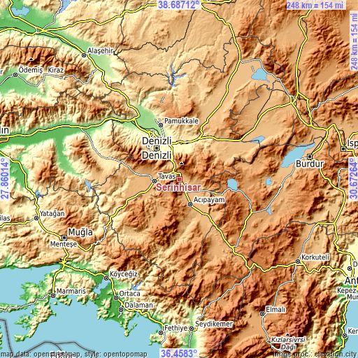
These maps also provides idea of topography and contour of this city, they are displayed at different zoom levels. More info about maps, scale and edge coordinates you can find below images.
| \ | Map #1 | Map #2 | Topo.Map |
| Scale [m] | 872..1913 m | 864..2228 m | × |
| Scale [ft] | 2861..6276 ft | 2835..7310 ft | × |
| Average | 1150 m = 3773 ft | 1243.6 m = 4080 ft | × |
| Width | 7.74 km = 4.8 mi | 15.49 km = 9.6 mi | 247.8 km = 154 mi |
| Height | 7.74 km = 4.8 mi | 15.49 km = 9.6 mi | 247.8 km = 154 mi |
| ↑Max Latitude | 37.615868° | 37.65067° | 38.68712° |
| Latitude at center | 37.58105° | 37.58105° | 37.58105° |
| ↓Min Latitude | 37.546216° | 37.511365° | 36.4583° |
| ← Min Longitude | 29.222445° | 29.178499° | 27.86014° |
| Longitude center | 29.26639° | 29.26639° | 29.26639° |
| →Max Longitude | 29.310335° | 29.354281° | 30.67264° |
Nearby cities:
Cities around Serinhisar sort by population:
• Denizli elevation 405 m
26.6 km,  323°
323°
• Merkezefendi 439 m
31.8 km, 321°
• Tavas 948 m
17.3 km,  267°
267°
• Acıpayam 947 m
19 km,  157°
157°
• Pamukkale 255 m
39.5 km,  340°
340°
• Honaz 559 m
19.6 km,  0°
0°
• Kale 1059 m
40.4 km,  246°
246°
• Nikfer 1064 m
22.6 km,  210°
210°
• Bozkurt 861 m
40.5 km,  48°
48°
• Kelekçi 815 m
38 km,  174°
174°
• Pamukkale 329 m
27.5 km,  328°
328°
• Kızılcabölük 962 m
22.1 km,  278°
278°
Multilingual:
 En español:
Serinhisar elevación 958 m.
 En France:
Serinhisar élévation 958 m.
 Auf Deutsch:
Serinhisar höhe über dem Meeresspiegel ist 958 m.

Sources and notes:
- [note 1] Map square and city borders are not equal. Map elevation data is calculated only from area inside that square.
- [src 1] Elevation data from geonames database provided with same terms of usage.
- [src 2] The elevation map of Serinhisar is generated using elevation data from NASA's 3 arcsec (90m) resolution SRTM data.
- [src 3] Base (background) map © OpenStreetMap contributors tiles are generated by Geofabrik and OpenTopoMap.
Copyright & License:
This Serinhisar Elevation Map is licensed under CC BY-SA. You may reuse any part from this page, if you give a proper credit by linking to this URL:
 More info on terms of use page.