Obigarm elevation
Obigarm (Republican Subordination), Tajikistan elevation is 1358 meters and Obigarm elevation in feet is 4455 ft above sea level [src 1]. Obigarm is a populated place (feature code) with elevation that is 404 meters (1325 ft) bigger than average city elevation in Tajikistan.
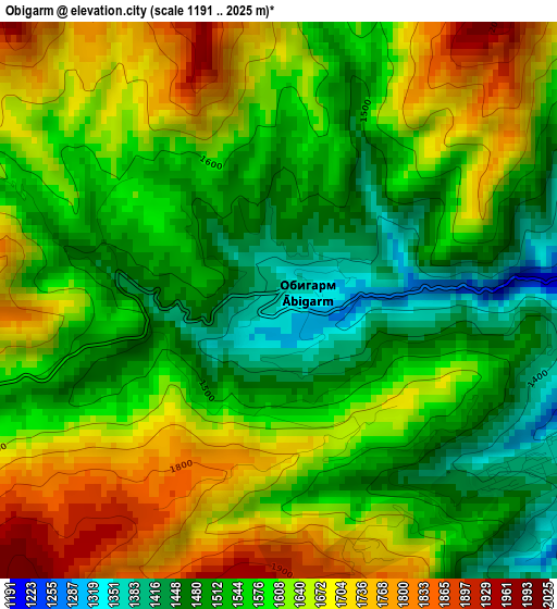
Below is the Elevation map of Obigarm, which displays elevation range with different colors. Scale of the first map is from 1191 to 2025 m (3907 to 6644 ft) with average elevation of 1592.5 meters (=5225 ft) [note 1]
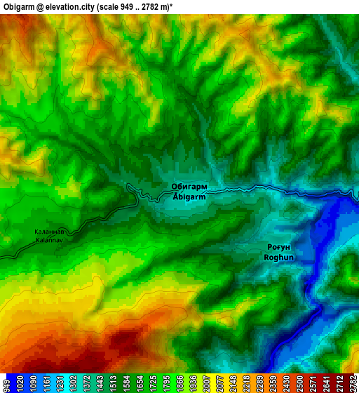
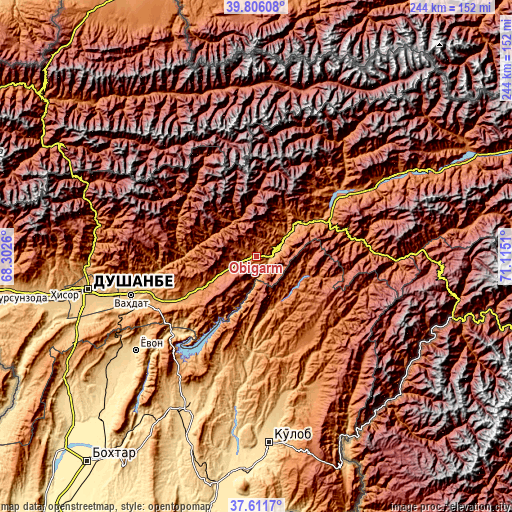
These maps also provides idea of topography and contour of this city, they are displayed at different zoom levels. More info about maps, scale and edge coordinates you can find below images.
| \ | Map #1 | Map #2 | Topo.Map |
| Scale [m] | 1191..2025 m | 949..2782 m | × |
| Scale [ft] | 3907..6644 ft | 3114..9127 ft | × |
| Average | 1592.5 m = 5225 ft | 1745 m = 5725 ft | × |
| Width | 7.62 km = 4.7 mi | 15.25 km = 9.5 mi | 244 km = 151.6 mi |
| Height | 7.62 km = 4.7 mi | 15.25 km = 9.5 mi | 244 km = 151.6 mi |
| ↑Max Latitude | 38.75159° | 38.785853° | 39.80608° |
| Latitude at center | 38.71731° | 38.71731° | 38.71731° |
| ↓Min Latitude | 38.683014° | 38.648701° | 37.6117° |
| ← Min Longitude | 69.664905° | 69.620959° | 68.3026° |
| Longitude center | 69.70885° | 69.70885° | 69.70885° |
| →Max Longitude | 69.752795° | 69.796741° | 71.1151° |
Nearby cities:
Cities around Obigarm sort by population:
• Vahdat elevation 872 m
63 km,  253°
253°
• Norak 660 m
49.6 km,  222°
222°
• Rasht 1371 m
67.2 km,  58°
58°
• Roghun 1251 m
15.8 km, 62°
• Novobod 1276 m
50.3 km,  49°
49°
• Tagob 1467 m
71.5 km,  280°
280°
• Darband 1254 m
27.9 km, 53°
• Tavildara 1618 m
67.3 km,  92°
92°
• Khovaling 1416 m
47.7 km,  150°
150°
• Baljuvon 915 m
45.6 km,  183°
183°
• Fayzobod 1212 m
38.7 km,  240°
240°
• Roghun 1454 m
3.6 km,  137°
137°
Multilingual:
 En español:
Obigarm elevación 1358 m.
 En France:
Obigarm élévation 1358 m.
 Auf Deutsch:
Obigarm höhe über dem Meeresspiegel ist 1358 m.

Sources and notes:
- [note 1] Map square and city borders are not equal. Map elevation data is calculated only from area inside that square.
- [src 1] Elevation data from geonames database provided with same terms of usage.
- [src 2] The elevation map of Obigarm is generated using elevation data from NASA's 3 arcsec (90m) resolution SRTM data.
- [src 3] Base (background) map © OpenStreetMap contributors tiles are generated by Geofabrik and OpenTopoMap.
Copyright & License:
This Obigarm Elevation Map is licensed under CC BY-SA. You may reuse any part from this page, if you give a proper credit by linking to this URL:
 More info on terms of use page.