Kartaly elevation
Kartaly (Chelyabinsk), Russia elevation is 299 meters and Kartaly elevation in feet is 981 ft above sea level [src 1]. Kartaly is a populated place (feature code) with elevation that is 100 meters (328 ft) bigger than average city elevation in Russia.
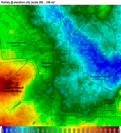
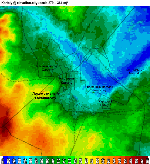
Below is the Elevation map of Kartaly, which displays elevation range with different colors. Scale of the first map is from 282 to 336 m (925 to 1102 ft) with average elevation of 301.6 meters (=990 ft) [note 1]
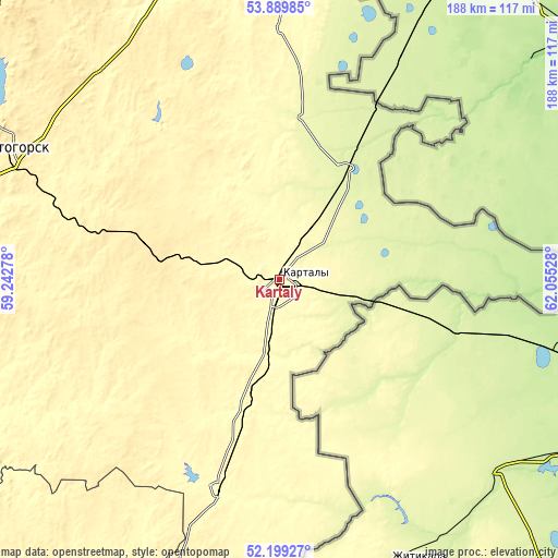
These maps also provides idea of topography and contour of this city, they are displayed at different zoom levels. More info about maps, scale and edge coordinates you can find below images.
| \ | Map #1 | Map #2 | Topo.Map |
| Scale [m] | 282..336 m | 279..364 m | × |
| Scale [ft] | 925..1102 ft | 915..1194 ft | × |
| Average | 301.6 m = 990 ft | 310.3 m = 1018 ft | × |
| Width | 5.87 km = 3.6 mi | 11.75 km = 7.3 mi | 188 km = 116.8 mi |
| Height | 5.87 km = 3.6 mi | 11.75 km = 7.3 mi | 188 km = 116.8 mi |
| ↑Max Latitude | 53.079256° | 53.105647° | 53.88985° |
| Latitude at center | 53.05285° | 53.05285° | 53.05285° |
| ↓Min Latitude | 53.026427° | 52.999988° | 52.19927° |
| ← Min Longitude | 60.605085° | 60.561139° | 59.24278° |
| Longitude center | 60.64903° | 60.64903° | 60.64903° |
| →Max Longitude | 60.692975° | 60.736921° | 62.05528° |
Nearby cities:
Cities around Kartaly sort by population:
• Magnitogorsk elevation 361 m
114.1 km,  290°
290°
• Lokomotivnyy 351 m
7.1 km,  229°
229°
• Bredy 302 m
73.9 km,  196°
196°
• Varna 250 m
42.5 km,  30°
30°
• Agapovka 344 m
104.5 km, 285°
• Chesma 314 m
84.3 km,  0°
0°
• Fershampenuaz 354 m
76.1 km,  313°
313°
• Kvarkeno 281 m
124.6 km,  210°
210°
• Krasnoyarskiy 318 m
131.2 km, 202°
• Parizh 377 m
45.6 km, 306°
• Alandskoye 318 m
108.5 km, 212°
• Velikopetrovka 328 m
24.5 km,  333°
333°
Multilingual:
 En español:
Kartaly elevación 299 m.
 En France:
Kartaly élévation 299 m.


Sources and notes:
- [note 1] Map square and city borders are not equal. Map elevation data is calculated only from area inside that square.
- [src 1] Elevation data from geonames database provided with same terms of usage.
- [src 2] The elevation map of Kartaly is generated using elevation data from NASA's 3 arcsec (90m) resolution SRTM data.
- [src 3] Base (background) map © OpenStreetMap contributors tiles are generated by Geofabrik and OpenTopoMap.
Copyright & License:
This Kartaly Elevation Map is licensed under CC BY-SA. You may reuse any part from this page, if you give a proper credit by linking to this URL:
 More info on terms of use page.