Icuseşti elevation
Icuseşti (Neamţ, Comuna Icuseşti), Romania elevation is 169 meters and Icuseşti elevation in feet is 554 ft above sea level [src 1]. Icuseşti is a seat of a second-order administrative division (feature code) with elevation that is 83 meters (272 ft) smaller than average city elevation in Romania.
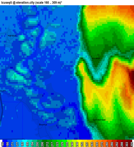
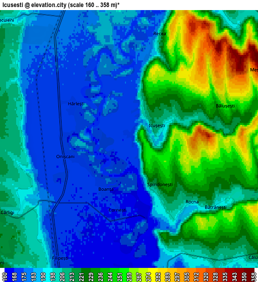
Below is the Elevation map of Icuseşti, which displays elevation range with different colors. Scale of the first map is from 160 to 309 m (525 to 1014 ft) with average elevation of 195.5 meters (=641 ft) [note 1]
These maps also provides idea of topography and contour of this city, they are displayed at different zoom levels. More info about maps, scale and edge coordinates you can find below images.
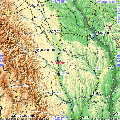
| \ | Map #1 | Map #2 | Topo.Map |
| Scale [m] | 160..309 m | 160..358 m | × |
| Scale [ft] | 525..1014 ft | 525..1175 ft | × |
| Average | 195.5 m = 641 ft | 207.3 m = 680 ft | × |
| Width | 6.69 km = 4.2 mi | 13.38 km = 8.3 mi | 214.1 km = 133 mi |
| Height | 6.69 km = 4.2 mi | 13.38 km = 8.3 mi | 214.1 km = 133 mi |
| ↑Max Latitude | 46.830074° | 46.860132° | 47.75404° |
| Latitude at center | 46.8° | 46.8° | 46.8° |
| ↓Min Latitude | 46.769909° | 46.739801° | 45.82874° |
| ← Min Longitude | 26.889385° | 26.845439° | 25.52708° |
| Longitude center | 26.93333° | 26.93333° | 26.93333° |
| →Max Longitude | 26.977275° | 27.021221° | 28.33958° |
Nearby cities:
Cities around Icuseşti sort by population:
• Filipeşti elevation 173 m
6.7 km,  214°
214°
• Valea Ursului 278 m
11.6 km,  80°
80°
• Bahna 282 m
11.6 km,  260°
260°
• Cotu Vameș 184 m
11.9 km,  8°
8°
• Negri 162 m
11.4 km,  167°
167°
• Ion Creangă 187 m
8.6 km,  24°
24°
• Bălușești 261 m
5.3 km,  70°
70°
• Dămieneşti 178 m
8.3 km,  152°
152°
• Izvoare 278 m
11.6 km,  239°
239°
• Cârligi 208 m
7.4 km, 238°
• Chilii 330 m
7.7 km,  87°
87°
• Secuieni 223 m
9.4 km,  306°
306°
Multilingual:
 En español:
Icuseşti elevación 169 m.
 En France:
Icuseşti élévation 169 m.
 Auf Deutsch:
Icuseşti höhe über dem Meeresspiegel ist 169 m.

Sources and notes:
- [note 1] Map square and city borders are not equal. Map elevation data is calculated only from area inside that square.
- [src 1] Elevation data from geonames database provided with same terms of usage.
- [src 2] The elevation map of Icuseşti is generated using elevation data from NASA's 3 arcsec (90m) resolution SRTM data.
- [src 3] Base (background) map © OpenStreetMap contributors tiles are generated by Geofabrik and OpenTopoMap.
Copyright & License:
This Icuseşti Elevation Map is licensed under CC BY-SA. You may reuse any part from this page, if you give a proper credit by linking to this URL:
 More info on terms of use page.