Lespezi elevation
Lespezi (Vrancea, Comuna Homocea), Romania elevation is 111 meters and Lespezi elevation in feet is 364 ft above sea level [src 1]. Lespezi is a populated place (feature code) with elevation that is 141 meters (463 ft) smaller than average city elevation in Romania.
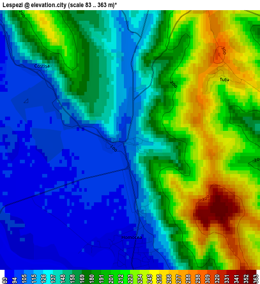
Below is the Elevation map of Lespezi, which displays elevation range with different colors. Scale of the first map is from 83 to 363 m (272 to 1191 ft) with average elevation of 165 meters (=541 ft) [note 1]
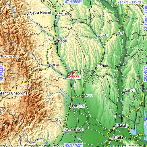
These maps also provides idea of topography and contour of this city, they are displayed at different zoom levels. More info about maps, scale and edge coordinates you can find below images.
| \ | Map #1 | Topo.Map |
| Scale [m] | 83..363 m | × |
| Scale [ft] | 272..1191 ft | × |
| Average | 165 m = 541 ft | × |
| Width | 6.77 km = 4.2 mi | 216.6 km = 134.6 mi |
| Height | 6.77 km = 4.2 mi | 216.6 km = 134.6 mi |
| ↑Max Latitude | 46.1907° | 47.12568° |
| Latitude at center | 46.16027° | 46.16027° |
| ↓Min Latitude | 46.129823° | 45.17762° |
| ← Min Longitude | 27.196705° | 25.8344° |
| Longitude center | 27.24065° | 27.24065° |
| →Max Longitude | 27.284595° | 28.6469° |
Nearby cities:
Cities around Lespezi sort by population:
• Adjud elevation 101 m
8.8 km,  220°
220°
• Sascut 152 m
11.7 km,  292°
292°
• Homocea 88 m
3 km,  190°
190°
• Podu Turcului 114 m
11.8 km,  68°
68°
• Ploscuțeni 91 m
9.4 km,  165°
165°
• Tănăsoaia 206 m
11.8 km,  124°
124°
• Corbiţa 136 m
4.7 km,  104°
104°
• Bogheşti 168 m
12.3 km,  86°
86°
• Adjudu Vechi 103 m
4.9 km,  234°
234°
• Berești 104 m
8.8 km,  302°
302°
• Huruiești 281 m
11.9 km,  3°
3°
• Tătărăști 227 m
7 km,  333°
333°
Multilingual:
 En español:
Lespezi elevación 111 m.
 En France:
Lespezi élévation 111 m.


Sources and notes:
- [note 1] Map square and city borders are not equal. Map elevation data is calculated only from area inside that square.
- [src 1] Elevation data from geonames database provided with same terms of usage.
- [src 2] The elevation map of Lespezi is generated using elevation data from NASA's 3 arcsec (90m) resolution SRTM data.
- [src 3] Base (background) map © OpenStreetMap contributors tiles are generated by Geofabrik and OpenTopoMap.
Copyright & License:
This Lespezi Elevation Map is licensed under CC BY-SA. You may reuse any part from this page, if you give a proper credit by linking to this URL:
 More info on terms of use page.