Adjud elevation
Adjud (Vrancea, Municipiul Adjud), Romania elevation is 101 meters and Adjud elevation in feet is 331 ft above sea level [src 1]. Adjud is a populated place (feature code) with elevation that is 151 meters (495 ft) smaller than average city elevation in Romania.
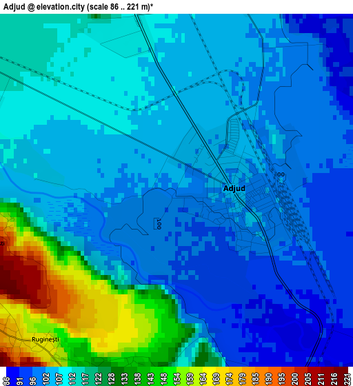
Below is the Elevation map of Adjud, which displays elevation range with different colors. Scale of the first map is from 86 to 221 m (282 to 725 ft) with average elevation of 111.8 meters (=367 ft) [note 1]
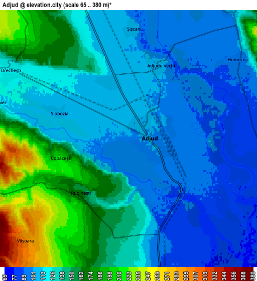
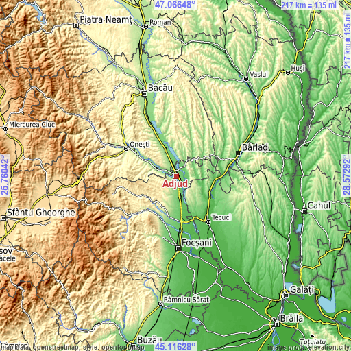
These maps also provides idea of topography and contour of this city, they are displayed at different zoom levels. More info about maps, scale and edge coordinates you can find below images.
| \ | Map #1 | Map #2 | Topo.Map |
| Scale [m] | 86..221 m | 65..380 m | × |
| Scale [ft] | 282..725 ft | 213..1247 ft | × |
| Average | 111.8 m = 367 ft | 132.4 m = 434 ft | × |
| Width | 6.78 km = 4.2 mi | 13.55 km = 8.4 mi | 216.8 km = 134.7 mi |
| Height | 6.78 km = 4.2 mi | 13.55 km = 8.4 mi | 216.8 km = 134.7 mi |
| ↑Max Latitude | 46.130463° | 46.16091° | 47.06648° |
| Latitude at center | 46.1° | 46.1° | 46.1° |
| ↓Min Latitude | 46.06952° | 46.039023° | 45.11628° |
| ← Min Longitude | 27.122725° | 27.078779° | 25.76042° |
| Longitude center | 27.16667° | 27.16667° | 27.16667° |
| →Max Longitude | 27.210615° | 27.254561° | 28.57292° |
Nearby cities:
Cities around Adjud sort by population:
• Homocea elevation 88 m
6.3 km,  54°
54°
• Păuneşti 261 m
9 km,  214°
214°
• Rugineşti 239 m
5.3 km,  226°
226°
• Pufeşti 86 m
11.4 km,  166°
166°
• Urecheşti 121 m
7.4 km,  299°
299°
• Ploscuțeni 91 m
8.3 km,  106°
106°
• Adjudu Vechi 103 m
4.2 km,  23°
23°
• Berești 104 m
11.6 km,  351°
351°
• Anghelești 238 m
8.2 km,  253°
253°
• Lespezi 111 m
8.8 km,  40°
40°
• Domnești-Târg 98 m
9.4 km, 172°
• Viișoara 299 m
7.7 km, 225°
Multilingual:
 En español:
Adjud elevación 101 m.
 En France:
Adjud élévation 101 m.


Sources and notes:
- [note 1] Map square and city borders are not equal. Map elevation data is calculated only from area inside that square.
- [src 1] Elevation data from geonames database provided with same terms of usage.
- [src 2] The elevation map of Adjud is generated using elevation data from NASA's 3 arcsec (90m) resolution SRTM data.
- [src 3] Base (background) map © OpenStreetMap contributors tiles are generated by Geofabrik and OpenTopoMap.
Copyright & License:
This Adjud Elevation Map is licensed under CC BY-SA. You may reuse any part from this page, if you give a proper credit by linking to this URL:
 More info on terms of use page.