Berești elevation
Berești (Bacău, Comuna Sascut), Romania elevation is 104 meters and Berești elevation in feet is 341 ft above sea level [src 1]. Berești is a populated place (feature code) with elevation that is 148 meters (486 ft) smaller than average city elevation in Romania.
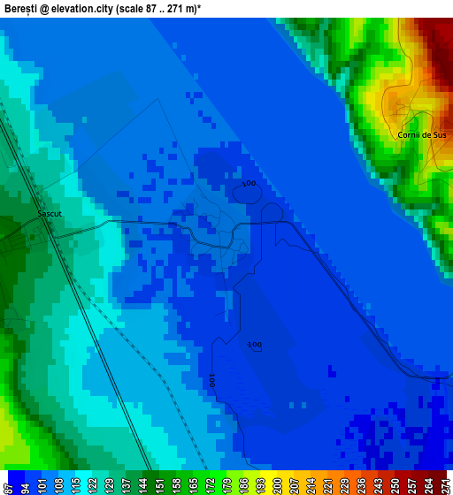
Below is the Elevation map of Berești, which displays elevation range with different colors. Scale of the first map is from 87 to 271 m (285 to 889 ft) with average elevation of 118.3 meters (=388 ft) [note 1]
These maps also provides idea of topography and contour of this city, they are displayed at different zoom levels. More info about maps, scale and edge coordinates you can find below images.
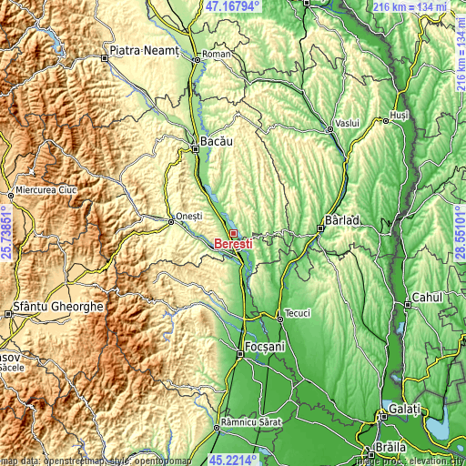
| \ | Map #1 | Topo.Map |
| Scale [m] | 87..271 m | × |
| Scale [ft] | 285..889 ft | × |
| Average | 118.3 m = 388 ft | × |
| Width | 6.76 km = 4.2 mi | 216.4 km = 134.5 mi |
| Height | 6.76 km = 4.2 mi | 216.4 km = 134.5 mi |
| ↑Max Latitude | 46.233696° | 47.16794° |
| Latitude at center | 46.20329° | 46.20329° |
| ↓Min Latitude | 46.172867° | 45.2214° |
| ← Min Longitude | 27.100815° | 25.73851° |
| Longitude center | 27.14476° | 27.14476° |
| →Max Longitude | 27.188705° | 28.55101° |
Nearby cities:
Cities around Berești sort by population:
• Adjud elevation 101 m
11.6 km,  171°
171°
• Sascut 152 m
3.5 km,  263°
263°
• Homocea 88 m
10.3 km,  138°
138°
• Corbasca 255 m
9.1 km,  10°
10°
• Urecheşti 121 m
9.1 km,  211°
211°
• Păncești 194 m
6 km,  278°
278°
• Valea Seacă 199 m
8.8 km,  300°
300°
• Sascut-Sat 218 m
6.1 km,  253°
253°
• Adjudu Vechi 103 m
8.3 km,  155°
155°
• Lespezi 111 m
8.8 km,  122°
122°
• Huruiești 281 m
10.7 km,  48°
48°
• Tătărăști 227 m
4.5 km,  70°
70°
Multilingual:
 En español:
Berești elevación 104 m.
 En France:
Berești élévation 104 m.


Sources and notes:
- [note 1] Map square and city borders are not equal. Map elevation data is calculated only from area inside that square.
- [src 1] Elevation data from geonames database provided with same terms of usage.
- [src 2] The elevation map of Berești is generated using elevation data from NASA's 3 arcsec (90m) resolution SRTM data.
- [src 3] Base (background) map © OpenStreetMap contributors tiles are generated by Geofabrik and OpenTopoMap.
Copyright & License:
This Berești Elevation Map is licensed under CC BY-SA. You may reuse any part from this page, if you give a proper credit by linking to this URL:
 More info on terms of use page.