Marghita elevation
Marghita (Bihor, Municipiul Marghita), Romania elevation is 140 meters and Marghita elevation in feet is 459 ft above sea level [src 1]. Marghita is a seat of a second-order administrative division (feature code) with elevation that is 112 meters (367 ft) smaller than average city elevation in Romania.
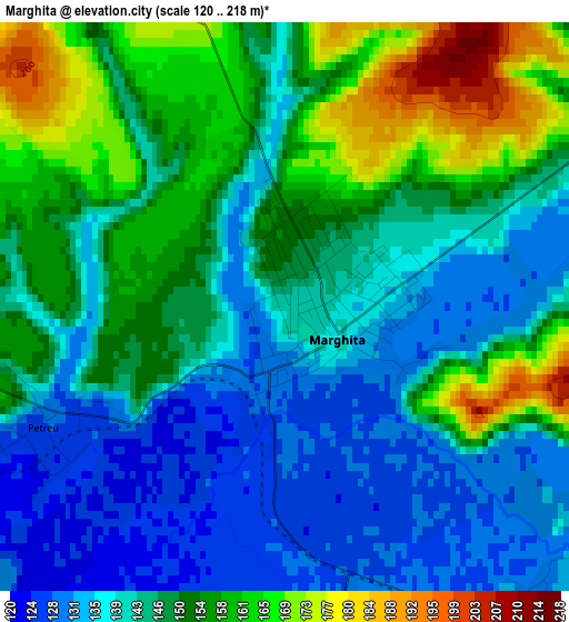
Below is the Elevation map of Marghita, which displays elevation range with different colors. Scale of the first map is from 120 to 218 m (394 to 715 ft) with average elevation of 147.1 meters (=483 ft) [note 1]
These maps also provides idea of topography and contour of this city, they are displayed at different zoom levels. More info about maps, scale and edge coordinates you can find below images.
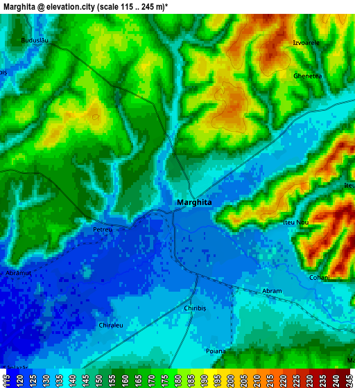
| \ | Map #1 | Map #2 | Topo.Map |
| Scale [m] | 120..218 m | 115..245 m | × |
| Scale [ft] | 394..715 ft | 377..804 ft | × |
| Average | 147.1 m = 483 ft | 154 m = 505 ft | × |
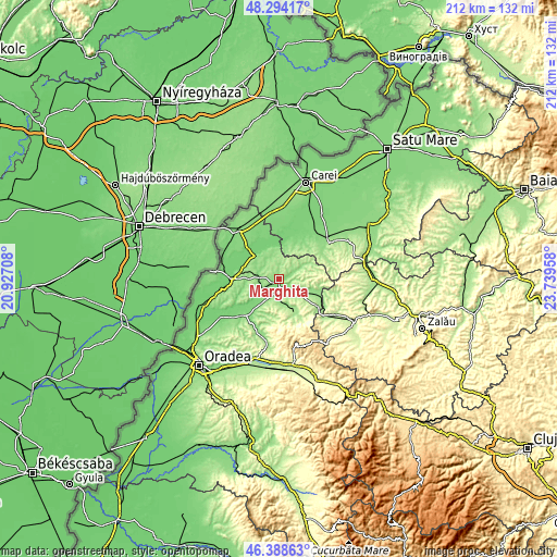
| Width | 6.62 km = 4.1 mi | 13.24 km = 8.2 mi | 211.9 km = 131.7 mi |
| Height | 6.62 km = 4.1 mi | 13.24 km = 8.2 mi | 211.9 km = 131.7 mi |
| ↑Max Latitude | 47.379765° | 47.409514° | 48.29417° |
| Latitude at center | 47.35° | 47.35° | 47.35° |
| ↓Min Latitude | 47.320218° | 47.290419° | 46.38863° |
| ← Min Longitude | 22.289385° | 22.245439° | 20.92708° |
| Longitude center | 22.33333° | 22.33333° | 22.33333° |
| →Max Longitude | 22.377275° | 22.421221° | 23.73958° |
Nearby cities:
Cities around Marghita sort by population:
• Tăuteu elevation 154 m
9.3 km,  180°
180°
• Chişlaz 116 m
10.6 km,  225°
225°
• Abram 130 m
5.3 km,  134°
134°
• Abrămuţ 119 m
7.3 km,  239°
239°
• Buduslău 136 m
7.5 km,  317°
317°
• Petreu 127 m
3.1 km, 243°
• Viişoara 207 m
9.5 km,  67°
67°
• Bogei 147 m
9.6 km,  167°
167°
• Cheț 170 m
7.7 km,  3°
3°
• Albiș 135 m
8 km,  304°
304°
• Mișca 168 m
11.2 km,  210°
210°
• Ciutelec 163 m
10.6 km,  157°
157°
Multilingual:
 En español:
Marghita elevación 140 m.
 En France:
Marghita élévation 140 m.
 Auf Deutsch:
Marghita höhe über dem Meeresspiegel ist 140 m.

Sources and notes:
- [note 1] Map square and city borders are not equal. Map elevation data is calculated only from area inside that square.
- [src 1] Elevation data from geonames database provided with same terms of usage.
- [src 2] The elevation map of Marghita is generated using elevation data from NASA's 3 arcsec (90m) resolution SRTM data.
- [src 3] Base (background) map © OpenStreetMap contributors tiles are generated by Geofabrik and OpenTopoMap.
Copyright & License:
This Marghita Elevation Map is licensed under CC BY-SA. You may reuse any part from this page, if you give a proper credit by linking to this URL:
 More info on terms of use page.