Albiș elevation
Albiș (Bihor, Comuna Buduslău), Romania elevation is 135 meters and Albiș elevation in feet is 443 ft above sea level [src 1]. Albiș is a populated place (feature code) with elevation that is 117 meters (384 ft) smaller than average city elevation in Romania.
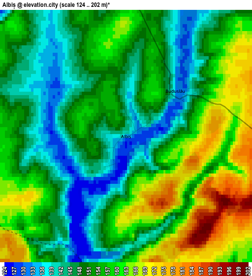
Below is the Elevation map of Albiș, which displays elevation range with different colors. Scale of the first map is from 124 to 202 m (407 to 663 ft) with average elevation of 153.2 meters (=503 ft) [note 1]
These maps also provides idea of topography and contour of this city, they are displayed at different zoom levels. More info about maps, scale and edge coordinates you can find below images.
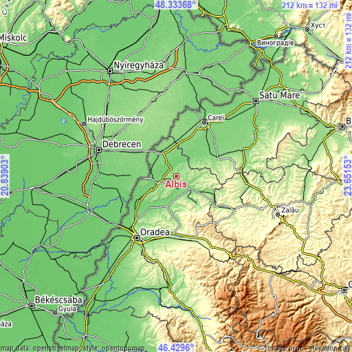
| \ | Map #1 | Topo.Map |
| Scale [m] | 124..202 m | × |
| Scale [ft] | 407..663 ft | × |
| Average | 153.2 m = 503 ft | × |
| Width | 6.62 km = 4.1 mi | 211.7 km = 131.5 mi |
| Height | 6.62 km = 4.1 mi | 211.7 km = 131.5 mi |
| ↑Max Latitude | 47.419983° | 48.33368° |
| Latitude at center | 47.39024° | 47.39024° |
| ↓Min Latitude | 47.360481° | 46.4296° |
| ← Min Longitude | 22.201335° | 20.83903° |
| Longitude center | 22.24528° | 22.24528° |
| →Max Longitude | 22.289225° | 23.65153° |
Nearby cities:
Cities around Albiș sort by population:
• Marghita elevation 140 m
8 km,  124°
124°
• Săcueni 116 m
11.8 km,  247°
247°
• Sălacea 105 m
10.1 km,  32°
32°
• Abrămuţ 119 m
8.2 km,  177°
177°
• Tarcea 105 m
8.1 km,  324°
324°
• Cherechiu 104 m
8.5 km,  264°
264°
• Buduslău 136 m
1.9 km,  56°
56°
• Petreu 127 m
7 km,  146°
146°
• Cheț 170 m
7.7 km,  65°
65°
• Cheșereu 106 m
10.7 km,  292°
292°
• Cubulcut 179 m
8.7 km,  210°
210°
• Galoșpetreu 112 m
10.6 km,  348°
348°
Multilingual:
 En español:
Albiș elevación 135 m.
 En France:
Albiș élévation 135 m.


Sources and notes:
- [note 1] Map square and city borders are not equal. Map elevation data is calculated only from area inside that square.
- [src 1] Elevation data from geonames database provided with same terms of usage.
- [src 2] The elevation map of Albiș is generated using elevation data from NASA's 3 arcsec (90m) resolution SRTM data.
- [src 3] Base (background) map © OpenStreetMap contributors tiles are generated by Geofabrik and OpenTopoMap.
Copyright & License:
This Albiș Elevation Map is licensed under CC BY-SA. You may reuse any part from this page, if you give a proper credit by linking to this URL:
 More info on terms of use page.