Gavião elevation
Gavião (Portalegre), Portugal elevation is 284 meters and Gavião elevation in feet is 932 ft above sea level [src 1]. Gavião is a seat of a second-order administrative division (feature code) with elevation that is 116 meters (381 ft) bigger than average city elevation in Portugal.
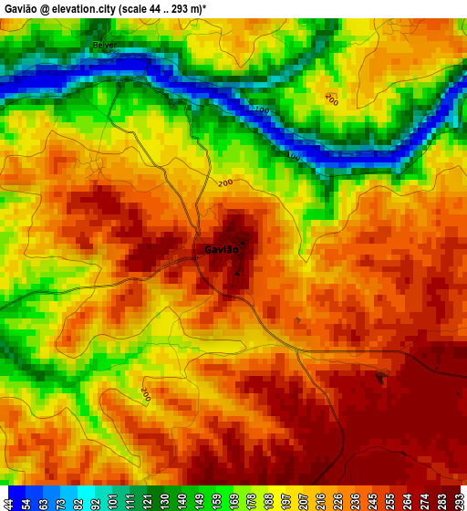
Below is the Elevation map of Gavião, which displays elevation range with different colors. Scale of the first map is from 44 to 293 m (144 to 961 ft) with average elevation of 206 meters (=676 ft) [note 1]
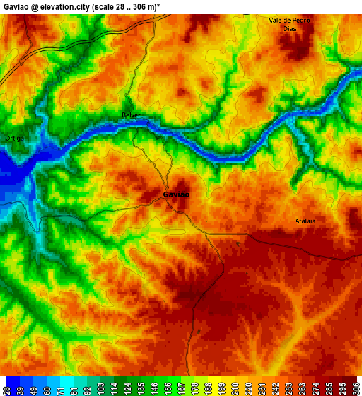
These maps also provides idea of topography and contour of this city, they are displayed at different zoom levels. More info about maps, scale and edge coordinates you can find below images.
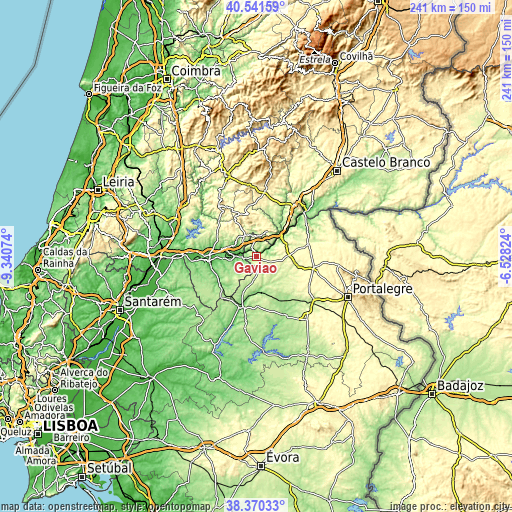
| \ | Map #1 | Map #2 | Topo.Map |
| Scale [m] | 44..293 m | 28..306 m | × |
| Scale [ft] | 144..961 ft | 92..1004 ft | × |
| Average | 206 m = 676 ft | 205.8 m = 675 ft | × |
| Width | 7.54 km = 4.7 mi | 15.09 km = 9.4 mi | 241.4 km = 150 mi |
| Height | 7.54 km = 4.7 mi | 15.09 km = 9.4 mi | 241.4 km = 150 mi |
| ↑Max Latitude | 39.498348° | 39.53225° | 40.54159° |
| Latitude at center | 39.46443° | 39.46443° | 39.46443° |
| ↓Min Latitude | 39.430495° | 39.396544° | 38.37033° |
| ← Min Longitude | -7.978435° | -8.022381° | -9.34074° |
| Longitude center | -7.93449° | -7.93449° | -7.93449° |
| →Max Longitude | -7.890545° | -7.846599° | -6.52824° |
Nearby cities:
Cities around Gavião sort by population:
• Abrantes elevation 133 m
22.8 km,  270°
270°
• Ponte de Sôr 108 m
24.8 km,  195°
195°
• Nisa 307 m
25.1 km,  77°
77°
• São Miguel de Rio Torto 143 m
24.5 km,  261°
261°
• Sardoal 197 m
21 km,  291°
291°
• Tramagal 84 m
27.1 km, 266°
• Alferrarede 66 m
20 km,  276°
276°
• Vila Velha de Ródão 183 m
30.7 km,  45°
45°
• Vila de Rei 444 m
29.7 km,  322°
322°
• Pego 104 m
18.5 km, 268°
• Atalaia 261 m
5.4 km,  100°
100°
• Mação 315 m
11.4 km,  333°
333°
Multilingual:
 En español:
Gavião elevación 284 m.
 En France:
Gavião élévation 284 m.


Sources and notes:
- [note 1] Map square and city borders are not equal. Map elevation data is calculated only from area inside that square.
- [src 1] Elevation data from geonames database provided with same terms of usage.
- [src 2] The elevation map of Gavião is generated using elevation data from NASA's 3 arcsec (90m) resolution SRTM data.
- [src 3] Base (background) map © OpenStreetMap contributors tiles are generated by Geofabrik and OpenTopoMap.
Copyright & License:
This Gavião Elevation Map is licensed under CC BY-SA. You may reuse any part from this page, if you give a proper credit by linking to this URL:
 More info on terms of use page.