Sardoal elevation
Sardoal (Santarém), Portugal elevation is 197 meters and Sardoal elevation in feet is 646 ft above sea level [src 1]. Sardoal is a populated place (feature code) with elevation that is 29 meters (95 ft) bigger than average city elevation in Portugal.
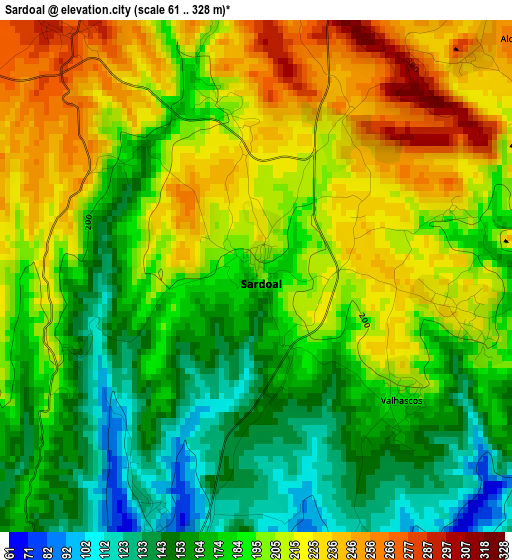
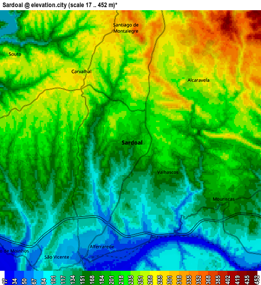
Below is the Elevation map of Sardoal, which displays elevation range with different colors. Scale of the first map is from 61 to 328 m (200 to 1076 ft) with average elevation of 191.5 meters (=628 ft) [note 1]
These maps also provides idea of topography and contour of this city, they are displayed at different zoom levels. More info about maps, scale and edge coordinates you can find below images.
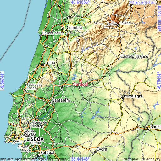
| \ | Map #1 | Map #2 | Topo.Map |
| Scale [m] | 61..328 m | 17..452 m | × |
| Scale [ft] | 200..1076 ft | 56..1483 ft | × |
| Average | 191.5 m = 628 ft | 190.6 m = 625 ft | × |
| Width | 7.54 km = 4.7 mi | 15.07 km = 9.4 mi | 241.2 km = 149.9 mi |
| Height | 7.54 km = 4.7 mi | 15.07 km = 9.4 mi | 241.2 km = 149.9 mi |
| ↑Max Latitude | 39.568374° | 39.602242° | 40.61056° |
| Latitude at center | 39.53449° | 39.53449° | 39.53449° |
| ↓Min Latitude | 39.500589° | 39.466672° | 38.44148° |
| ← Min Longitude | -8.205135° | -8.249081° | -9.56744° |
| Longitude center | -8.16119° | -8.16119° | -8.16119° |
| →Max Longitude | -8.117245° | -8.073299° | -6.75494° |
Nearby cities:
Cities around Sardoal sort by population:
• Abrantes elevation 133 m
8.2 km,  203°
203°
• São Miguel de Rio Torto 143 m
12.2 km, 202°
• Tramagal 84 m
12.1 km,  219°
219°
• Alferrarede 66 m
5.7 km,  184°
184°
• Vila de Rei 444 m
15.8 km,  4°
4°
• Pego 104 m
8.2 km,  172°
172°
• Santa Margarida da Coutada 125 m
16.3 km,  234°
234°
• Praia do Ribatejo 45 m
17.9 km,  245°
245°
• Montalvinho 68 m
13.2 km,  244°
244°
• Montalvo 68 m
13.2 km, 244°
• Constância 37 m
16.3 km, 247°
• Mação 315 m
14.5 km,  80°
80°
Multilingual:
 En español:
Sardoal elevación 197 m.
 En France:
Sardoal élévation 197 m.


Sources and notes:
- [note 1] Map square and city borders are not equal. Map elevation data is calculated only from area inside that square.
- [src 1] Elevation data from geonames database provided with same terms of usage.
- [src 2] The elevation map of Sardoal is generated using elevation data from NASA's 3 arcsec (90m) resolution SRTM data.
- [src 3] Base (background) map © OpenStreetMap contributors tiles are generated by Geofabrik and OpenTopoMap.
Copyright & License:
This Sardoal Elevation Map is licensed under CC BY-SA. You may reuse any part from this page, if you give a proper credit by linking to this URL:
 More info on terms of use page.