Nisa elevation
Nisa (Portalegre), Portugal elevation is 307 meters and Nisa elevation in feet is 1007 ft above sea level [src 1]. Nisa is a seat of a second-order administrative division (feature code) with elevation that is 139 meters (456 ft) bigger than average city elevation in Portugal.
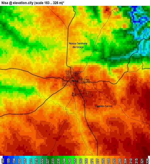
Below is the Elevation map of Nisa, which displays elevation range with different colors. Scale of the first map is from 183 to 326 m (600 to 1070 ft) with average elevation of 278.9 meters (=915 ft) [note 1]
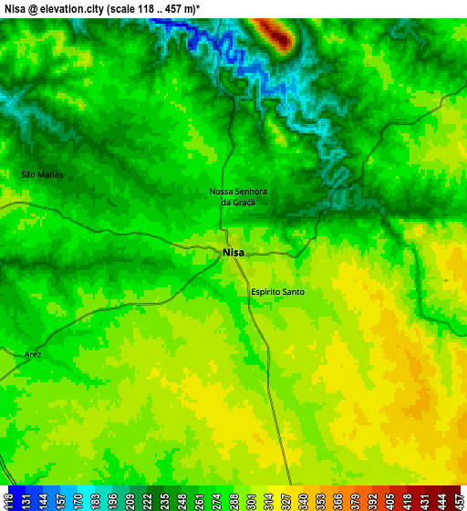
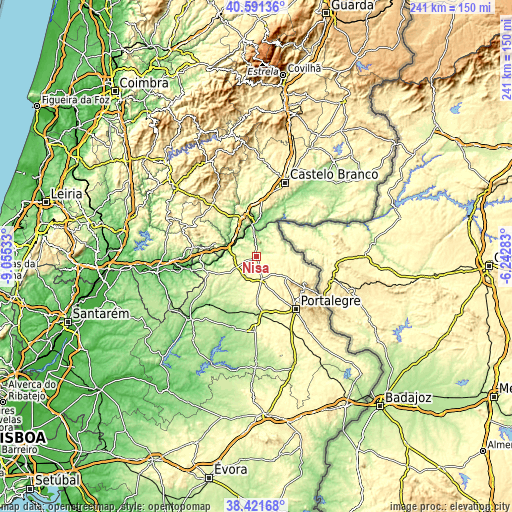
These maps also provides idea of topography and contour of this city, they are displayed at different zoom levels. More info about maps, scale and edge coordinates you can find below images.
| \ | Map #1 | Map #2 | Topo.Map |
| Scale [m] | 183..326 m | 118..457 m | × |
| Scale [ft] | 600..1070 ft | 387..1499 ft | × |
| Average | 278.9 m = 915 ft | 278.4 m = 913 ft | × |
| Width | 7.54 km = 4.7 mi | 15.08 km = 9.4 mi | 241.2 km = 149.9 mi |
| Height | 7.54 km = 4.7 mi | 15.08 km = 9.4 mi | 241.2 km = 149.9 mi |
| ↑Max Latitude | 39.548884° | 39.582761° | 40.59136° |
| Latitude at center | 39.51499° | 39.51499° | 39.51499° |
| ↓Min Latitude | 39.48108° | 39.447153° | 38.42168° |
| ← Min Longitude | -7.693025° | -7.736971° | -9.05533° |
| Longitude center | -7.64908° | -7.64908° | -7.64908° |
| →Max Longitude | -7.605135° | -7.561189° | -6.24283° |
Nearby cities:
Cities around Nisa sort by population:
• Portalegre elevation 460 m
30.9 km,  142°
142°
• Gavião 284 m
25.1 km,  257°
257°
• Castelo de Vide 570 m
19.8 km,  123°
123°
• Marvão 825 m
27 km, 119°
• Vila Velha de Ródão 183 m
15.9 km,  351°
351°
• Alter do Chão 269 m
35.3 km,  181°
181°
• Atalaia 261 m
20.3 km,  251°
251°
• Reguengo 604 m
32.7 km, 137°
• Mação 315 m
29.9 km,  278°
278°
• Fortios 397 m
24.7 km,  148°
148°
• Alagoa 385 m
19.5 km, 151°
• Póvoa e Meadas 335 m
11.3 km,  92°
92°
Multilingual:
 En español:
Nisa elevación 307 m.
 En France:
Nisa élévation 307 m.


Sources and notes:
- [note 1] Map square and city borders are not equal. Map elevation data is calculated only from area inside that square.
- [src 1] Elevation data from geonames database provided with same terms of usage.
- [src 2] The elevation map of Nisa is generated using elevation data from NASA's 3 arcsec (90m) resolution SRTM data.
- [src 3] Base (background) map © OpenStreetMap contributors tiles are generated by Geofabrik and OpenTopoMap.
Copyright & License:
This Nisa Elevation Map is licensed under CC BY-SA. You may reuse any part from this page, if you give a proper credit by linking to this URL:
 More info on terms of use page.