Portalegre elevation
Portalegre, Portugal elevation is 460 meters and Portalegre elevation in feet is 1509 ft above sea level [src 1]. Portalegre is a seat of a first-order administrative division (feature code) with elevation that is 292 meters (958 ft) bigger than average city elevation in Portugal.
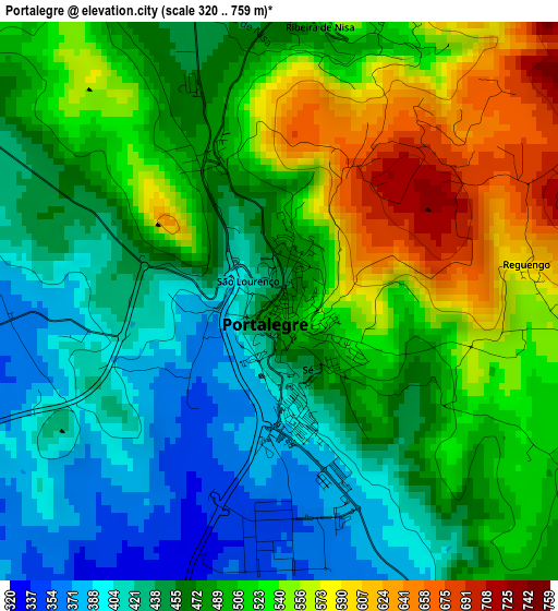
Below is the Elevation map of Portalegre, which displays elevation range with different colors. Scale of the first map is from 320 to 759 m (1050 to 2490 ft) with average elevation of 485.8 meters (=1594 ft) [note 1]
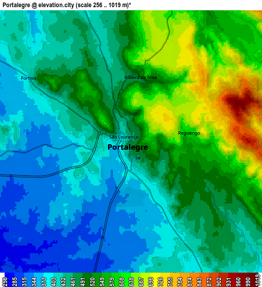
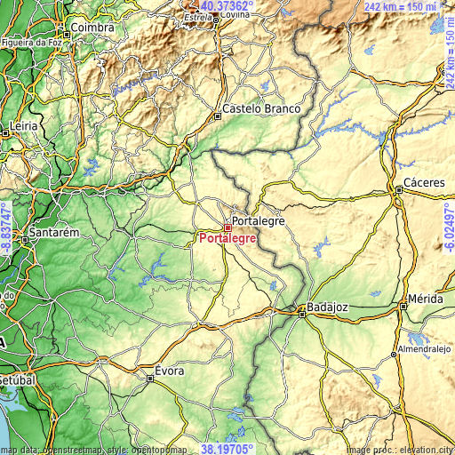
These maps also provides idea of topography and contour of this city, they are displayed at different zoom levels. More info about maps, scale and edge coordinates you can find below images.
| \ | Map #1 | Map #2 | Topo.Map |
| Scale [m] | 320..759 m | 256..1019 m | × |
| Scale [ft] | 1050..2490 ft | 840..3343 ft | × |
| Average | 485.8 m = 1594 ft | 478.7 m = 1571 ft | × |
| Width | 7.56 km = 4.7 mi | 15.13 km = 9.4 mi | 242 km = 150.4 mi |
| Height | 7.56 km = 4.7 mi | 15.13 km = 9.4 mi | 242 km = 150.4 mi |
| ↑Max Latitude | 39.327791° | 39.361776° | 40.37362° |
| Latitude at center | 39.29379° | 39.29379° | 39.29379° |
| ↓Min Latitude | 39.259772° | 39.225738° | 38.19705° |
| ← Min Longitude | -7.475165° | -7.519111° | -8.83747° |
| Longitude center | -7.43122° | -7.43122° | -7.43122° |
| →Max Longitude | -7.387275° | -7.343329° | -6.02497° |
Nearby cities:
Cities around Portalegre sort by population:
• Castelo de Vide elevation 570 m
13.8 km,  350°
350°
• Marvão 825 m
12.1 km,  22°
22°
• Monforte 285 m
26.8 km,  181°
181°
• Arronches 292 m
22.8 km,  146°
146°
• Alter do Chão 269 m
22.3 km,  241°
241°
• Póvoa e Meadas 335 m
25.2 km,  342°
342°
• Alagoa 385 m
11.9 km,  308°
308°
• Alegrete 480 m
11.1 km,  122°
122°
• São Julião 563 m
10.8 km,  72°
72°
• Urra 411 m
7.8 km,  158°
158°
• Fortios 397 m
6.9 km,  300°
300°
• Reguengo 604 m
3.4 km,  82°
82°
Multilingual:
 En español:
Portalegre elevación 460 m.
 En France:
Portalegre élévation 460 m.
 Auf Deutsch:
Portalegre höhe über dem Meeresspiegel ist 460 m.

Sources and notes:
- [note 1] Map square and city borders are not equal. Map elevation data is calculated only from area inside that square.
- [src 1] Elevation data from geonames database provided with same terms of usage.
- [src 2] The elevation map of Portalegre is generated using elevation data from NASA's 3 arcsec (90m) resolution SRTM data.
- [src 3] Base (background) map © OpenStreetMap contributors tiles are generated by Geofabrik and OpenTopoMap.
Copyright & License:
This Portalegre Elevation Map is licensed under CC BY-SA. You may reuse any part from this page, if you give a proper credit by linking to this URL:
 More info on terms of use page.