Oleiros elevation
Oleiros (Castelo Branco), Portugal elevation is 510 meters and Oleiros elevation in feet is 1673 ft above sea level [src 1]. Oleiros is a seat of a second-order administrative division (feature code) with elevation that is 342 meters (1122 ft) bigger than average city elevation in Portugal.
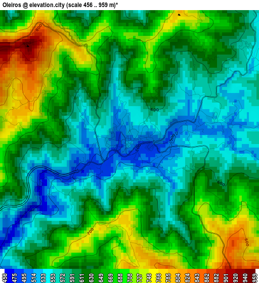
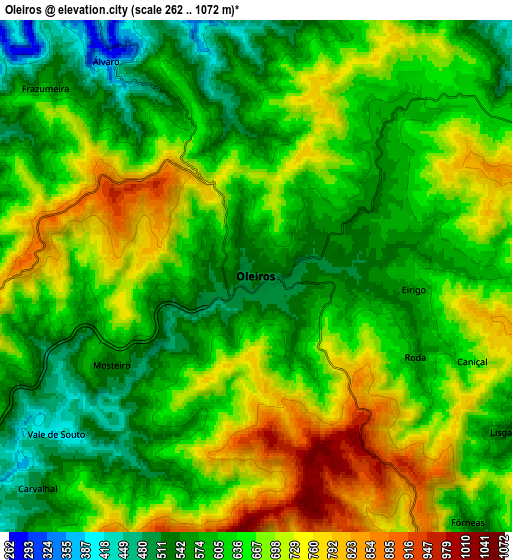
Below is the Elevation map of Oleiros, which displays elevation range with different colors. Scale of the first map is from 456 to 959 m (1496 to 3146 ft) with average elevation of 629.6 meters (=2066 ft) [note 1]
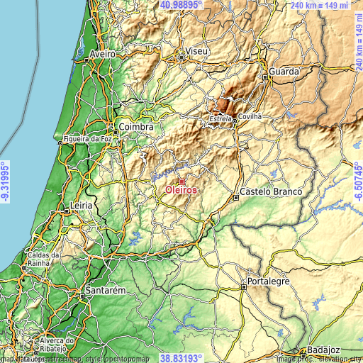
These maps also provides idea of topography and contour of this city, they are displayed at different zoom levels. More info about maps, scale and edge coordinates you can find below images.
| \ | Map #1 | Map #2 | Topo.Map |
| Scale [m] | 456..959 m | 262..1072 m | × |
| Scale [ft] | 1496..3146 ft | 860..3517 ft | × |
| Average | 629.6 m = 2066 ft | 642.2 m = 2107 ft | × |
| Width | 7.5 km = 4.7 mi | 14.99 km = 9.3 mi | 239.8 km = 149 mi |
| Height | 7.5 km = 4.7 mi | 14.99 km = 9.3 mi | 239.8 km = 149 mi |
| ↑Max Latitude | 39.952626° | 39.986305° | 40.98895° |
| Latitude at center | 39.91893° | 39.91893° | 39.91893° |
| ↓Min Latitude | 39.885218° | 39.851489° | 38.83193° |
| ← Min Longitude | -7.957645° | -8.001591° | -9.31995° |
| Longitude center | -7.9137° | -7.9137° | -7.9137° |
| →Max Longitude | -7.869755° | -7.825809° | -6.50745° |
Nearby cities:
Cities around Oleiros sort by population:
• Castelo Branco elevation 409 m
37.7 km,  106°
106°
• Lousã 150 m
36.1 km,  307°
307°
• Sertã 262 m
20.3 km,  230°
230°
• Proença-a-Nova 464 m
18.6 km,  182°
182°
• Arganil 175 m
35.4 km,  340°
340°
• Pedrógão Grande 400 m
19.8 km,  269°
269°
• Vila Velha de Ródão 183 m
35.5 km,  145°
145°
• Vila de Rei 444 m
33.5 km,  216°
216°
• Castanheira de Pêra 478 m
27.1 km,  291°
291°
• Góis 201 m
31.3 km,  327°
327°
• Pampilhosa da Serra 398 m
14.5 km,  347°
347°
• Figueiró dos Vinhos 464 m
30.9 km, 266°
Multilingual:
 En español:
Oleiros elevación 510 m.
 En France:
Oleiros élévation 510 m.


Sources and notes:
- [note 1] Map square and city borders are not equal. Map elevation data is calculated only from area inside that square.
- [src 1] Elevation data from geonames database provided with same terms of usage.
- [src 2] The elevation map of Oleiros is generated using elevation data from NASA's 3 arcsec (90m) resolution SRTM data.
- [src 3] Base (background) map © OpenStreetMap contributors tiles are generated by Geofabrik and OpenTopoMap.
Copyright & License:
This Oleiros Elevation Map is licensed under CC BY-SA. You may reuse any part from this page, if you give a proper credit by linking to this URL:
 More info on terms of use page.