Dayr Istiyā elevation
Dayr Istiyā (West Bank, Salfit), Palestinian Territory elevation is 445 meters and Dayr Istiyā elevation in feet is 1460 ft above sea level [src 1]. Dayr Istiyā is a populated place (feature code) with elevation that is 22 meters (72 ft) smaller than average city elevation in Palestinian Territory.
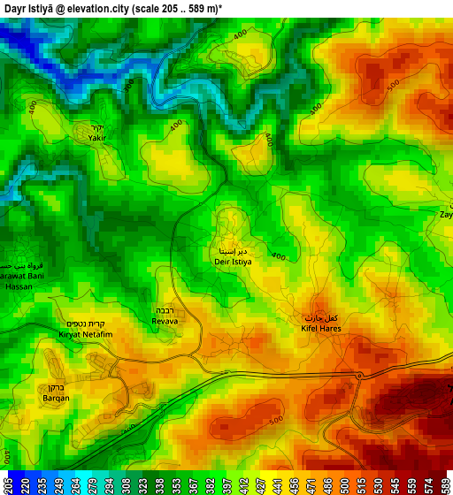
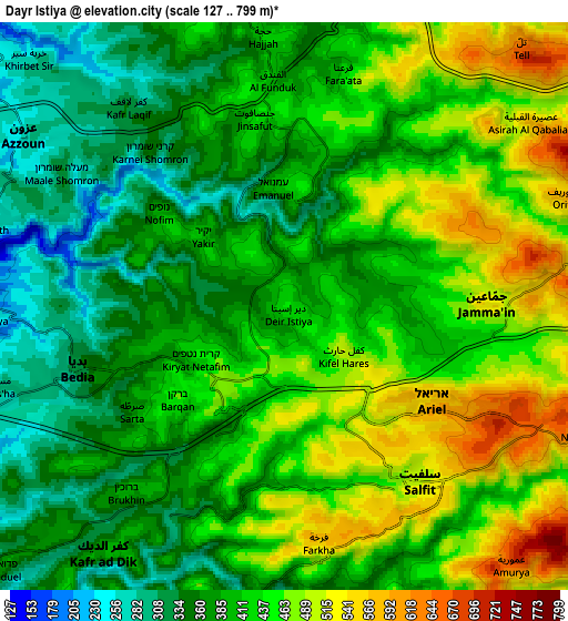
Below is the Elevation map of Dayr Istiyā, which displays elevation range with different colors. Scale of the first map is from 205 to 589 m (673 to 1932 ft) with average elevation of 410.4 meters (=1346 ft) [note 1]
These maps also provides idea of topography and contour of this city, they are displayed at different zoom levels. More info about maps, scale and edge coordinates you can find below images.
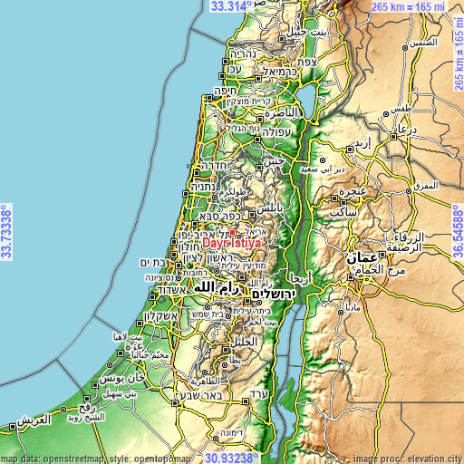
| \ | Map #1 | Map #2 | Topo.Map |
| Scale [m] | 205..589 m | 127..799 m | × |
| Scale [ft] | 673..1932 ft | 417..2621 ft | × |
| Average | 410.4 m = 1346 ft | 414.8 m = 1361 ft | × |
| Width | 8.28 km = 5.1 mi | 16.55 km = 10.3 mi | 264.8 km = 164.5 mi |
| Height | 8.28 km = 5.1 mi | 16.55 km = 10.3 mi | 264.8 km = 164.5 mi |
| ↑Max Latitude | 32.168167° | 32.205358° | 33.314° |
| Latitude at center | 32.13096° | 32.13096° | 32.13096° |
| ↓Min Latitude | 32.093738° | 32.056501° | 30.93238° |
| ← Min Longitude | 35.095685° | 35.051739° | 33.73338° |
| Longitude center | 35.13963° | 35.13963° | 35.13963° |
| →Max Longitude | 35.183575° | 35.227521° | 36.54588° |
Nearby cities:
Cities around Dayr Istiyā sort by population:
• Salfīt elevation 510 m
6.5 km,  143°
143°
• Bidyā 344 m
5.9 km,  251°
251°
• Jammā‘īn 531 m
6.1 km,  89°
89°
• Qarāwat Banī Ḩasan 383 m
3.7 km,  260°
260°
• Kifil Ḩāris 516 m
2.2 km,  130°
130°
• Ḩāris 479 m
1.9 km,  173°
173°
• Şarţah 374 m
5.4 km,  236°
236°
• Mardā 442 m
5.6 km,  109°
109°
• Zaytā Jammā‘īn 447 m
4.4 km,  81°
81°
• Jinşāfūţ 435 m
5.4 km,  350°
350°
• Qīrah 489 m
3.2 km, 107°
• Karney Shomron 352 m
6 km,  318°
318°
Multilingual:
 En español:
Dayr Istiyā elevación 445 m.
 En France:
Dayr Istiyā élévation 445 m.
 Auf Deutsch:
Dayr Istiyā höhe über dem Meeresspiegel ist 445 m.

Sources and notes:
- [note 1] Map square and city borders are not equal. Map elevation data is calculated only from area inside that square.
- [src 1] Elevation data from geonames database provided with same terms of usage.
- [src 2] The elevation map of Dayr Istiyā is generated using elevation data from NASA's 3 arcsec (90m) resolution SRTM data.
- [src 3] Base (background) map © OpenStreetMap contributors tiles are generated by Geofabrik and OpenTopoMap.
Copyright & License:
This Dayr Istiyā Elevation Map is licensed under CC BY-SA. You may reuse any part from this page, if you give a proper credit by linking to this URL:
 More info on terms of use page.