Bidyā elevation
Bidyā (West Bank, Salfit), Palestinian Territory elevation is 344 meters and Bidyā elevation in feet is 1129 ft above sea level [src 1]. Bidyā is a populated place (feature code) with elevation that is 123 meters (404 ft) smaller than average city elevation in Palestinian Territory.
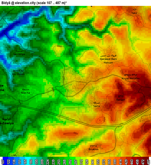
Below is the Elevation map of Bidyā, which displays elevation range with different colors. Scale of the first map is from 107 to 487 m (351 to 1598 ft) with average elevation of 312.2 meters (=1024 ft) [note 1]
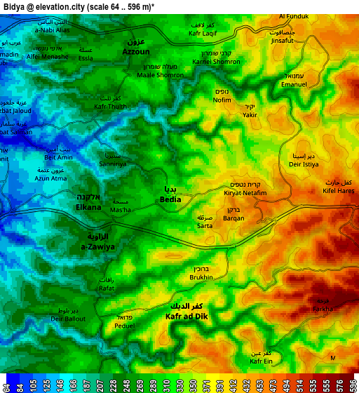
These maps also provides idea of topography and contour of this city, they are displayed at different zoom levels. More info about maps, scale and edge coordinates you can find below images.
| \ | Map #1 | Map #2 | Topo.Map |
| Scale [m] | 107..487 m | 64..596 m | × |
| Scale [ft] | 351..1598 ft | 210..1955 ft | × |
| Average | 312.2 m = 1024 ft | 307.7 m = 1010 ft | × |
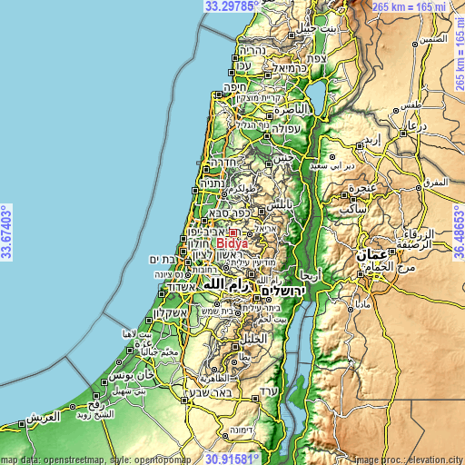
| Width | 8.28 km = 5.1 mi | 16.55 km = 10.3 mi | 264.9 km = 164.6 mi |
| Height | 8.28 km = 5.1 mi | 16.55 km = 10.3 mi | 264.9 km = 164.6 mi |
| ↑Max Latitude | 32.151813° | 32.189012° | 33.29785° |
| Latitude at center | 32.1146° | 32.1146° | 32.1146° |
| ↓Min Latitude | 32.077371° | 32.040127° | 30.91581° |
| ← Min Longitude | 35.036335° | 34.992389° | 33.67403° |
| Longitude center | 35.08028° | 35.08028° | 35.08028° |
| →Max Longitude | 35.124225° | 35.168171° | 36.48653° |
Nearby cities:
Cities around Bidyā sort by population:
• Kafr ad Dīk elevation 377 m
5.3 km,  177°
177°
• Az Zāwiyah 250 m
4.3 km,  241°
241°
• Kafr Thulth 281 m
5.3 km,  323°
323°
• Qarāwat Banī Ḩasan 383 m
2.3 km,  57°
57°
• Dayr Istiyā 445 m
5.9 km,  71°
71°
• Brūqīn 368 m
5.1 km,  159°
159°
• Ḩāris 479 m
5.8 km,  90°
90°
• Sannīryā 245 m
3.5 km,  296°
296°
• Şarţah 374 m
1.6 km,  135°
135°
• Masḩah 293 m
2.8 km,  255°
255°
• Rāfāt 306 m
5.3 km,  219°
219°
• Azun Atme 165 m
5.7 km,  277°
277°
Multilingual:
 En español:
Bidyā elevación 344 m.
 En France:
Bidyā élévation 344 m.


Sources and notes:
- [note 1] Map square and city borders are not equal. Map elevation data is calculated only from area inside that square.
- [src 1] Elevation data from geonames database provided with same terms of usage.
- [src 2] The elevation map of Bidyā is generated using elevation data from NASA's 3 arcsec (90m) resolution SRTM data.
- [src 3] Base (background) map © OpenStreetMap contributors tiles are generated by Geofabrik and OpenTopoMap.
Copyright & License:
This Bidyā Elevation Map is licensed under CC BY-SA. You may reuse any part from this page, if you give a proper credit by linking to this URL:
 More info on terms of use page.