Banī Zayd ash Shārqīyah elevation
Banī Zayd ash Shārqīyah (West Bank), Palestinian Territory elevation is 478 meters and Banī Zayd ash Shārqīyah elevation in feet is 1568 ft above sea level [src 1]. Banī Zayd ash Shārqīyah is a populated place (feature code) with elevation that is 11 meters (36 ft) bigger than average city elevation in Palestinian Territory.
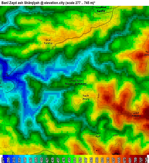
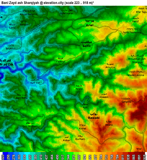
Below is the Elevation map of Banī Zayd ash Shārqīyah, which displays elevation range with different colors. Scale of the first map is from 277 to 745 m (909 to 2444 ft) with average elevation of 481.9 meters (=1581 ft) [note 1]
These maps also provides idea of topography and contour of this city, they are displayed at different zoom levels. More info about maps, scale and edge coordinates you can find below images.
| \ | Map #1 | Map #2 | Topo.Map |
| Scale [m] | 277..745 m | 223..918 m | × |
| Scale [ft] | 909..2444 ft | 732..3012 ft | × |
| Average | 481.9 m = 1581 ft | 524.4 m = 1720 ft | × |
| Width | 8.28 km = 5.1 mi | 16.57 km = 10.3 mi | 265 km = 164.7 mi |
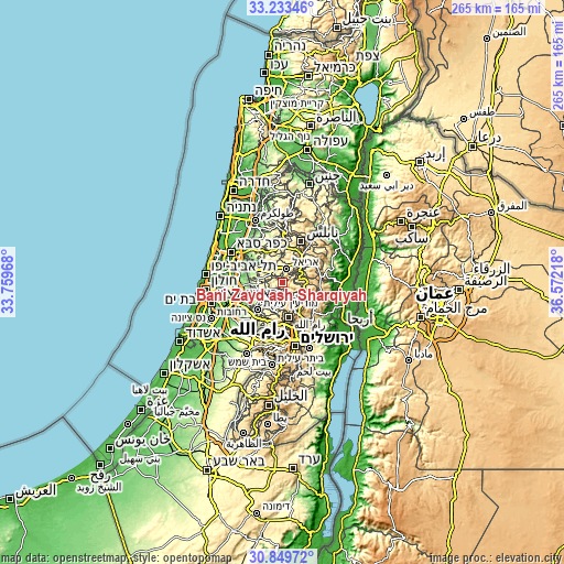
| Height | 8.28 km = 5.1 mi | 16.57 km = 10.3 mi | 265.1 km = 164.7 mi |
| ↑Max Latitude | 32.08659° | 32.123815° | 33.23346° |
| Latitude at center | 32.04935° | 32.04935° | 32.04935° |
| ↓Min Latitude | 32.012095° | 31.974824° | 30.84972° |
| ← Min Longitude | 35.121985° | 35.078039° | 33.75968° |
| Longitude center | 35.16593° | 35.16593° | 35.16593° |
| →Max Longitude | 35.209875° | 35.253821° | 36.57218° |
Nearby cities:
Cities around Banī Zayd ash Shārqīyah sort by population:
• Salfīt elevation 510 m
4.1 km,  20°
20°
• Banī Zayd 480 m
6 km,  259°
259°
• Kūbar 647 m
6.9 km,  186°
186°
• Brūqīn 368 m
6.8 km,  292°
292°
• ‘Ibwayn 674 m
3.8 km,  121°
121°
• Qarāwat Banī Zayd 345 m
3.5 km,  279°
279°
• Al Lubban ash Sharqīyah 586 m
7.4 km,  71°
71°
• ‘Aţārah 814 m
6.5 km,  146°
146°
• Dayr as Sūdān 518 m
2.5 km,  220°
220°
• Kafr ‘Ayn 388 m
4.3 km,  267°
267°
• Farkhah 586 m
2.5 km,  330°
330°
• ‘Ajjūl 495 m
3.3 km,  156°
156°
Multilingual:
 En español:
Banī Zayd ash Shārqīyah elevación 478 m.
 En France:
Banī Zayd ash Shārqīyah élévation 478 m.
 Auf Deutsch:
Banī Zayd ash Shārqīyah höhe über dem Meeresspiegel ist 478 m.
 На русском:
Banī Zayd ash Shārqīyah высота над уровнем моря 478 м
Sources and notes:
- [note 1] Map square and city borders are not equal. Map elevation data is calculated only from area inside that square.
- [src 1] Elevation data from geonames database provided with same terms of usage.
- [src 2] The elevation map of Banī Zayd ash Shārqīyah is generated using elevation data from NASA's 3 arcsec (90m) resolution SRTM data.
- [src 3] Base (background) map © OpenStreetMap contributors tiles are generated by Geofabrik and OpenTopoMap.
Copyright & License:
This Banī Zayd ash Shārqīyah Elevation Map is licensed under CC BY-SA. You may reuse any part from this page, if you give a proper credit by linking to this URL:
 More info on terms of use page.