Kūbar elevation
Kūbar (West Bank), Palestinian Territory elevation is 647 meters and Kūbar elevation in feet is 2123 ft above sea level [src 1]. Kūbar is a populated place (feature code) with elevation that is 180 meters (591 ft) bigger than average city elevation in Palestinian Territory.
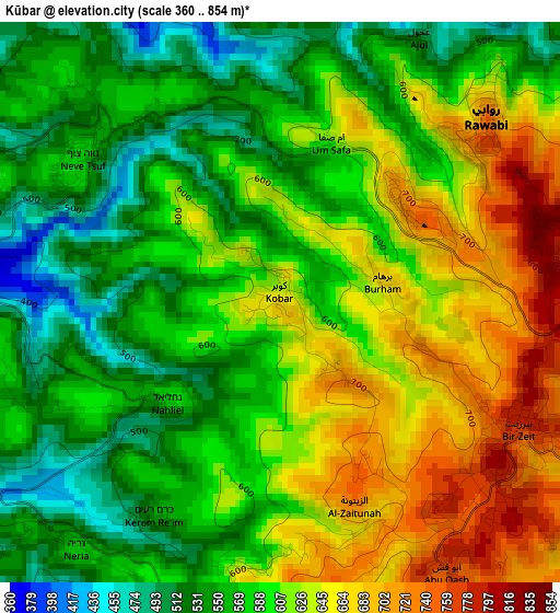
Below is the Elevation map of Kūbar, which displays elevation range with different colors. Scale of the first map is from 360 to 854 m (1181 to 2802 ft) with average elevation of 599.1 meters (=1966 ft) [note 1]
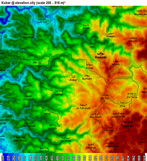
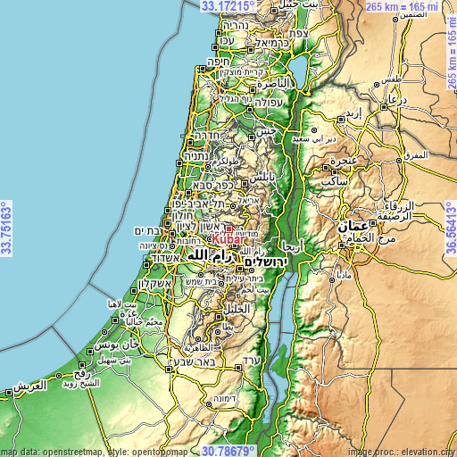
These maps also provides idea of topography and contour of this city, they are displayed at different zoom levels. More info about maps, scale and edge coordinates you can find below images.
| \ | Map #1 | Map #2 | Topo.Map |
| Scale [m] | 360..854 m | 208..916 m | × |
| Scale [ft] | 1181..2802 ft | 682..3005 ft | × |
| Average | 599.1 m = 1966 ft | 569.8 m = 1869 ft | × |
| Width | 8.29 km = 5.2 mi | 16.58 km = 10.3 mi | 265.2 km = 164.8 mi |
| Height | 8.29 km = 5.2 mi | 16.58 km = 10.3 mi | 265.2 km = 164.8 mi |
| ↑Max Latitude | 32.024485° | 32.061736° | 33.17215° |
| Latitude at center | 31.98722° | 31.98722° | 31.98722° |
| ↓Min Latitude | 31.949939° | 31.912644° | 30.78679° |
| ← Min Longitude | 35.113935° | 35.069989° | 33.75163° |
| Longitude center | 35.15788° | 35.15788° | 35.15788° |
| →Max Longitude | 35.201825° | 35.245771° | 36.56413° |
Nearby cities:
Cities around Kūbar sort by population:
• Bīr Zayt elevation 775 m
3.9 km,  119°
119°
• Az Zaytūnīyah 695 m
3.7 km,  173°
173°
• Banī Zayd ash Shārqīyah 478 m
6.9 km,  6°
6°
• ‘Ibwayn 674 m
6.3 km,  38°
38°
• Al Ittiḩād 558 m
4.2 km,  251°
251°
• ‘Aţārah 814 m
4.7 km,  71°
71°
• Dayr as Sūdān 518 m
5.1 km,  349°
349°
• Jifnā 666 m
5.9 km, 118°
• Rās Karkar 479 m
6.9 km,  223°
223°
• Abū Qashsh 763 m
4.9 km,  149°
149°
• ‘Ajjūl 495 m
4.4 km,  27°
27°
• Al Jāniyah 542 m
6.4 km,  212°
212°
Multilingual:
 En español:
Kūbar elevación 647 m.
 En France:
Kūbar élévation 647 m.


Sources and notes:
- [note 1] Map square and city borders are not equal. Map elevation data is calculated only from area inside that square.
- [src 1] Elevation data from geonames database provided with same terms of usage.
- [src 2] The elevation map of Kūbar is generated using elevation data from NASA's 3 arcsec (90m) resolution SRTM data.
- [src 3] Base (background) map © OpenStreetMap contributors tiles are generated by Geofabrik and OpenTopoMap.
Copyright & License:
This Kūbar Elevation Map is licensed under CC BY-SA. You may reuse any part from this page, if you give a proper credit by linking to this URL:
 More info on terms of use page.