Barkhan elevation
Barkhan (Balochistan), Pakistan elevation is 1100 meters and Barkhan elevation in feet is 3609 ft above sea level [src 1]. Barkhan is a seat of a second-order administrative division (feature code) with elevation that is 754 meters (2474 ft) bigger than average city elevation in Pakistan.
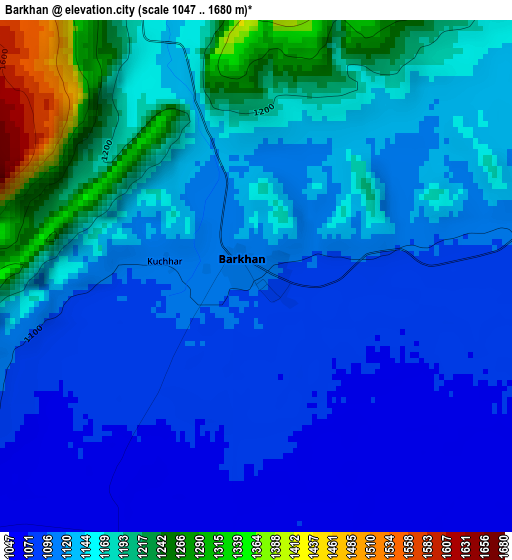
Below is the Elevation map of Barkhan, which displays elevation range with different colors. Scale of the first map is from 1047 to 1680 m (3435 to 5512 ft) with average elevation of 1138.5 meters (=3735 ft) [note 1]
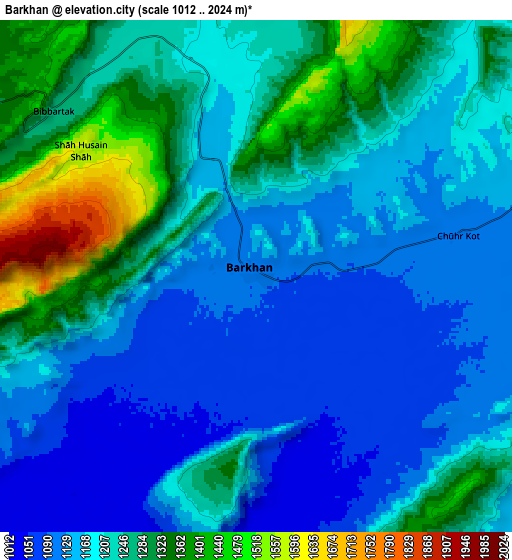
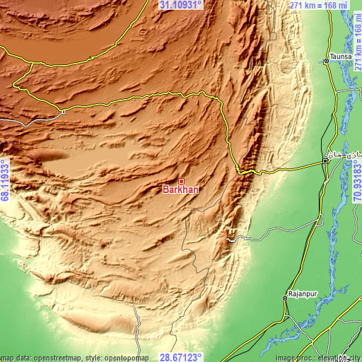
These maps also provides idea of topography and contour of this city, they are displayed at different zoom levels. More info about maps, scale and edge coordinates you can find below images.
| \ | Map #1 | Map #2 | Topo.Map |
| Scale [m] | 1047..1680 m | 1012..2024 m | × |
| Scale [ft] | 3435..5512 ft | 3320..6640 ft | × |
| Average | 1138.5 m = 3735 ft | 1207.1 m = 3960 ft | × |
| Width | 8.47 km = 5.3 mi | 16.94 km = 10.5 mi | 271.1 km = 168.5 mi |
| Height | 8.47 km = 5.3 mi | 16.94 km = 10.5 mi | 271.1 km = 168.5 mi |
| ↑Max Latitude | 29.93582° | 29.973895° | 31.10931° |
| Latitude at center | 29.89773° | 29.89773° | 29.89773° |
| ↓Min Latitude | 29.859626° | 29.821507° | 28.67123° |
| ← Min Longitude | 69.481635° | 69.437689° | 68.11933° |
| Longitude center | 69.52558° | 69.52558° | 69.52558° |
| →Max Longitude | 69.569525° | 69.613471° | 70.93183° |
Nearby cities:
Cities around Barkhan sort by population:
• Dera Ghazi Khan elevation 122 m
108.6 km,  81°
81°
• Jampur 107 m
107.1 km,  105°
105°
• Rajanpur 95 m
117.7 km,  138°
138°
• Jatoi Shimali 106 m
134.2 km, 108°
• Taunsa 175 m
140.3 km,  50°
50°
• Loralai 1440 m
103.5 km,  300°
300°
• Dera Bugti 473 m
102.2 km,  200°
200°
• Dajal 124 m
90.4 km, 114°
• Rojhan 88 m
140.8 km,  162°
162°
• Kohlu 1175 m
26.3 km,  269°
269°
• Duki 1092 m
96 km,  287°
287°
• Musa Khel Bazar 1349 m
110.6 km,  14°
14°
Multilingual:
 En español:
Barkhan elevación 1100 m.
 En France:
Barkhan élévation 1100 m.
 Auf Deutsch:
Barkhan höhe über dem Meeresspiegel ist 1100 m.

Sources and notes:
- [note 1] Map square and city borders are not equal. Map elevation data is calculated only from area inside that square.
- [src 1] Elevation data from geonames database provided with same terms of usage.
- [src 2] The elevation map of Barkhan is generated using elevation data from NASA's 3 arcsec (90m) resolution SRTM data.
- [src 3] Base (background) map © OpenStreetMap contributors tiles are generated by Geofabrik and OpenTopoMap.
Copyright & License:
This Barkhan Elevation Map is licensed under CC BY-SA. You may reuse any part from this page, if you give a proper credit by linking to this URL:
 More info on terms of use page.