Rojhan elevation
Rojhan (Punjab), Pakistan elevation is 88 meters and Rojhan elevation in feet is 289 ft above sea level [src 1]. Rojhan is a populated place (feature code) with elevation that is 258 meters (846 ft) smaller than average city elevation in Pakistan.
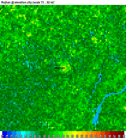
Below is the Elevation map of Rojhan, which displays elevation range with different colors. Scale of the first map is from 73 to 92 m (240 to 302 ft) with average elevation of 82.1 meters (=269 ft) [note 1]
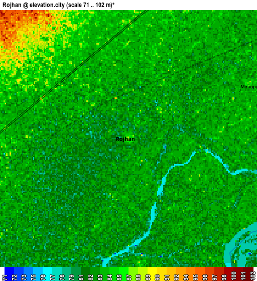
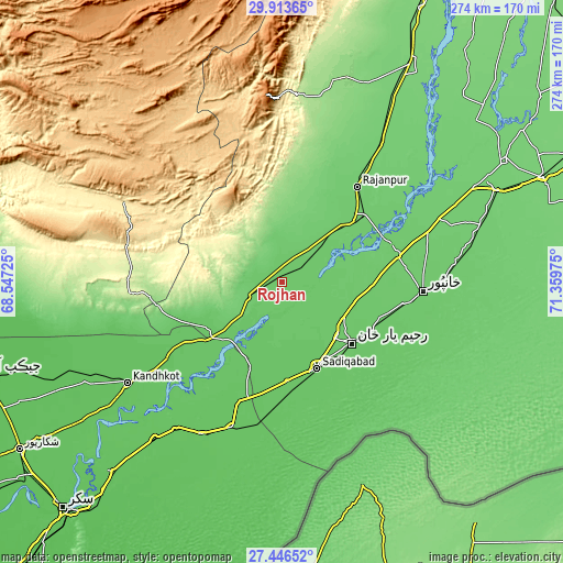
These maps also provides idea of topography and contour of this city, they are displayed at different zoom levels. More info about maps, scale and edge coordinates you can find below images.
| \ | Map #1 | Map #2 | Topo.Map |
| Scale [m] | 73..92 m | 71..102 m | × |
| Scale [ft] | 240..302 ft | 233..335 ft | × |
| Average | 82.1 m = 269 ft | 82.9 m = 272 ft | × |
| Width | 8.57 km = 5.3 mi | 17.15 km = 10.7 mi | 274.3 km = 170.4 mi |
| Height | 8.57 km = 5.3 mi | 17.15 km = 10.7 mi | 274.3 km = 170.4 mi |
| ↑Max Latitude | 28.725894° | 28.764424° | 29.91365° |
| Latitude at center | 28.68735° | 28.68735° | 28.68735° |
| ↓Min Latitude | 28.648792° | 28.610219° | 27.44652° |
| ← Min Longitude | 69.909555° | 69.865609° | 68.54725° |
| Longitude center | 69.9535° | 69.9535° | 69.9535° |
| →Max Longitude | 69.997445° | 70.041391° | 71.35975° |
Nearby cities:
Cities around Rojhan sort by population:
• Rahim Yar Khan elevation 85 m
45.3 km,  131°
131°
• Saddiqabad 78 m
45.3 km,  158°
158°
• Khanpur 90 m
68.8 km,  93°
93°
• Kandhkot 71 m
90.2 km,  237°
237°
• Rajanpur 95 m
59.1 km,  38°
38°
• Mirpur Mathelo 76 m
84 km,  208°
208°
• Khairpur 72 m
73.5 km,  199°
199°
• Zahir Pir 93 m
57.3 km,  75°
75°
• Kashmor 81 m
45.9 km,  231°
231°
• Ubauro 74 m
62.1 km, 200°
• Kot Samaba 83 m
52.5 km,  106°
106°
• Dera Bugti 473 m
86.6 km,  296°
296°
Multilingual:
 En español:
Rojhan elevación 88 m.
 En France:
Rojhan élévation 88 m.


Sources and notes:
- [note 1] Map square and city borders are not equal. Map elevation data is calculated only from area inside that square.
- [src 1] Elevation data from geonames database provided with same terms of usage.
- [src 2] The elevation map of Rojhan is generated using elevation data from NASA's 3 arcsec (90m) resolution SRTM data.
- [src 3] Base (background) map © OpenStreetMap contributors tiles are generated by Geofabrik and OpenTopoMap.
Copyright & License:
This Rojhan Elevation Map is licensed under CC BY-SA. You may reuse any part from this page, if you give a proper credit by linking to this URL:
 More info on terms of use page.