Dadhar elevation
Dadhar (Balochistan), Pakistan elevation is 160 meters and Dadhar elevation in feet is 525 ft above sea level [src 1]. Dadhar is a populated place (feature code) with elevation that is 186 meters (610 ft) smaller than average city elevation in Pakistan.
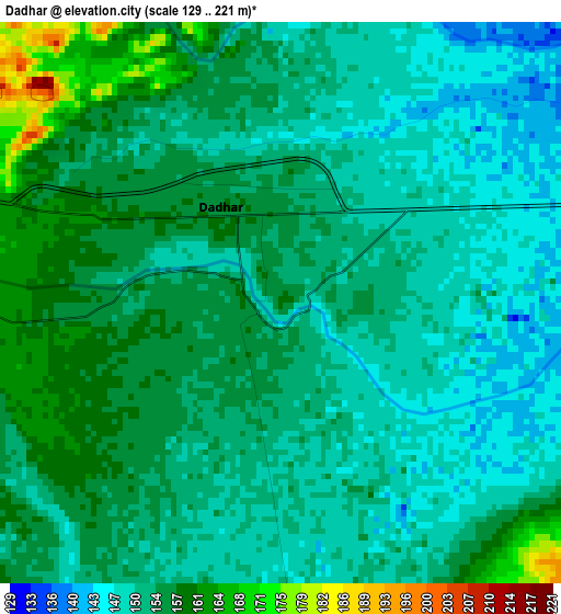
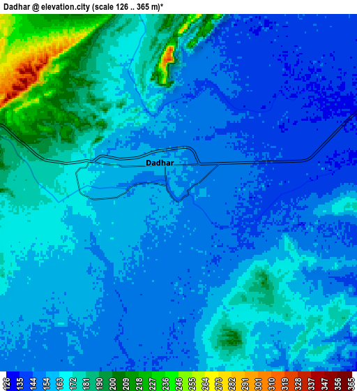
Below is the Elevation map of Dadhar, which displays elevation range with different colors. Scale of the first map is from 129 to 221 m (423 to 725 ft) with average elevation of 153 meters (=502 ft) [note 1]
These maps also provides idea of topography and contour of this city, they are displayed at different zoom levels. More info about maps, scale and edge coordinates you can find below images.
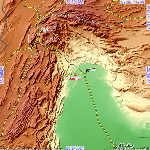
| \ | Map #1 | Map #2 | Topo.Map |
| Scale [m] | 129..221 m | 126..365 m | × |
| Scale [ft] | 423..725 ft | 413..1198 ft | × |
| Average | 153 m = 502 ft | 163.2 m = 535 ft | × |
| Width | 8.51 km = 5.3 mi | 17.02 km = 10.6 mi | 272.2 km = 169.1 mi |
| Height | 8.51 km = 5.3 mi | 17.02 km = 10.6 mi | 272.2 km = 169.1 mi |
| ↑Max Latitude | 29.51314° | 29.551376° | 30.69168° |
| Latitude at center | 29.47489° | 29.47489° | 29.47489° |
| ↓Min Latitude | 29.436625° | 29.398346° | 28.24332° |
| ← Min Longitude | 67.607725° | 67.563779° | 66.24542° |
| Longitude center | 67.65167° | 67.65167° | 67.65167° |
| →Max Longitude | 67.695615° | 67.739561° | 69.05792° |
Nearby cities:
Cities around Dadhar sort by population:
• Quetta elevation 1683 m
100.8 km,  321°
321°
• Kot Malik Barkhurdar 1651 m
103.3 km, 321°
• Sibi 136 m
23.1 km,  70°
70°
• Mastung 1682 m
85.9 km,  294°
294°
• Kalat 2014 m
114.1 km,  244°
244°
• Mach 977 m
53.2 km, 324°
• Bhag 103 m
51 km,  160°
160°
• Harnai 903 m
74.9 km,  21°
21°
• Alik Ghund 2239 m
113.5 km,  353°
353°
• Duki 1092 m
116.6 km,  49°
49°
• Ziarat 2433 m
101.2 km,  4°
4°
• Gandava 88 m
97.2 km,  189°
189°
Multilingual:
 En español:
Dadhar elevación 160 m.
 En France:
Dadhar élévation 160 m.


Sources and notes:
- [note 1] Map square and city borders are not equal. Map elevation data is calculated only from area inside that square.
- [src 1] Elevation data from geonames database provided with same terms of usage.
- [src 2] The elevation map of Dadhar is generated using elevation data from NASA's 3 arcsec (90m) resolution SRTM data.
- [src 3] Base (background) map © OpenStreetMap contributors tiles are generated by Geofabrik and OpenTopoMap.
Copyright & License:
This Dadhar Elevation Map is licensed under CC BY-SA. You may reuse any part from this page, if you give a proper credit by linking to this URL:
 More info on terms of use page.