Kot Malik Barkhurdar elevation
Kot Malik Barkhurdar (Balochistan), Pakistan elevation is 1651 meters and Kot Malik Barkhurdar elevation in feet is 5417 ft above sea level [src 1]. Kot Malik Barkhurdar is a section of populated place (feature code) with elevation that is 1305 meters (4281 ft) bigger than average city elevation in Pakistan.
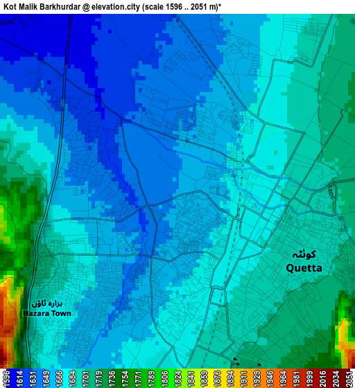
Below is the Elevation map of Kot Malik Barkhurdar, which displays elevation range with different colors. Scale of the first map is from 1596 to 2051 m (5236 to 6729 ft) with average elevation of 1674.2 meters (=5493 ft) [note 1]
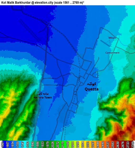
These maps also provides idea of topography and contour of this city, they are displayed at different zoom levels. More info about maps, scale and edge coordinates you can find below images.
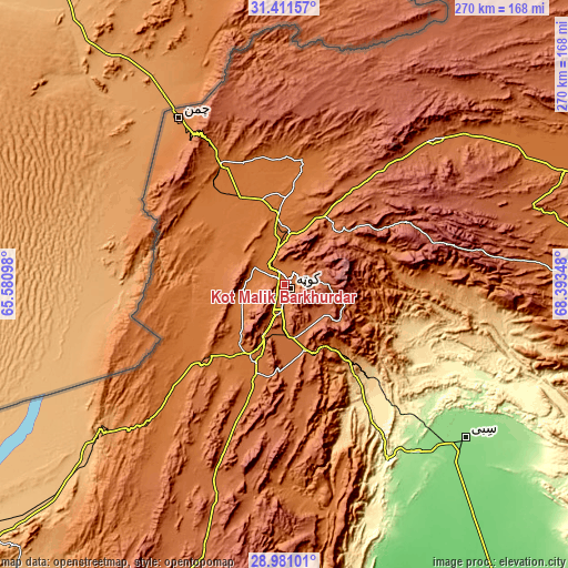
| \ | Map #1 | Map #2 | Topo.Map |
| Scale [m] | 1596..2051 m | 1561..2769 m | × |
| Scale [ft] | 5236..6729 ft | 5121..9085 ft | × |
| Average | 1674.2 m = 5493 ft | 1780.1 m = 5840 ft | × |
| Width | 8.45 km = 5.3 mi | 16.89 km = 10.5 mi | 270.3 km = 168 mi |
| Height | 8.45 km = 5.3 mi | 16.89 km = 10.5 mi | 270.3 km = 168 mi |
| ↑Max Latitude | 30.241762° | 30.279719° | 31.41157° |
| Latitude at center | 30.20379° | 30.20379° | 30.20379° |
| ↓Min Latitude | 30.165803° | 30.127802° | 28.98101° |
| ← Min Longitude | 66.943285° | 66.899339° | 65.58098° |
| Longitude center | 66.98723° | 66.98723° | 66.98723° |
| →Max Longitude | 67.031175° | 67.075121° | 68.39348° |
Nearby cities:
Cities around Kot Malik Barkhurdar sort by population:
• Quetta elevation 1683 m
2.6 km,  148°
148°
• Chaman 1336 m
94.5 km,  327°
327°
• Sibi 136 m
113 km,  130°
130°
• Mastung 1682 m
47 km,  196°
196°
• Pishin 1541 m
42 km,  0°
0°
• Mach 977 m
50.2 km,  138°
138°
• Dadhar 160 m
103.3 km, 141°
• Harnai 903 m
92.1 km,  97°
97°
• Alik Ghund 2239 m
60.3 km,  58°
58°
• Khadan Khak 1939 m
92.4 km,  48°
48°
• Ziarat 2433 m
73.6 km,  74°
74°
• Qila Abdullah 1562 m
66.1 km, 331°
Multilingual:
 En español:
Kot Malik Barkhurdar elevación 1651 m.
 En France:
Kot Malik Barkhurdar élévation 1651 m.
 Auf Deutsch:
Kot Malik Barkhurdar höhe über dem Meeresspiegel ist 1651 m.
 На русском:
Kot Malik Barkhurdar высота над уровнем моря 1651 м
Sources and notes:
- [note 1] Map square and city borders are not equal. Map elevation data is calculated only from area inside that square.
- [src 1] Elevation data from geonames database provided with same terms of usage.
- [src 2] The elevation map of Kot Malik Barkhurdar is generated using elevation data from NASA's 3 arcsec (90m) resolution SRTM data.
- [src 3] Base (background) map © OpenStreetMap contributors tiles are generated by Geofabrik and OpenTopoMap.
Copyright & License:
This Kot Malik Barkhurdar Elevation Map is licensed under CC BY-SA. You may reuse any part from this page, if you give a proper credit by linking to this URL:
 More info on terms of use page.