Dinga elevation
Dinga (Punjab), Pakistan elevation is 229 meters and Dinga elevation in feet is 751 ft above sea level [src 1]. Dinga is a populated place (feature code) with elevation that is 117 meters (384 ft) smaller than average city elevation in Pakistan.
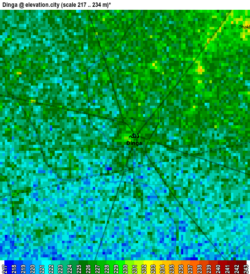
Below is the Elevation map of Dinga, which displays elevation range with different colors. Scale of the first map is from 217 to 234 m (712 to 768 ft) with average elevation of 223.7 meters (=734 ft) [note 1]
These maps also provides idea of topography and contour of this city, they are displayed at different zoom levels. More info about maps, scale and edge coordinates you can find below images.
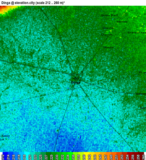
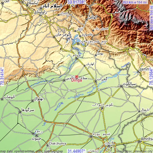
| \ | Map #1 | Map #2 | Topo.Map |
| Scale [m] | 217..234 m | 212..260 m | × |
| Scale [ft] | 712..768 ft | 696..853 ft | × |
| Average | 223.7 m = 734 ft | 224 m = 735 ft | × |
| Width | 8.23 km = 5.1 mi | 16.46 km = 10.2 mi | 263.3 km = 163.6 mi |
| Height | 8.23 km = 5.1 mi | 16.46 km = 10.2 mi | 263.3 km = 163.6 mi |
| ↑Max Latitude | 32.678007° | 32.714989° | 33.81728° |
| Latitude at center | 32.64101° | 32.64101° | 32.64101° |
| ↓Min Latitude | 32.603997° | 32.56697° | 31.44907° |
| ← Min Longitude | 73.676445° | 73.632499° | 72.31414° |
| Longitude center | 73.72039° | 73.72039° | 73.72039° |
| →Max Longitude | 73.764335° | 73.808281° | 75.12664° |
Nearby cities:
Cities around Dinga sort by population:
• Gujrat elevation 237 m
34.1 km,  102°
102°
• Jhelum 230 m
32.6 km,  1°
1°
• Mandi Bahauddin 223 m
22.3 km,  254°
254°
• Wazirabad 231 m
43.4 km,  120°
120°
• Jalalpur Jattan 250 m
45.4 km,  89°
89°
• Kharian 285 m
24.9 km,  38°
38°
• Lala Musa 258 m
23.2 km,  73°
73°
• Sarai Alamgir 232 m
29.5 km,  6°
6°
• Kunjah 234 m
26.9 km, 117°
• Phalia 211 m
26.8 km,  209°
209°
• Rasulnagar 220 m
35.3 km,  170°
170°
• Mehmand Chak 274 m
18.7 km,  30°
30°
Multilingual:
 En español:
Dinga elevación 229 m.
 En France:
Dinga élévation 229 m.


Sources and notes:
- [note 1] Map square and city borders are not equal. Map elevation data is calculated only from area inside that square.
- [src 1] Elevation data from geonames database provided with same terms of usage.
- [src 2] The elevation map of Dinga is generated using elevation data from NASA's 3 arcsec (90m) resolution SRTM data.
- [src 3] Base (background) map © OpenStreetMap contributors tiles are generated by Geofabrik and OpenTopoMap.
Copyright & License:
This Dinga Elevation Map is licensed under CC BY-SA. You may reuse any part from this page, if you give a proper credit by linking to this URL:
 More info on terms of use page.