Mandi Bahauddin elevation
Mandi Bahauddin (Punjab), Pakistan elevation is 223 meters and Mandi Bahauddin elevation in feet is 732 ft above sea level [src 1]. Mandi Bahauddin is a seat of a second-order administrative division (feature code) with elevation that is 123 meters (404 ft) smaller than average city elevation in Pakistan.
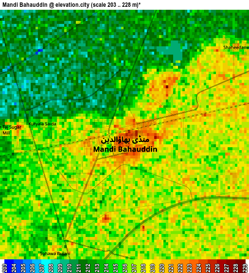
Below is the Elevation map of Mandi Bahauddin, which displays elevation range with different colors. Scale of the first map is from 203 to 228 m (666 to 748 ft) with average elevation of 215.1 meters (=706 ft) [note 1]
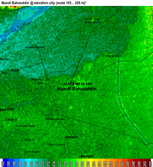
These maps also provides idea of topography and contour of this city, they are displayed at different zoom levels. More info about maps, scale and edge coordinates you can find below images.
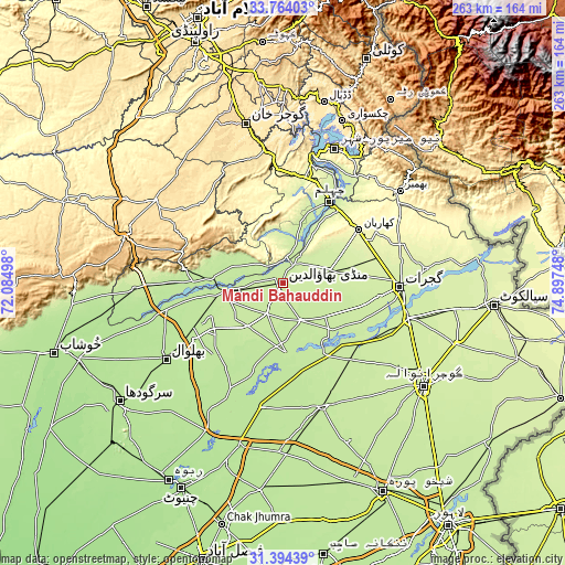
| \ | Map #1 | Map #2 | Topo.Map |
| Scale [m] | 203..228 m | 193..255 m | × |
| Scale [ft] | 666..748 ft | 633..837 ft | × |
| Average | 215.1 m = 706 ft | 215 m = 705 ft | × |
| Width | 8.23 km = 5.1 mi | 16.47 km = 10.2 mi | 263.5 km = 163.7 mi |
| Height | 8.23 km = 5.1 mi | 16.47 km = 10.2 mi | 263.5 km = 163.7 mi |
| ↑Max Latitude | 32.62406° | 32.661064° | 33.76403° |
| Latitude at center | 32.58704° | 32.58704° | 32.58704° |
| ↓Min Latitude | 32.550005° | 32.512955° | 31.39439° |
| ← Min Longitude | 73.447285° | 73.403339° | 72.08498° |
| Longitude center | 73.49123° | 73.49123° | 73.49123° |
| →Max Longitude | 73.535175° | 73.579121° | 74.89748° |
Nearby cities:
Cities around Mandi Bahauddin sort by population:
• Jhelum elevation 230 m
44.7 km,  30°
30°
• Kharian 285 m
44.9 km,  55°
55°
• Lala Musa 258 m
45.5 km,  73°
73°
• Sarai Alamgir 232 m
43.1 km, 34°
• Dinga 229 m
22.3 km, 74°
• Malakwal City 211 m
26.4 km,  262°
262°
• Malakwal 209 m
26.3 km, 262°
• Khewra 374 m
45.5 km,  278°
278°
• Phalia 211 m
19.2 km,  154°
154°
• Pind Dadan Khan 205 m
41.8 km,  269°
269°
• Rasulnagar 220 m
39.6 km,  136°
136°
• Mehmand Chak 274 m
38.1 km,  54°
54°
Multilingual:
 En español:
Mandi Bahauddin elevación 223 m.
 En France:
Mandi Bahauddin élévation 223 m.
 Auf Deutsch:
Mandi Bahauddin höhe über dem Meeresspiegel ist 223 m.

Sources and notes:
- [note 1] Map square and city borders are not equal. Map elevation data is calculated only from area inside that square.
- [src 1] Elevation data from geonames database provided with same terms of usage.
- [src 2] The elevation map of Mandi Bahauddin is generated using elevation data from NASA's 3 arcsec (90m) resolution SRTM data.
- [src 3] Base (background) map © OpenStreetMap contributors tiles are generated by Geofabrik and OpenTopoMap.
Copyright & License:
This Mandi Bahauddin Elevation Map is licensed under CC BY-SA. You may reuse any part from this page, if you give a proper credit by linking to this URL:
 More info on terms of use page.