Doaba elevation
Doaba (Khyber Pakhtunkhwa), Pakistan elevation is 890 meters and Doaba elevation in feet is 2920 ft above sea level [src 1]. Doaba is a populated place (feature code) with elevation that is 544 meters (1785 ft) bigger than average city elevation in Pakistan.
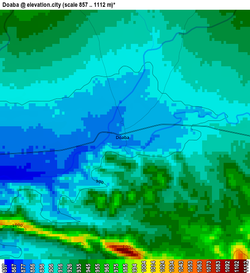
Below is the Elevation map of Doaba, which displays elevation range with different colors. Scale of the first map is from 857 to 1112 m (2812 to 3648 ft) with average elevation of 916.1 meters (=3006 ft) [note 1]
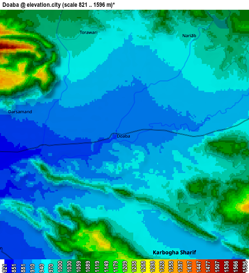
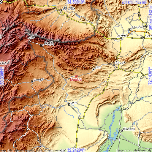
These maps also provides idea of topography and contour of this city, they are displayed at different zoom levels. More info about maps, scale and edge coordinates you can find below images.
| \ | Map #1 | Map #2 | Topo.Map |
| Scale [m] | 857..1112 m | 821..1596 m | × |
| Scale [ft] | 2812..3648 ft | 2694..5236 ft | × |
| Average | 916.1 m = 3006 ft | 970.6 m = 3184 ft | × |
| Width | 8.16 km = 5.1 mi | 16.31 km = 10.1 mi | 261 km = 162.2 mi |
| Height | 8.16 km = 5.1 mi | 16.31 km = 10.1 mi | 261 km = 162.2 mi |
| ↑Max Latitude | 33.46117° | 33.497824° | 34.59019° |
| Latitude at center | 33.4245° | 33.4245° | 33.4245° |
| ↓Min Latitude | 33.387815° | 33.351114° | 32.24294° |
| ← Min Longitude | 70.692815° | 70.648869° | 69.33051° |
| Longitude center | 70.73676° | 70.73676° | 70.73676° |
| →Max Longitude | 70.780705° | 70.824651° | 72.14301° |
Nearby cities:
Cities around Doaba sort by population:
• Kohat elevation 503 m
68.3 km,  75°
75°
• Bannu 379 m
50.4 km,  194°
194°
• Hangu 840 m
32.2 km,  68°
68°
• Sarai Naurang 305 m
66.7 km,  176°
176°
• Lachi 463 m
55.9 km,  94°
94°
• Kalabagh 218 m
91.2 km,  124°
124°
• Kamar Mushani 213 m
87 km,  137°
137°
• Karak 582 m
47.7 km, 135°
• Miran Shah 916 m
77.8 km,  232°
232°
• Alizai 979 m
38.3 km,  288°
288°
• Landi Kotal 1064 m
83.8 km,  26°
26°
• Parachinar 1743 m
79.1 km,  311°
311°
Multilingual:
 En español:
Doaba elevación 890 m.
 En France:
Doaba élévation 890 m.


Sources and notes:
- [note 1] Map square and city borders are not equal. Map elevation data is calculated only from area inside that square.
- [src 1] Elevation data from geonames database provided with same terms of usage.
- [src 2] The elevation map of Doaba is generated using elevation data from NASA's 3 arcsec (90m) resolution SRTM data.
- [src 3] Base (background) map © OpenStreetMap contributors tiles are generated by Geofabrik and OpenTopoMap.
Copyright & License:
This Doaba Elevation Map is licensed under CC BY-SA. You may reuse any part from this page, if you give a proper credit by linking to this URL:
 More info on terms of use page.