Shorkot elevation
Shorkot (Khyber Pakhtunkhwa), Pakistan elevation is 182 meters and Shorkot elevation in feet is 597 ft above sea level [src 1]. Shorkot is a populated place (feature code) with elevation that is 164 meters (538 ft) smaller than average city elevation in Pakistan.
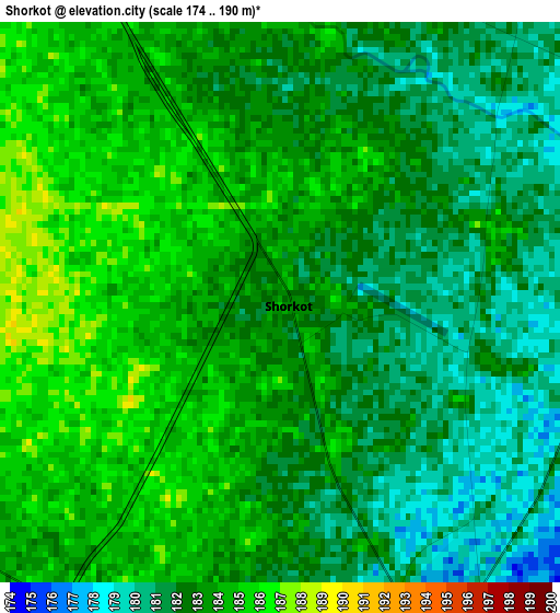
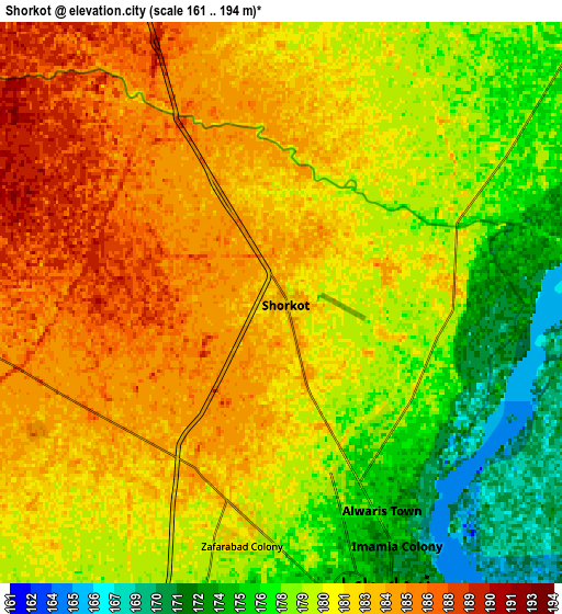
Below is the Elevation map of Shorkot, which displays elevation range with different colors. Scale of the first map is from 174 to 190 m (571 to 623 ft) with average elevation of 182.7 meters (=599 ft) [note 1]
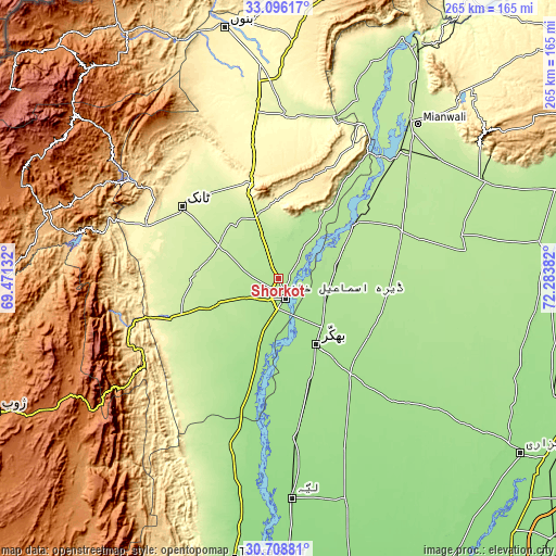
These maps also provides idea of topography and contour of this city, they are displayed at different zoom levels. More info about maps, scale and edge coordinates you can find below images.
| \ | Map #1 | Map #2 | Topo.Map |
| Scale [m] | 174..190 m | 161..194 m | × |
| Scale [ft] | 571..623 ft | 528..636 ft | × |
| Average | 182.7 m = 599 ft | 180.6 m = 593 ft | × |
| Width | 8.3 km = 5.2 mi | 16.59 km = 10.3 mi | 265.4 km = 164.9 mi |
| Height | 8.3 km = 5.2 mi | 16.59 km = 10.3 mi | 265.5 km = 165 mi |
| ↑Max Latitude | 31.947527° | 31.984808° | 33.09617° |
| Latitude at center | 31.91023° | 31.91023° | 31.91023° |
| ↓Min Latitude | 31.872918° | 31.835591° | 30.70881° |
| ← Min Longitude | 70.833625° | 70.789679° | 69.47132° |
| Longitude center | 70.87757° | 70.87757° | 70.87757° |
| →Max Longitude | 70.921515° | 70.965461° | 72.28382° |
Nearby cities:
Cities around Shorkot sort by population:
• Dera Ismail Khan elevation 177 m
9.1 km,  165°
165°
• Bhakkar 171 m
36.1 km,  150°
150°
• Dullewala 183 m
53.4 km,  99°
99°
• Tank 259 m
57.7 km,  306°
306°
• Lakki 267 m
77.6 km,  2°
2°
• Karor 157 m
76.6 km, 174°
• Kalur Kot 191 m
45.7 km,  53°
53°
• Kulachi 218 m
39.5 km,  273°
273°
• Paharpur 182 m
23.4 km,  22°
22°
• Harnoli 194 m
75.8 km,  57°
57°
• Darya Khan 176 m
25.4 km,  123°
123°
• Mankera 163 m
78.8 km,  137°
137°
Multilingual:
 En español:
Shorkot elevación 182 m.
 En France:
Shorkot élévation 182 m.


Sources and notes:
- [note 1] Map square and city borders are not equal. Map elevation data is calculated only from area inside that square.
- [src 1] Elevation data from geonames database provided with same terms of usage.
- [src 2] The elevation map of Shorkot is generated using elevation data from NASA's 3 arcsec (90m) resolution SRTM data.
- [src 3] Base (background) map © OpenStreetMap contributors tiles are generated by Geofabrik and OpenTopoMap.
Copyright & License:
This Shorkot Elevation Map is licensed under CC BY-SA. You may reuse any part from this page, if you give a proper credit by linking to this URL:
 More info on terms of use page.