Rawala Kot elevation
Rawala Kot (Azad Kashmir), Pakistan elevation is 1640 meters and Rawala Kot elevation in feet is 5381 ft above sea level [src 1]. Rawala Kot is a seat of a second-order administrative division (feature code) with elevation that is 1294 meters (4245 ft) bigger than average city elevation in Pakistan.
Below is the Elevation map of Rawala Kot, which displays elevation range with different colors. Scale of the first map is from 1070 to 2078 m (3510 to 6818 ft) with average elevation of 1626.9 meters (=5338 ft) [note 1]
These maps also provides idea of topography and contour of this city, they are displayed at different zoom levels. More info about maps, scale and edge coordinates you can find below images.
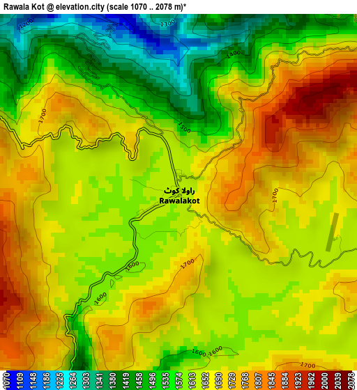
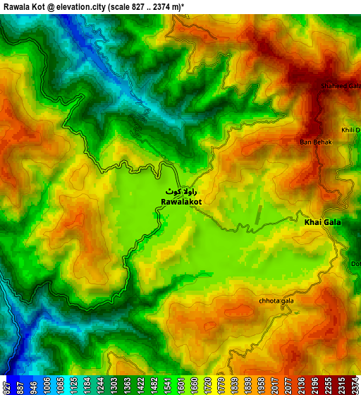
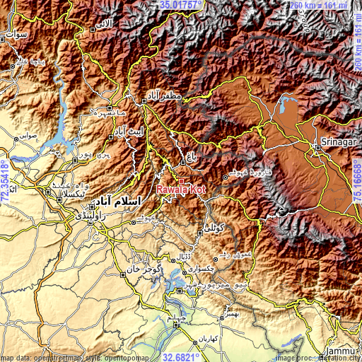
| \ | Map #1 | Map #2 | Topo.Map |
| Scale [m] | 1070..2078 m | 827..2374 m | × |
| Scale [ft] | 3510..6818 ft | 2713..7789 ft | × |
| Average | 1626.9 m = 5338 ft | 1659 m = 5443 ft | × |
| Width | 8.12 km = 5 mi | 16.23 km = 10.1 mi | 259.7 km = 161.4 mi |
| Height | 8.12 km = 5 mi | 16.23 km = 10.1 mi | 259.7 km = 161.4 mi |
| ↑Max Latitude | 33.894305° | 33.930775° | 35.01757° |
| Latitude at center | 33.85782° | 33.85782° | 33.85782° |
| ↓Min Latitude | 33.821319° | 33.784802° | 32.6821° |
| ← Min Longitude | 73.716485° | 73.672539° | 72.35418° |
| Longitude center | 73.76043° | 73.76043° | 73.76043° |
| →Max Longitude | 73.804375° | 73.848321° | 75.16668° |
Nearby cities:
Cities around Rawala Kot sort by population:
• Muzaffarābād elevation 739 m
62.9 km,  334°
334°
• Kotli 609 m
40 km,  160°
160°
• Islamabad 579 m
68 km,  257°
257°
• Abbottabad 1241 m
59.9 km,  302°
302°
• Kamra 1006 m
26 km,  241°
241°
• Havelian 863 m
59.5 km,  291°
291°
• Murree 2098 m
34.6 km,  279°
279°
• Kahuta 610 m
45.4 km,  229°
229°
• Nazir Town 495 m
66.5 km,  202°
202°
• Amirabad 1297 m
71.8 km, 300°
• Hattian Bala 1006 m
34.6 km,  357°
357°
• Bagh 1100 m
13.8 km,  6°
6°
Multilingual:
 En español:
Rawala Kot elevación 1640 m.
 En France:
Rawala Kot élévation 1640 m.
 Auf Deutsch:
Rawala Kot höhe über dem Meeresspiegel ist 1640 m.

Sources and notes:
- [note 1] Map square and city borders are not equal. Map elevation data is calculated only from area inside that square.
- [src 1] Elevation data from geonames database provided with same terms of usage.
- [src 2] The elevation map of Rawala Kot is generated using elevation data from NASA's 3 arcsec (90m) resolution SRTM data.
- [src 3] Base (background) map © OpenStreetMap contributors tiles are generated by Geofabrik and OpenTopoMap.
Copyright & License:
This Rawala Kot Elevation Map is licensed under CC BY-SA. You may reuse any part from this page, if you give a proper credit by linking to this URL:
 More info on terms of use page.