Talavera elevation
Talavera (Apurímac, Provincia de Andahuaylas), Peru elevation is 2826 meters and Talavera elevation in feet is 9272 ft above sea level [src 1]. Talavera is a seat of a third-order administrative division (feature code) with elevation that is 505 meters (1657 ft) bigger than average city elevation in Peru.
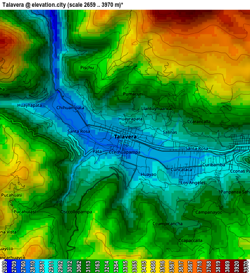
Below is the Elevation map of Talavera, which displays elevation range with different colors. Scale of the first map is from 2659 to 3970 m (8724 to 13025 ft) with average elevation of 3180.6 meters (=10435 ft) [note 1]
These maps also provides idea of topography and contour of this city, they are displayed at different zoom levels. More info about maps, scale and edge coordinates you can find below images.
| \ | Map #1 | Map #2 | Topo.Map |
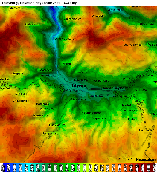
| Scale [m] | 2659..3970 m | 2321..4242 m | × |
| Scale [ft] | 8724..13025 ft | 7615..13917 ft | × |
| Average | 3180.6 m = 10435 ft | 3429.4 m = 11251 ft | × |
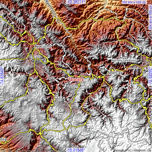
| Width | 9.5 km = 5.9 mi | 18.99 km = 11.8 mi | 303.9 km = 188.8 mi |
| Height | 9.5 km = 5.9 mi | 18.99 km = 11.8 mi | 303.9 km = 188.8 mi |
| ↑Max Latitude | -13.610353° | -13.567637° | -12.28271° |
| Latitude at center | -13.65306° | -13.65306° | -13.65306° |
| ↓Min Latitude | -13.69576° | -13.738452° | -15.01549° |
| ← Min Longitude | -73.473115° | -73.517061° | -74.83542° |
| Longitude center | -73.42917° | -73.42917° | -73.42917° |
| →Max Longitude | -73.385225° | -73.341279° | -72.02292° |
Nearby cities:
Cities around Talavera sort by population:
• Andahuaylas elevation 2902 m
4.5 km,  93°
93°
• San Jerónimo 2958 m
7.1 km, 88°
• Chincheros 2781 m
35 km,  295°
295°
• Kishuara 3716 m
34.1 km,  97°
97°
• Cocharcas 3022 m
33.9 km,  278°
278°
• Uripa 3209 m
30 km, 296°
• Ocobamba 3005 m
23.8 km,  323°
323°
• Ranracancha 3394 m
23.2 km, 304°
• Huancaray 2917 m
15.8 km,  222°
222°
• Andarapa 2914 m
15.7 km,  25°
25°
• Turpo 3301 m
15.5 km,  198°
198°
• Pacucha 3132 m
10.5 km,  62°
62°
Multilingual:
 En español:
Talavera elevación 2826 m.
 En France:
Talavera élévation 2826 m.
 Auf Deutsch:
Talavera höhe über dem Meeresspiegel ist 2826 m.

Sources and notes:
- [note 1] Map square and city borders are not equal. Map elevation data is calculated only from area inside that square.
- [src 1] Elevation data from geonames database provided with same terms of usage.
- [src 2] The elevation map of Talavera is generated using elevation data from NASA's 3 arcsec (90m) resolution SRTM data.
- [src 3] Base (background) map © OpenStreetMap contributors tiles are generated by Geofabrik and OpenTopoMap.
Copyright & License:
This Talavera Elevation Map is licensed under CC BY-SA. You may reuse any part from this page, if you give a proper credit by linking to this URL:
 More info on terms of use page.