Contamana elevation
Contamana (Loreto, Provincia de Ucayali), Peru elevation is 147 meters and Contamana elevation in feet is 482 ft above sea level [src 1]. Contamana is a seat of a third-order administrative division (feature code) with elevation that is 2174 meters (7133 ft) smaller than average city elevation in Peru.
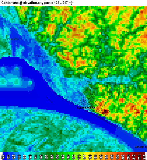
Below is the Elevation map of Contamana, which displays elevation range with different colors. Scale of the first map is from 122 to 217 m (400 to 712 ft) with average elevation of 150.5 meters (=494 ft) [note 1]
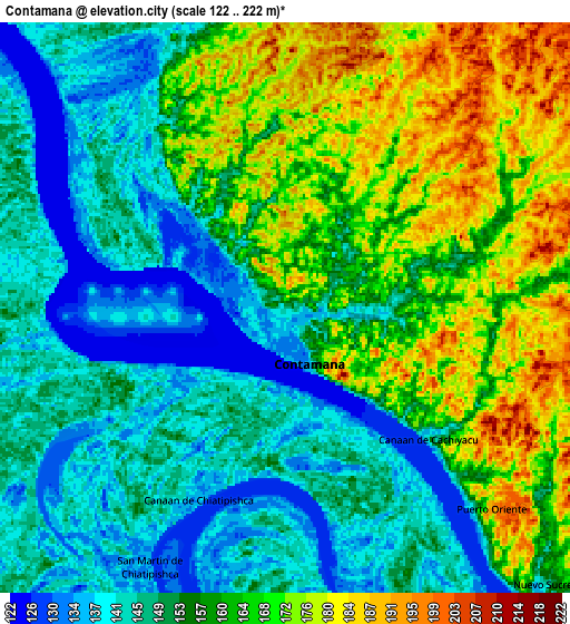
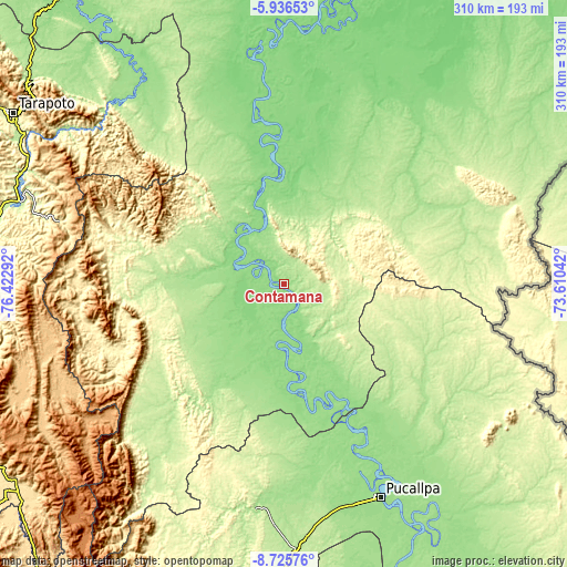
These maps also provides idea of topography and contour of this city, they are displayed at different zoom levels. More info about maps, scale and edge coordinates you can find below images.
| \ | Map #1 | Map #2 | Topo.Map |
| Scale [m] | 122..217 m | 122..222 m | × |
| Scale [ft] | 400..712 ft | 400..728 ft | × |
| Average | 150.5 m = 494 ft | 156.8 m = 514 ft | × |
| Width | 9.69 km = 6 mi | 19.39 km = 12 mi | 310.1 km = 192.7 mi |
| Height | 9.69 km = 6 mi | 19.39 km = 12 mi | 310.2 km = 192.7 mi |
| ↑Max Latitude | -7.289742° | -7.24615° | -5.93653° |
| Latitude at center | -7.33333° | -7.33333° | -7.33333° |
| ↓Min Latitude | -7.376914° | -7.420493° | -8.72576° |
| ← Min Longitude | -75.060615° | -75.104561° | -76.42292° |
| Longitude center | -75.01667° | -75.01667° | -75.01667° |
| →Max Longitude | -74.972725° | -74.928779° | -73.61042° |
Nearby cities:
Cities around Contamana sort by population:
• Pucallpa elevation 155 m
127 km,  156°
156°
• Campoverde 198 m
129.1 km,  169°
169°
• Chazuta 214 m
150 km,  304°
304°
• Sauce 611 m
150.3 km, 298°
• Tres Unidos 275 m
146.1 km,  293°
293°
• Navarro 160 m
137.5 km,  323°
323°
• Shamboyacu 302 m
127.9 km, 285°
• Puerto Callao 153 m
124 km, 156°
• Nueva Requena 151 m
110.1 km, 171°
• Orellana 154 m
50.9 km,  341°
341°
• Inahuaya 139 m
35.8 km, 304°
• Pampa Hermosa 132 m
34.6 km, 295°
Multilingual:
 En español:
Contamana elevación 147 m.
 En France:
Contamana élévation 147 m.
 Auf Deutsch:
Contamana höhe über dem Meeresspiegel ist 147 m.

Sources and notes:
- [note 1] Map square and city borders are not equal. Map elevation data is calculated only from area inside that square.
- [src 1] Elevation data from geonames database provided with same terms of usage.
- [src 2] The elevation map of Contamana is generated using elevation data from NASA's 3 arcsec (90m) resolution SRTM data.
- [src 3] Base (background) map © OpenStreetMap contributors tiles are generated by Geofabrik and OpenTopoMap.
Copyright & License:
This Contamana Elevation Map is licensed under CC BY-SA. You may reuse any part from this page, if you give a proper credit by linking to this URL:
 More info on terms of use page.