Inahuaya elevation
Inahuaya (Loreto, Provincia de Ucayali), Peru elevation is 139 meters and Inahuaya elevation in feet is 456 ft above sea level [src 1]. Inahuaya is a seat of a third-order administrative division (feature code) with elevation that is 2182 meters (7159 ft) smaller than average city elevation in Peru.
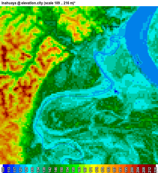
Below is the Elevation map of Inahuaya, which displays elevation range with different colors. Scale of the first map is from 109 to 216 m (358 to 709 ft) with average elevation of 147.2 meters (=483 ft) [note 1]
These maps also provides idea of topography and contour of this city, they are displayed at different zoom levels. More info about maps, scale and edge coordinates you can find below images.
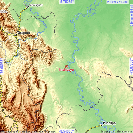
| \ | Map #1 | Topo.Map |
| Scale [m] | 109..216 m | × |
| Scale [ft] | 358..709 ft | × |
| Average | 147.2 m = 483 ft | × |
| Width | 9.7 km = 6 mi | 310.3 km = 192.8 mi |
| Height | 9.7 km = 6 mi | 310.3 km = 192.8 mi |
| ↑Max Latitude | -7.106394° | -5.75269° |
| Latitude at center | -7.15° | -7.15° |
| ↓Min Latitude | -7.193601° | -8.54305° |
| ← Min Longitude | -75.327275° | -76.68958° |
| Longitude center | -75.28333° | -75.28333° |
| →Max Longitude | -75.239385° | -73.87708° |
Nearby cities:
Cities around Inahuaya sort by population:
• Contamana elevation 147 m
35.8 km,  124°
124°
• Chazuta 214 m
114.2 km,  304°
304°
• Picota 223 m
118.4 km,  282°
282°
• Pucacaca 216 m
121.4 km,  285°
285°
• Pelejo 143 m
119.3 km,  330°
330°
• Pilluana 213 m
118.6 km, 290°
• Sauce 611 m
114.8 km, 296°
• Tres Unidos 275 m
111.2 km, 290°
• Navarro 160 m
104.4 km, 330°
• Shamboyacu 302 m
94.8 km, 278°
• Orellana 154 m
30.6 km,  24°
24°
• Pampa Hermosa 132 m
5.9 km,  198°
198°
Multilingual:
 En español:
Inahuaya elevación 139 m.
 En France:
Inahuaya élévation 139 m.
 Auf Deutsch:
Inahuaya höhe über dem Meeresspiegel ist 139 m.

Sources and notes:
- [note 1] Map square and city borders are not equal. Map elevation data is calculated only from area inside that square.
- [src 1] Elevation data from geonames database provided with same terms of usage.
- [src 2] The elevation map of Inahuaya is generated using elevation data from NASA's 3 arcsec (90m) resolution SRTM data.
- [src 3] Base (background) map © OpenStreetMap contributors tiles are generated by Geofabrik and OpenTopoMap.
Copyright & License:
This Inahuaya Elevation Map is licensed under CC BY-SA. You may reuse any part from this page, if you give a proper credit by linking to this URL:
 More info on terms of use page.