Ado-Ekiti elevation
Ado-Ekiti (Ekiti), Nigeria elevation is 439 meters and Ado-Ekiti elevation in feet is 1440 ft above sea level [src 1]. Ado-Ekiti is a seat of a first-order administrative division (feature code) with elevation that is 142 meters (466 ft) bigger than average city elevation in Nigeria.
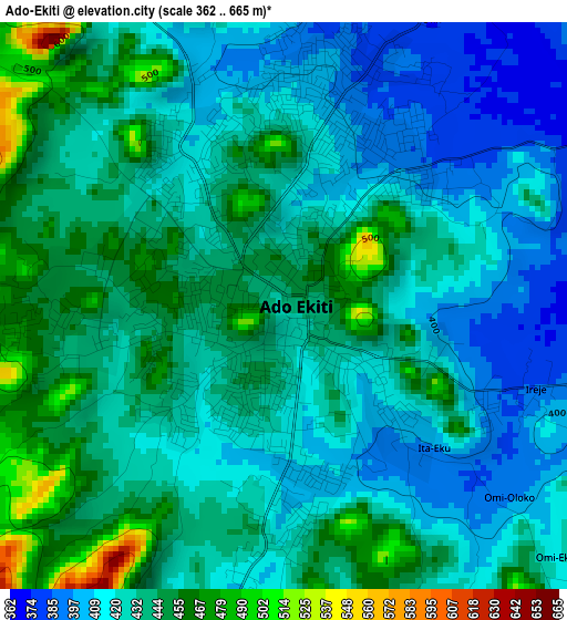
Below is the Elevation map of Ado-Ekiti, which displays elevation range with different colors. Scale of the first map is from 362 to 665 m (1188 to 2182 ft) with average elevation of 430.6 meters (=1413 ft) [note 1]
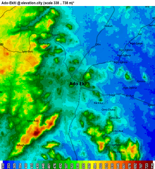
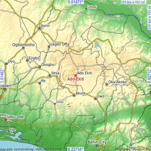
These maps also provides idea of topography and contour of this city, they are displayed at different zoom levels. More info about maps, scale and edge coordinates you can find below images.
| \ | Map #1 | Map #2 | Topo.Map |
| Scale [m] | 362..665 m | 338..738 m | × |
| Scale [ft] | 1188..2182 ft | 1109..2421 ft | × |
| Average | 430.6 m = 1413 ft | 444.4 m = 1458 ft | × |
| Width | 9.69 km = 6 mi | 19.37 km = 12 mi | 309.9 km = 192.6 mi |
| Height | 9.69 km = 6 mi | 19.37 km = 12 mi | 310 km = 192.6 mi |
| ↑Max Latitude | 7.666845° | 7.710395° | 9.01471° |
| Latitude at center | 7.62329° | 7.62329° | 7.62329° |
| ↓Min Latitude | 7.579731° | 7.536167° | 6.22734° |
| ← Min Longitude | 5.176925° | 5.132979° | 3.81462° |
| Longitude center | 5.22087° | 5.22087° | 5.22087° |
| →Max Longitude | 5.264815° | 5.308761° | 6.62712° |
Nearby cities:
Cities around Ado-Ekiti sort by population:
• Ise-Ekiti elevation 379 m
28.4 km,  128°
128°
• Ijero-Ekiti 491 m
27.2 km,  321°
321°
• Ikere-Ekiti 381 m
14 km,  175°
175°
• Igede-Ekiti 576 m
11.6 km,  295°
295°
• Aramoko-Ekiti 458 m
21.8 km,  294°
294°
• Igbara-Odo 367 m
22 km,  232°
232°
• Ifaki 571 m
18.7 km,  9°
9°
• Ita-Ogbolu 346 m
28.5 km,  174°
174°
• Iju 368 m
25.8 km, 170°
• Ido-Ekiti 569 m
25.1 km,  350°
350°
• Oye-Ekiti 536 m
23.2 km,  32°
32°
• Ilawe-Ekiti 426 m
13.1 km,  257°
257°
Multilingual:
 En español:
Ado-Ekiti elevación 439 m.
 En France:
Ado-Ekiti élévation 439 m.
 Auf Deutsch:
Ado-Ekiti höhe über dem Meeresspiegel ist 439 m.

Sources and notes:
- [note 1] Map square and city borders are not equal. Map elevation data is calculated only from area inside that square.
- [src 1] Elevation data from geonames database provided with same terms of usage.
- [src 2] The elevation map of Ado-Ekiti is generated using elevation data from NASA's 3 arcsec (90m) resolution SRTM data.
- [src 3] Base (background) map © OpenStreetMap contributors tiles are generated by Geofabrik and OpenTopoMap.
Copyright & License:
This Ado-Ekiti Elevation Map is licensed under CC BY-SA. You may reuse any part from this page, if you give a proper credit by linking to this URL:
 More info on terms of use page.