Ijero-Ekiti elevation
Ijero-Ekiti (Ekiti, Ijero), Nigeria elevation is 491 meters and Ijero-Ekiti elevation in feet is 1611 ft above sea level [src 1]. Ijero-Ekiti is a seat of a second-order administrative division (feature code) with elevation that is 194 meters (636 ft) bigger than average city elevation in Nigeria.
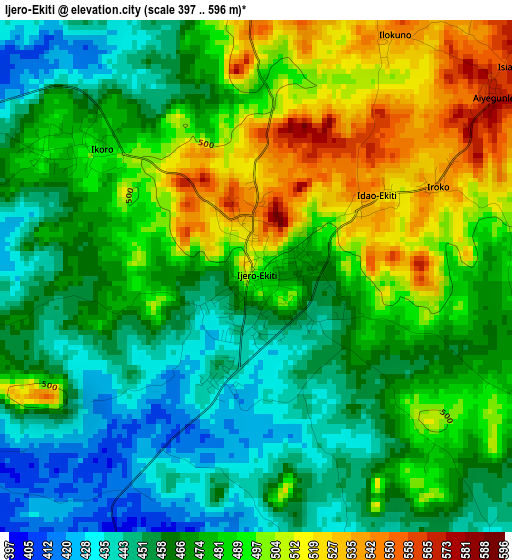
Below is the Elevation map of Ijero-Ekiti, which displays elevation range with different colors. Scale of the first map is from 397 to 596 m (1302 to 1955 ft) with average elevation of 476.4 meters (=1563 ft) [note 1]
These maps also provides idea of topography and contour of this city, they are displayed at different zoom levels. More info about maps, scale and edge coordinates you can find below images.
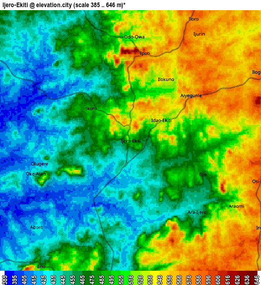
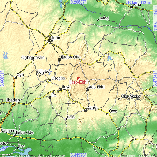
| \ | Map #1 | Map #2 | Topo.Map |
| Scale [m] | 397..596 m | 385..646 m | × |
| Scale [ft] | 1302..1955 ft | 1263..2119 ft | × |
| Average | 476.4 m = 1563 ft | 488.1 m = 1601 ft | × |
| Width | 9.68 km = 6 mi | 19.36 km = 12 mi | 309.8 km = 192.5 mi |
| Height | 9.68 km = 6 mi | 19.36 km = 12 mi | 309.8 km = 192.5 mi |
| ↑Max Latitude | 7.858675° | 7.902205° | 9.20587° |
| Latitude at center | 7.81514° | 7.81514° | 7.81514° |
| ↓Min Latitude | 7.771601° | 7.728057° | 6.41976° |
| ← Min Longitude | 5.023215° | 4.979269° | 3.66091° |
| Longitude center | 5.06716° | 5.06716° | 5.06716° |
| →Max Longitude | 5.111105° | 5.155051° | 6.47341° |
Nearby cities:
Cities around Ijero-Ekiti sort by population:
• Ado-Ekiti elevation 439 m
27.2 km,  141°
141°
• Efon-Alaaye 556 m
23.8 km,  222°
222°
• Igede-Ekiti 576 m
17.6 km,  158°
158°
• Ipoti 593 m
6.6 km,  9°
9°
• Oke Mesi 514 m
16.6 km,  270°
270°
• Aramoko-Ekiti 458 m
12.6 km,  193°
193°
• Oke Ila 540 m
17.6 km,  328°
328°
• Ifaki 571 m
20.2 km,  98°
98°
• Ilawe-Ekiti 426 m
24.4 km,  170°
170°
• Iye-Ekiti 564 m
24 km,  49°
49°
• Otun-Ekiti 535 m
20.2 km,  17°
17°
• Ido-Ekiti 569 m
13.2 km,  74°
74°
Multilingual:
 En español:
Ijero-Ekiti elevación 491 m.
 En France:
Ijero-Ekiti élévation 491 m.
 Auf Deutsch:
Ijero-Ekiti höhe über dem Meeresspiegel ist 491 m.

Sources and notes:
- [note 1] Map square and city borders are not equal. Map elevation data is calculated only from area inside that square.
- [src 1] Elevation data from geonames database provided with same terms of usage.
- [src 2] The elevation map of Ijero-Ekiti is generated using elevation data from NASA's 3 arcsec (90m) resolution SRTM data.
- [src 3] Base (background) map © OpenStreetMap contributors tiles are generated by Geofabrik and OpenTopoMap.
Copyright & License:
This Ijero-Ekiti Elevation Map is licensed under CC BY-SA. You may reuse any part from this page, if you give a proper credit by linking to this URL:
 More info on terms of use page.