Ipoti elevation
Ipoti (Ekiti, Ijero), Nigeria elevation is 593 meters and Ipoti elevation in feet is 1946 ft above sea level [src 1]. Ipoti is a populated place (feature code) with elevation that is 296 meters (971 ft) bigger than average city elevation in Nigeria.
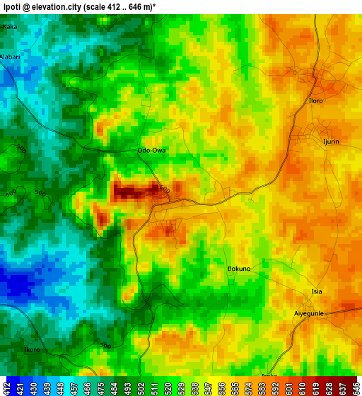
Below is the Elevation map of Ipoti, which displays elevation range with different colors. Scale of the first map is from 412 to 646 m (1352 to 2119 ft) with average elevation of 527.9 meters (=1732 ft) [note 1]
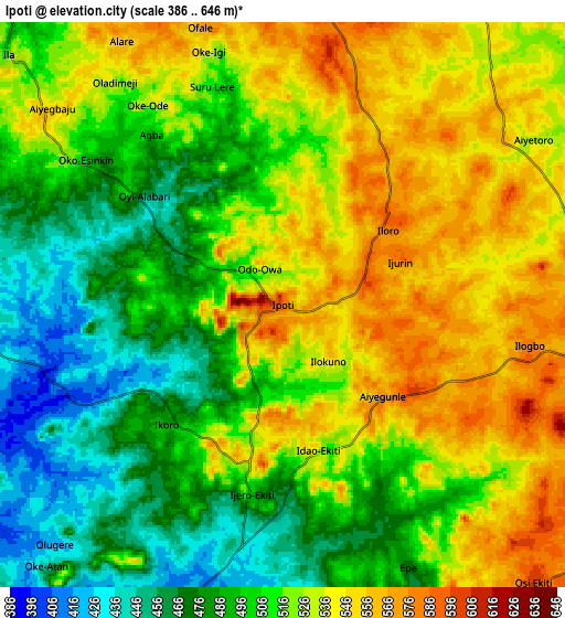
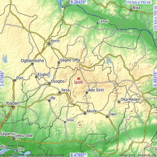
These maps also provides idea of topography and contour of this city, they are displayed at different zoom levels. More info about maps, scale and edge coordinates you can find below images.
| \ | Map #1 | Map #2 | Topo.Map |
| Scale [m] | 412..646 m | 386..646 m | × |
| Scale [ft] | 1352..2119 ft | 1266..2119 ft | × |
| Average | 527.9 m = 1732 ft | 513.2 m = 1684 ft | × |
| Width | 9.68 km = 6 mi | 19.36 km = 12 mi | 309.7 km = 192.4 mi |
| Height | 9.68 km = 6 mi | 19.36 km = 12 mi | 309.8 km = 192.5 mi |
| ↑Max Latitude | 7.917299° | 7.960823° | 9.26429° |
| Latitude at center | 7.87377° | 7.87377° | 7.87377° |
| ↓Min Latitude | 7.830237° | 7.786699° | 6.47857° |
| ← Min Longitude | 5.032965° | 4.989019° | 3.67066° |
| Longitude center | 5.07691° | 5.07691° | 5.07691° |
| →Max Longitude | 5.120855° | 5.164801° | 6.48316° |
Nearby cities:
Cities around Ipoti sort by population:
• Ila Orangun elevation 493 m
24.8 km,  309°
309°
• Ijero-Ekiti 491 m
6.6 km,  189°
189°
• Igede-Ekiti 576 m
23.5 km,  166°
166°
• Oke Mesi 514 m
18.8 km,  250°
250°
• Aramoko-Ekiti 458 m
19.2 km, 192°
• Oke Ila 540 m
13.3 km, 309°
• Ifaki 571 m
21.1 km,  116°
116°
• Araromi-Opin 521 m
28.9 km,  42°
42°
• Iloffa 568 m
25.5 km,  16°
16°
• Iye-Ekiti 564 m
19.4 km,  62°
62°
• Otun-Ekiti 535 m
13.7 km, 21°
• Ido-Ekiti 569 m
12.1 km,  104°
104°
Multilingual:
 En español:
Ipoti elevación 593 m.
 En France:
Ipoti élévation 593 m.


Sources and notes:
- [note 1] Map square and city borders are not equal. Map elevation data is calculated only from area inside that square.
- [src 1] Elevation data from geonames database provided with same terms of usage.
- [src 2] The elevation map of Ipoti is generated using elevation data from NASA's 3 arcsec (90m) resolution SRTM data.
- [src 3] Base (background) map © OpenStreetMap contributors tiles are generated by Geofabrik and OpenTopoMap.
Copyright & License:
This Ipoti Elevation Map is licensed under CC BY-SA. You may reuse any part from this page, if you give a proper credit by linking to this URL:
 More info on terms of use page.