Igbara-Odo elevation
Igbara-Odo (Ekiti, Ekiti South-West), Nigeria elevation is 367 meters and Igbara-Odo elevation in feet is 1204 ft above sea level [src 1]. Igbara-Odo is a populated place (feature code) with elevation that is 70 meters (230 ft) bigger than average city elevation in Nigeria.
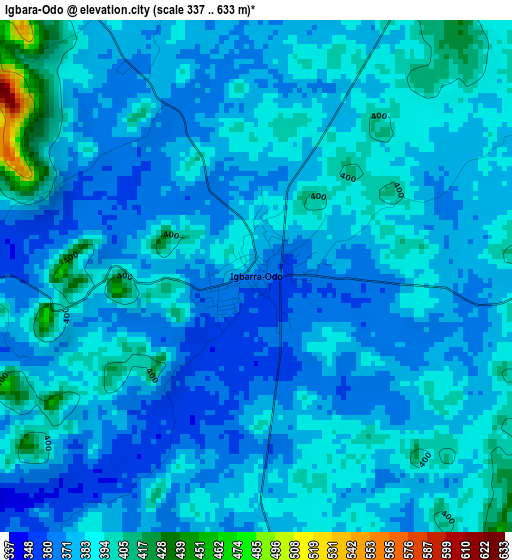
Below is the Elevation map of Igbara-Odo, which displays elevation range with different colors. Scale of the first map is from 337 to 633 m (1106 to 2077 ft) with average elevation of 381.8 meters (=1253 ft) [note 1]
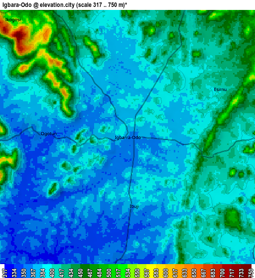
These maps also provides idea of topography and contour of this city, they are displayed at different zoom levels. More info about maps, scale and edge coordinates you can find below images.
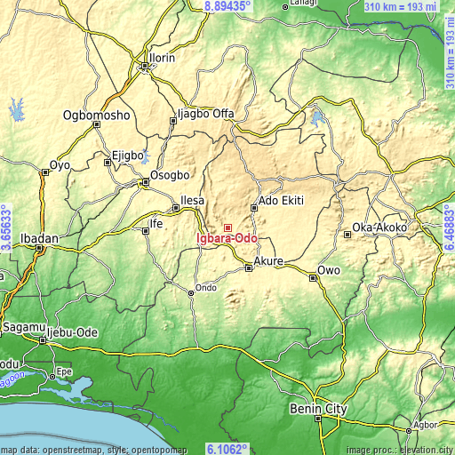
| \ | Map #1 | Map #2 | Topo.Map |
| Scale [m] | 337..633 m | 317..750 m | × |
| Scale [ft] | 1106..2077 ft | 1040..2461 ft | × |
| Average | 381.8 m = 1253 ft | 400.8 m = 1315 ft | × |
| Width | 9.69 km = 6 mi | 19.38 km = 12 mi | 310 km = 192.6 mi |
| Height | 9.69 km = 6 mi | 19.38 km = 12 mi | 310 km = 192.6 mi |
| ↑Max Latitude | 7.546077° | 7.589639° | 8.89435° |
| Latitude at center | 7.50251° | 7.50251° | 7.50251° |
| ↓Min Latitude | 7.458939° | 7.415363° | 6.1062° |
| ← Min Longitude | 5.018635° | 4.974689° | 3.65633° |
| Longitude center | 5.06258° | 5.06258° | 5.06258° |
| →Max Longitude | 5.106525° | 5.150471° | 6.46883° |
Nearby cities:
Cities around Igbara-Odo sort by population:
• Ado-Ekiti elevation 439 m
22 km,  52°
52°
• Akure 353 m
31.3 km,  152°
152°
• Efon-Alaaye 556 m
23.1 km,  317°
317°
• Ikere-Ekiti 381 m
18.5 km,  91°
91°
• Igede-Ekiti 576 m
19.7 km,  20°
20°
• Aramoko-Ekiti 458 m
22.6 km,  353°
353°
• Ilare 348 m
17.8 km,  161°
161°
• Iperindo 303 m
26.1 km,  269°
269°
• Ita-Ogbolu 346 m
25.2 km,  126°
126°
• Iju 368 m
24.8 km,  118°
118°
• Ilawe-Ekiti 426 m
11.7 km, 23°
• Igbara-Oke 353 m
10.1 km,  182°
182°
Multilingual:
 En español:
Igbara-Odo elevación 367 m.
 En France:
Igbara-Odo élévation 367 m.
 Auf Deutsch:
Igbara-Odo höhe über dem Meeresspiegel ist 367 m.

Sources and notes:
- [note 1] Map square and city borders are not equal. Map elevation data is calculated only from area inside that square.
- [src 1] Elevation data from geonames database provided with same terms of usage.
- [src 2] The elevation map of Igbara-Odo is generated using elevation data from NASA's 3 arcsec (90m) resolution SRTM data.
- [src 3] Base (background) map © OpenStreetMap contributors tiles are generated by Geofabrik and OpenTopoMap.
Copyright & License:
This Igbara-Odo Elevation Map is licensed under CC BY-SA. You may reuse any part from this page, if you give a proper credit by linking to this URL:
 More info on terms of use page.