Iperindo elevation
Iperindo (Osun, Atakunmosa East), Nigeria elevation is 303 meters and Iperindo elevation in feet is 994 ft above sea level [src 1]. Iperindo is a seat of a second-order administrative division (feature code) with elevation that is 6 meters (20 ft) bigger than average city elevation in Nigeria.
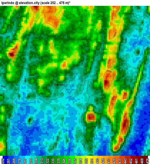
Below is the Elevation map of Iperindo, which displays elevation range with different colors. Scale of the first map is from 252 to 478 m (827 to 1568 ft) with average elevation of 324.9 meters (=1066 ft) [note 1]
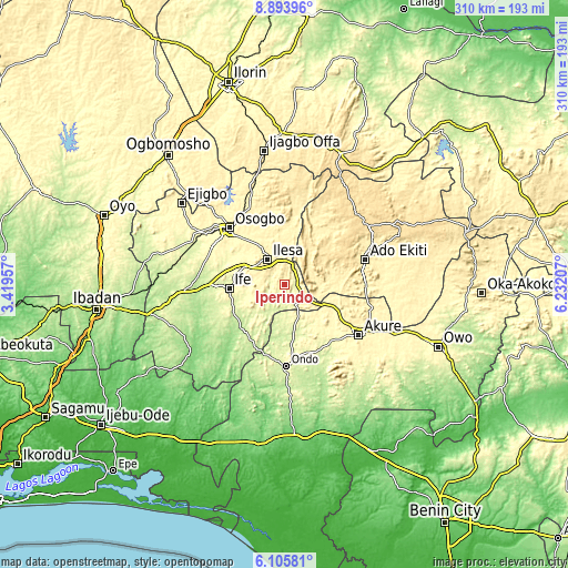
These maps also provides idea of topography and contour of this city, they are displayed at different zoom levels. More info about maps, scale and edge coordinates you can find below images.
| \ | Map #1 | Topo.Map |
| Scale [m] | 252..478 m | × |
| Scale [ft] | 827..1568 ft | × |
| Average | 324.9 m = 1066 ft | × |
| Width | 9.69 km = 6 mi | 310 km = 192.6 mi |
| Height | 9.69 km = 6 mi | 310 km = 192.6 mi |
| ↑Max Latitude | 7.545687° | 8.89396° |
| Latitude at center | 7.50212° | 7.50212° |
| ↓Min Latitude | 7.458549° | 6.10581° |
| ← Min Longitude | 4.781875° | 3.41957° |
| Longitude center | 4.82582° | 4.82582° |
| →Max Longitude | 4.869765° | 6.23207° |
Nearby cities:
Cities around Iperindo sort by population:
• Efon-Alaaye elevation 556 m
20.2 km,  31°
31°
• Ilesa 377 m
16.8 km,  326°
326°
• Aramoko-Ekiti 458 m
32.7 km,  46°
46°
• Igbara-Odo 367 m
26.1 km,  89°
89°
• Ijebu-Jesa 477 m
20.1 km,  357°
357°
• Ilare 348 m
35.9 km,  117°
117°
• Ibokun 425 m
33.4 km,  341°
341°
• Ilawe-Ekiti 426 m
32.6 km,  70°
70°
• Ile-Oluji 240 m
32.5 km,  171°
171°
• Ile-Ife 295 m
29.4 km,  265°
265°
• Igbara-Oke 353 m
27.5 km,  111°
111°
• Osu 338 m
24.2 km,  292°
292°
Multilingual:
 En español:
Iperindo elevación 303 m.
 En France:
Iperindo élévation 303 m.
 Auf Deutsch:
Iperindo höhe über dem Meeresspiegel ist 303 m.

Sources and notes:
- [note 1] Map square and city borders are not equal. Map elevation data is calculated only from area inside that square.
- [src 1] Elevation data from geonames database provided with same terms of usage.
- [src 2] The elevation map of Iperindo is generated using elevation data from NASA's 3 arcsec (90m) resolution SRTM data.
- [src 3] Base (background) map © OpenStreetMap contributors tiles are generated by Geofabrik and OpenTopoMap.
Copyright & License:
This Iperindo Elevation Map is licensed under CC BY-SA. You may reuse any part from this page, if you give a proper credit by linking to this URL:
 More info on terms of use page.