Ilesa elevation
Ilesa (Osun, Ilesha West), Nigeria elevation is 377 meters and Ilesa elevation in feet is 1237 ft above sea level [src 1]. Ilesa is a seat of a second-order administrative division (feature code) with elevation that is 80 meters (262 ft) bigger than average city elevation in Nigeria.
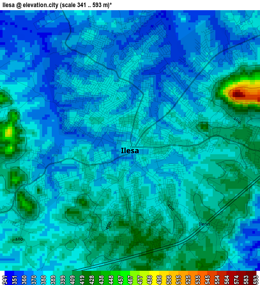
Below is the Elevation map of Ilesa, which displays elevation range with different colors. Scale of the first map is from 341 to 593 m (1119 to 1946 ft) with average elevation of 386.4 meters (=1268 ft) [note 1]
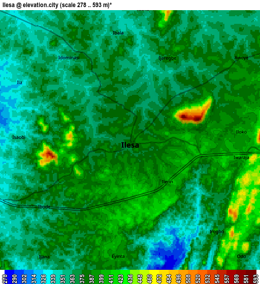
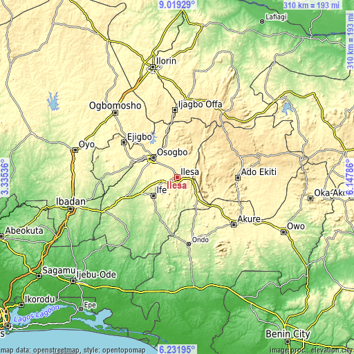
These maps also provides idea of topography and contour of this city, they are displayed at different zoom levels. More info about maps, scale and edge coordinates you can find below images.
| \ | Map #1 | Map #2 | Topo.Map |
| Scale [m] | 341..593 m | 278..593 m | × |
| Scale [ft] | 1119..1946 ft | 912..1946 ft | × |
| Average | 386.4 m = 1268 ft | 376.8 m = 1236 ft | × |
| Width | 9.69 km = 6 mi | 19.37 km = 12 mi | 309.9 km = 192.6 mi |
| Height | 9.69 km = 6 mi | 19.37 km = 12 mi | 310 km = 192.6 mi |
| ↑Max Latitude | 7.671444° | 7.714994° | 9.01929° |
| Latitude at center | 7.62789° | 7.62789° | 7.62789° |
| ↓Min Latitude | 7.584331° | 7.540768° | 6.23195° |
| ← Min Longitude | 4.697665° | 4.653719° | 3.33536° |
| Longitude center | 4.74161° | 4.74161° | 4.74161° |
| →Max Longitude | 4.785555° | 4.829501° | 6.14786° |
Nearby cities:
Cities around Ilesa sort by population:
• Efon-Alaaye elevation 556 m
20.2 km,  80°
80°
• Osogbo 336 m
25.8 km,  308°
308°
• Ikirun 379 m
32.7 km,  345°
345°
• Oke Mesi 514 m
28.5 km,  42°
42°
• Aramoko-Ekiti 458 m
34 km, 75°
• Ijebu-Jesa 477 m
10.4 km,  53°
53°
• Ipetumodu 255 m
34.8 km,  250°
250°
• Iragbiji 417 m
31.3 km, 348°
• Ile-Ife 295 m
25.7 km,  231°
231°
• Ibokun 425 m
17.8 km,  355°
355°
• Iperindo 303 m
16.8 km,  146°
146°
• Osu 338 m
13.9 km, 250°
Multilingual:
 En español:
Ilesa elevación 377 m.
 En France:
Ilesa élévation 377 m.


Sources and notes:
- [note 1] Map square and city borders are not equal. Map elevation data is calculated only from area inside that square.
- [src 1] Elevation data from geonames database provided with same terms of usage.
- [src 2] The elevation map of Ilesa is generated using elevation data from NASA's 3 arcsec (90m) resolution SRTM data.
- [src 3] Base (background) map © OpenStreetMap contributors tiles are generated by Geofabrik and OpenTopoMap.
Copyright & License:
This Ilesa Elevation Map is licensed under CC BY-SA. You may reuse any part from this page, if you give a proper credit by linking to this URL:
 More info on terms of use page.