Agbor elevation
Agbor (Delta, Ika South), Nigeria elevation is 130 meters and Agbor elevation in feet is 427 ft above sea level [src 1]. Agbor is a seat of a second-order administrative division (feature code) with elevation that is 167 meters (548 ft) smaller than average city elevation in Nigeria.
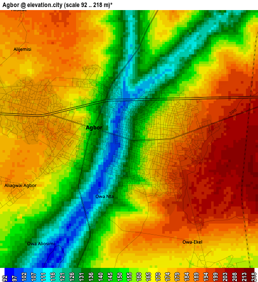
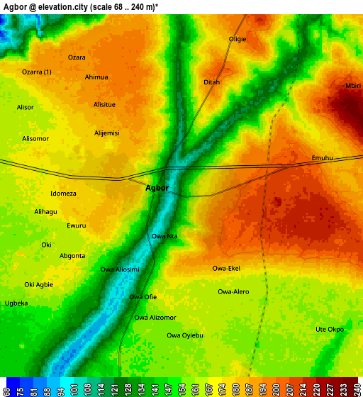
Below is the Elevation map of Agbor, which displays elevation range with different colors. Scale of the first map is from 92 to 218 m (302 to 715 ft) with average elevation of 165.1 meters (=542 ft) [note 1]
These maps also provides idea of topography and contour of this city, they are displayed at different zoom levels. More info about maps, scale and edge coordinates you can find below images.
| \ | Map #1 | Map #2 | Topo.Map |
| Scale [m] | 92..218 m | 68..240 m | × |
| Scale [ft] | 302..715 ft | 223..787 ft | × |
| Average | 165.1 m = 542 ft | 167.2 m = 549 ft | × |
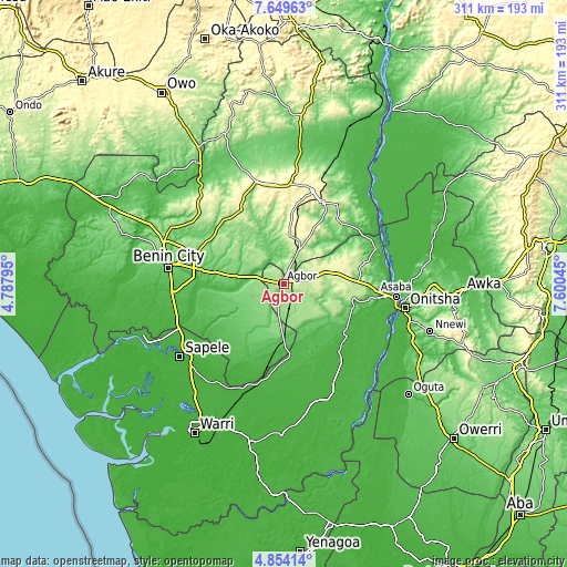
| Width | 9.71 km = 6 mi | 19.43 km = 12.1 mi | 310.8 km = 193.1 mi |
| Height | 9.71 km = 6 mi | 19.43 km = 12.1 mi | 310.9 km = 193.2 mi |
| ↑Max Latitude | 6.297432° | 6.34111° | 7.64963° |
| Latitude at center | 6.25375° | 6.25375° | 6.25375° |
| ↓Min Latitude | 6.210064° | 6.166375° | 4.85414° |
| ← Min Longitude | 6.150255° | 6.106309° | 4.78795° |
| Longitude center | 6.1942° | 6.1942° | 6.1942° |
| →Max Longitude | 6.238145° | 6.282091° | 7.60045° |
Nearby cities:
Cities around Agbor sort by population:
• Uromi elevation 381 m
51.9 km,  17°
17°
• Ogwashi-Uku 198 m
37.5 km,  102°
102°
• Ubiaja 286 m
49.4 km,  25°
25°
• Obiaruku 35 m
45.5 km,  185°
185°
• Umunede 247 m
12.8 km,  84°
84°
• Abraka 29 m
52.5 km, 190°
• Ehor 245 m
46.5 km,  329°
329°
• Akwukwu-Igbo 191 m
45.3 km, 75°
• Igueben 286 m
39.1 km,  7°
7°
• Issele-Uku 262 m
31.9 km, 77°
• Abudu 57 m
18.7 km,  284°
284°
• Owa-Oyibu 159 m
7.9 km,  176°
176°
Multilingual:
 En español:
Agbor elevación 130 m.
 En France:
Agbor élévation 130 m.


Sources and notes:
- [note 1] Map square and city borders are not equal. Map elevation data is calculated only from area inside that square.
- [src 1] Elevation data from geonames database provided with same terms of usage.
- [src 2] The elevation map of Agbor is generated using elevation data from NASA's 3 arcsec (90m) resolution SRTM data.
- [src 3] Base (background) map © OpenStreetMap contributors tiles are generated by Geofabrik and OpenTopoMap.
Copyright & License:
This Agbor Elevation Map is licensed under CC BY-SA. You may reuse any part from this page, if you give a proper credit by linking to this URL:
 More info on terms of use page.