Gusau elevation
Gusau (Zamfara), Nigeria elevation is 451 meters and Gusau elevation in feet is 1480 ft above sea level [src 1]. Gusau is a seat of a first-order administrative division (feature code) with elevation that is 154 meters (505 ft) bigger than average city elevation in Nigeria.
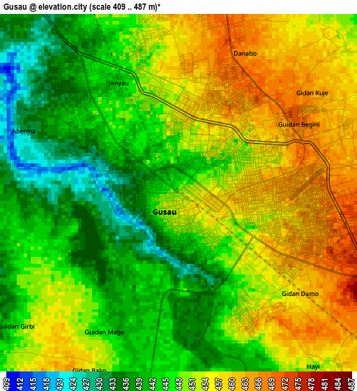
Below is the Elevation map of Gusau, which displays elevation range with different colors. Scale of the first map is from 409 to 487 m (1342 to 1598 ft) with average elevation of 448.7 meters (=1472 ft) [note 1]
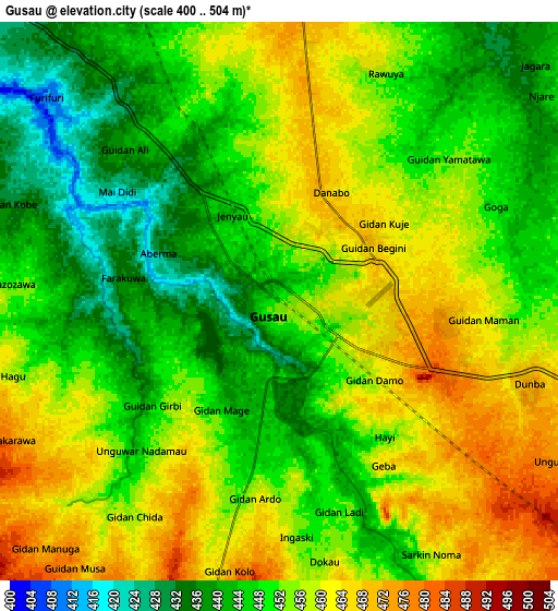
These maps also provides idea of topography and contour of this city, they are displayed at different zoom levels. More info about maps, scale and edge coordinates you can find below images.
| \ | Map #1 | Map #2 | Topo.Map |
| Scale [m] | 409..487 m | 400..504 m | × |
| Scale [ft] | 1342..1598 ft | 1312..1654 ft | × |
| Average | 448.7 m = 1472 ft | 452 m = 1483 ft | × |
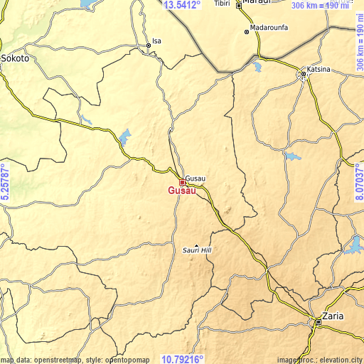
| Width | 9.55 km = 5.9 mi | 19.11 km = 11.9 mi | 305.7 km = 190 mi |
| Height | 9.55 km = 5.9 mi | 19.11 km = 11.9 mi | 305.7 km = 190 mi |
| ↑Max Latitude | 12.213194° | 12.256141° | 13.5412° |
| Latitude at center | 12.17024° | 12.17024° | 12.17024° |
| ↓Min Latitude | 12.127279° | 12.084311° | 10.79216° |
| ← Min Longitude | 6.620175° | 6.576229° | 5.25787° |
| Longitude center | 6.66412° | 6.66412° | 6.66412° |
| →Max Longitude | 6.708065° | 6.752011° | 8.07037° |
Nearby cities:
Cities around Gusau sort by population:
• Kaura Namoda elevation 396 m
47.8 km,  349°
349°
• Sauri 612 m
51 km,  165°
165°
• Runka 489 m
76.6 km,  66°
66°
• Maru 381 m
33.6 km,  302°
302°
• Tsafe 565 m
36.6 km,  130°
130°
• Kwatarkwashi 483 m
17.5 km,  100°
100°
• Dan Musa 492 m
73.5 km,  82°
82°
• Zurmi 397 m
68.7 km,  10°
10°
• Faskari 629 m
63.9 km,  141°
141°
• Maradun 346 m
63.5 km,  314°
314°
• Birnin Magaji 428 m
50 km,  30°
30°
• Bungudu 413 m
16.3 km, 312°
Multilingual:
 En español:
Gusau elevación 451 m.
 En France:
Gusau élévation 451 m.


Sources and notes:
- [note 1] Map square and city borders are not equal. Map elevation data is calculated only from area inside that square.
- [src 1] Elevation data from geonames database provided with same terms of usage.
- [src 2] The elevation map of Gusau is generated using elevation data from NASA's 3 arcsec (90m) resolution SRTM data.
- [src 3] Base (background) map © OpenStreetMap contributors tiles are generated by Geofabrik and OpenTopoMap.
Copyright & License:
This Gusau Elevation Map is licensed under CC BY-SA. You may reuse any part from this page, if you give a proper credit by linking to this URL:
 More info on terms of use page.