Runka elevation
Runka (Katsina, Safana), Nigeria elevation is 489 meters and Runka elevation in feet is 1604 ft above sea level [src 1]. Runka is a populated place (feature code) with elevation that is 192 meters (630 ft) bigger than average city elevation in Nigeria.
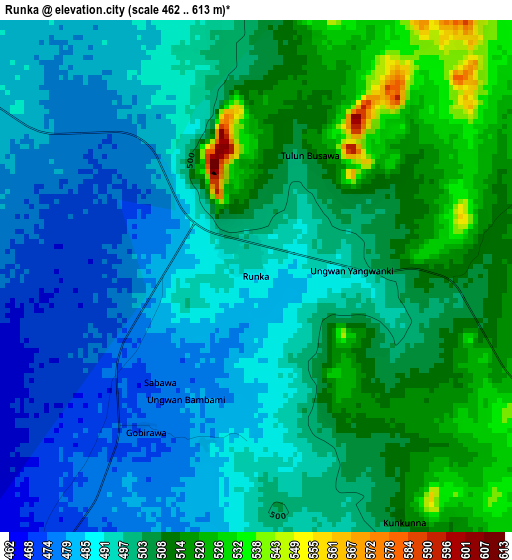
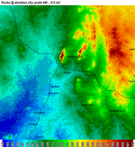
Below is the Elevation map of Runka, which displays elevation range with different colors. Scale of the first map is from 462 to 613 m (1516 to 2011 ft) with average elevation of 498.1 meters (=1634 ft) [note 1]
These maps also provides idea of topography and contour of this city, they are displayed at different zoom levels. More info about maps, scale and edge coordinates you can find below images.
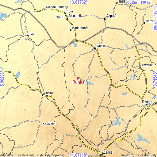
| \ | Map #1 | Map #2 | Topo.Map |
| Scale [m] | 462..613 m | 449..613 m | × |
| Scale [ft] | 1516..2011 ft | 1473..2011 ft | × |
| Average | 498.1 m = 1634 ft | 505.3 m = 1658 ft | × |
| Width | 9.54 km = 5.9 mi | 19.09 km = 11.9 mi | 305.3 km = 189.7 mi |
| Height | 9.54 km = 5.9 mi | 19.09 km = 11.9 mi | 305.4 km = 189.8 mi |
| ↑Max Latitude | 12.490789° | 12.53369° | 13.81732° |
| Latitude at center | 12.44788° | 12.44788° | 12.44788° |
| ↓Min Latitude | 12.404964° | 12.362041° | 11.07118° |
| ← Min Longitude | 7.265235° | 7.221289° | 5.90293° |
| Longitude center | 7.30918° | 7.30918° | 7.30918° |
| →Max Longitude | 7.353125° | 7.397071° | 8.71543° |
Nearby cities:
Cities around Runka sort by population:
• Dutsin-Ma elevation 544 m
20.4 km,  88°
88°
• Wagini 488 m
29.4 km,  335°
335°
• Musawa 578 m
52.8 km,  132°
132°
• Ruma 502 m
46.8 km,  350°
350°
• Batsari 471 m
34.8 km, 349°
• Kankia 543 m
56.8 km,  78°
78°
• Charanchi 550 m
51.9 km,  61°
61°
• Birnin Magaji 428 m
46.7 km,  285°
285°
• Matazu 535 m
46.2 km,  120°
120°
• Kurfi 532 m
30.9 km,  38°
38°
• Dan Musa 492 m
20.9 km,  172°
172°
• Safana 509 m
12.2 km,  109°
109°
Multilingual:
 En español:
Runka elevación 489 m.
 En France:
Runka élévation 489 m.


Sources and notes:
- [note 1] Map square and city borders are not equal. Map elevation data is calculated only from area inside that square.
- [src 1] Elevation data from geonames database provided with same terms of usage.
- [src 2] The elevation map of Runka is generated using elevation data from NASA's 3 arcsec (90m) resolution SRTM data.
- [src 3] Base (background) map © OpenStreetMap contributors tiles are generated by Geofabrik and OpenTopoMap.
Copyright & License:
This Runka Elevation Map is licensed under CC BY-SA. You may reuse any part from this page, if you give a proper credit by linking to this URL:
 More info on terms of use page.